 '
'
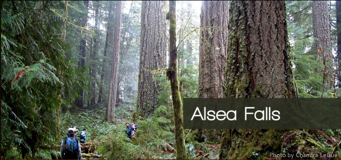
Near the town of Alsea in the central Coast Range, tributaries of the Alsea River – including Fall Creek, Coleman Creek, Skunk Creek, and the South Fork Alsea – flow through Salem District BLM lands and private timberland. Located about 15 miles west of Highway 99, the Alsea Falls Recreation Area contains numerous drainages harboring massive trees in remnant forests. (T13-15S, R6-8W)
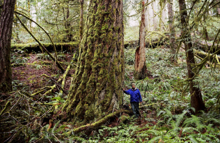
Fast Fact: The Alsea Falls area contains the State Champion Western Hemlock. The tree measures more than 260 inches in circumference, 197 feet high, and has a crown spread of 51 feet.
Why this area is important
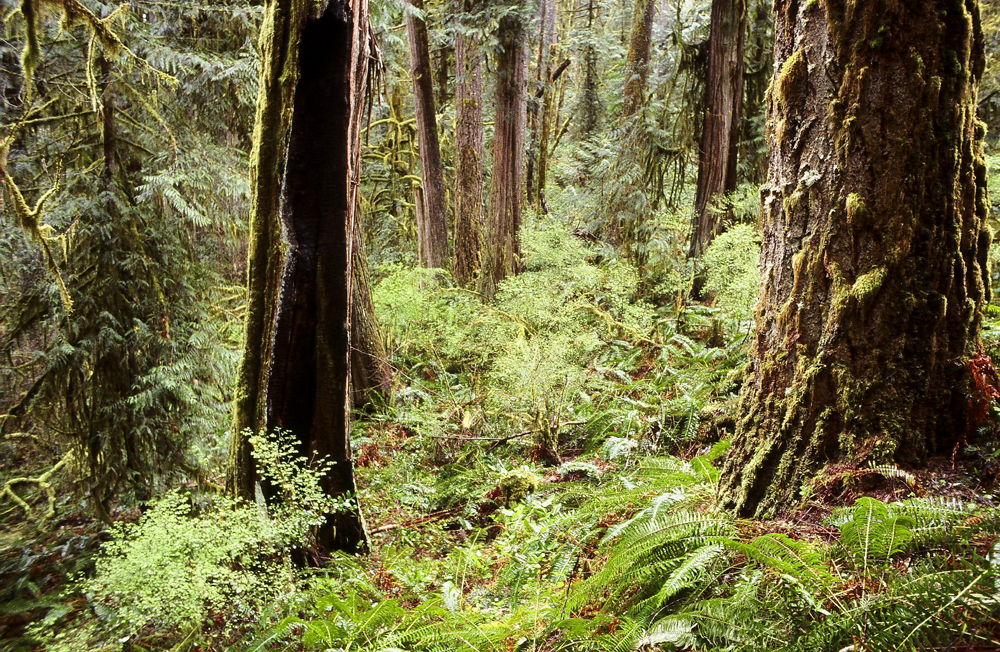
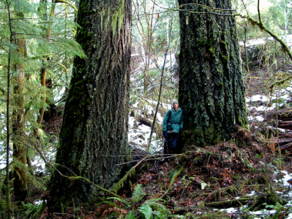
The Alsea River and its tributaries are one of the last free-flowing watersheds in Oregon, supporting Chinook and Coho salmon as well as steelhead and trout. Spotted owls, barred owls, screech owls, pygmy owls, mountain beavers, and slender salamanders call these forests home. The Alsea also contains a treasure trove of ancient, old-growth forests – the remnants of a once unbroken forest landscape rich with salmon, elk, and other wildlife. Keeping these remaining forests intact offers a chance for this natural setting to survive.
Residents of Benton and northern Lane Counties consider these forests to be their backyard, with the Fall Creek and Coleman Creek drainages particularly noted by members of the Benton Forest Coalition for their spectacular scenery and old growth. Numerous Douglas firs, hemlocks, and cedars seven to eleven feet in diameter have been found in the area, including the new Oregon State Champion Western Hemlock tree.
Recreational opportunities
 The Alsea Falls Recreation Area, managed by the BLM, offers picnic tables and trails along the South Fork Alsea and nearby forests. Additional trails exist to the south, accessible from Fall Creek Road. Local advocates have identified and flagged six miles of proposed new trails, and the BLM has incorporated several of these into a new management plan for the Recreation Area.
Users enjoy the area for hiking, photography in all seasons, picnics, mushroom hunting, and spending time with friends and family in a beautiful setting close to home. With additional miles of trails already planned, residents will have even greater access to this wonderful area.
Current threats
 Vast clear-cut logging on private land has severely fragmented the local landscape and endangered fish and wildlife. Plans for increased logging on BLM lands – in current plan revisions or under proposals being pushed in Congress – will increase this fragmentation and habitat loss. The recently proposed Rainbow Ridge Timber Sale is an example of how the Mary’s Peak Resource Area of the Salem BLM is moving in a direction which, unfortunately, encourages increased logging.
“I have explored this area and have been blessed to walk in these ancient forests. All who follow me into these sacred groves feel blessed to experience a glimpse of a forest that has almost disappeared. We owe it to the future to keep these forests intact.” – Mahogany Aulenbach
“A few years ago I descended into a pristine old-growth stand at Coleman Creek, and came upon a recently-deceased screech owl with beautiful plumage. Crossing the creek I found a pile of flicker feathers, then saw a spotted owl wheeling overhead. During the course of our outing we encountered this owl at least three times. One summer night this owl even called in the dark after I slammed a car door. While hiking along Fall Creek some time later, I looked up at a nest structure when a spotted owl flew silently over my head. Landing on a branch, it turned its head 180 degrees to look back at me as I raised my binoculars and spotted it.” - Reed Wilson