 '
'
Explore Wild Oregon
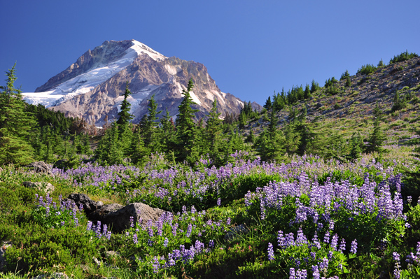
Oregon is blessed with some of the most beautiful and inspiring landscapes in America. From the majestic silhouette of Mount Hood, to the rushing whitewater and wild salmon of the Rogue River, Oregon is truly a special place!
Oregon has been home to Indigenous people for time immemorial and is currently home to nine federally recognized tribes. We encourage those seeking to recreate and explore Oregon to learn more about Indigenous peoples and their relationship with the land, their history and their current efforts. Learn more here.
Oregon Wild works to protect our state’s wildlands and helps Oregonians get outdoors to enjoy them. The people who get to know Oregon's wild places can do so much to help keep them pristine!
Suggested hikes and outdoor adventures:
Our list of suggested trails includes hikes of a variety of difficulties, locations, and landscapes, and are connected to our campaigns to protect ancient forests, wild lands, Wild and Scenic Rivers, and wildlife habitats. Trail conditions are constantly changing, and are not necessarily kept up to date here.
Additional information about the many hikes in Oregon can be found by exploring the US Forest Service’s webpages and the Oregon Hikers Forum and Field Guide or by seeking out any number of guides at your local library or bookstore. We also offer suggested guides and resources here.
If you're specifically interested in hiking in Oregon's ancient and old-growth forests, be sure to check out our book Oregon's Ancient Forests: A hiking guide by Chandra LeGue. Another great resource old-growth trails in the Willamette National Forest can be found here.
Our ranking system:
| Easy | Little elevation gain (less than 500 feet), well maintained trails, under 4 miles in distance. |
| Moderate | More elevation gain (up to 1000 feet), more difficult trails, between 4 and 8 miles in distance |
| Strenuous | Significant elevation gain (over 1000 feet), over 8 miles in distance, or trail for experienced hikers only (not well maintained, steep, stream crossings, etc.) |
Northwest Oregon | Coast and Coast Range | Central Cascades | Northeast Oregon | Southwest Oregon | Southern Cascades | Central Oregon
| name | difficulty | season | attractions | campaign tie-in |
|---|---|---|---|---|
| Easy | Early summer - fall | Ancient forests and a beautiful mountain lake | Unprotected wild area we’re still working to protect, Boulder Creek proposed Wild & Scenic River, important climate forests | |
| Crabtree Valley* | Moderate | late spring through fall | Some of the largest trees in Oregon | Headwaters of proposed Crabtree Creek Wild & Scenic River, old-growth forest we have worked to protect |
| Larch Mountain | Strenuous | late spring, summer, fall | Old-growth, close to Portland | Partially protected as Wilderness, in an area we have been working to protect for decades |
| Lost Lake* | Easy | spring, summer, fall | Family friendly, great view of Mount Hood | Headwaters of proposed Lake Branch Fork of Hood River Wild & Scenic River |
| Salmon River* | Easy | Year round | Ancient forest along beautiful river | Along Wild & Scenic Salmon River, important climate forests |
| Tamanawas Falls | Easy | spring, summer, fall | Beautiful falls on the East-side of Mount Hood | Part of the proposed Mt. Hood Wilderness expansions we have been working to protect for decades |
| Vista Ridge | Strenuous | July and August | Scenic views of Mount Hood, amazing wildflowers in August | Borders Mt. Hood Wilderness and unprotected but proposed wilderness area we have worked to defend |
| name | difficulty | season | attractions | campaign tie-in |
|---|---|---|---|---|
| Easy | July to October | Short hike with great views of Van Patten Peak near Anthony Lakes ski area | Sandwiched between the headwaters of 3 proposed Wild & Scenic Rivers, in large Twin Mountain roadless area | |
| Blue Mountain Trail | Moderate - Strenuous | Late spring - fall, depending on section | Oreogn's newest long-distance trail linking diverse ecosystems and landscapes | Numerous proposed Wild & Scenic Rivers, unprotected wild lands, and climate forests at risk |
| Imnaha River-Blue Hole* | Moderate | Summer and fall | Forest recovering from fire, rocky cliffs, and a view into the stunning blue river | Along the Wild & Scenic Imnaha River, accessed via forested corridor we have worked to defend from logging |
| Maxwell Lake | Strenuous | Late July - October | Rock meadows and open slopes to one of the few alpine lakes in the Wallowas that doesn't require an overnight trip | Accessed via the Lostine Wild & Scenic River corridor that we worked to establish and now work to defend from logging |
| North Fork Umatilla* | Moderate | spring-fall | A lush riverside hike in the Blue Mountains | Within North Fork Umatilla Wilderness area, adjacent to proposed South Fork Umatilla Wild & Scenic River |
| name | difficulty | season | attractions | campaign tie-in |
|---|---|---|---|---|
| Brice Creek/Trestle Creek Falls* | Easy - Moderate | All year | Towering trees, swimming holes, and a walk-behind waterfall | Brice Creek proposed Wild & Scenic River, important climate forests |
| Clear Lake* | Easy - moderate | May-October | Huge springs, lava crossings, and a beautiful old-growth forest of Douglas fir and mountain hemlock | Headwaters of Wild & Scenic McKenzie River, important climate forests |
| Crabtree Valley* | Moderate | late spring through fall | Some of the oldest trees in Oregon | Headwaters of proposed Crabtree Creek Wild & Scenic River, old-growth forest we have worked to protect |
| Lookout Creek* | Strenuous | June-August | Wander up and down through towering forests and into cool, mossy groves | Important climate forests |
| Middle Fork Willamette Trail* | Moderate | Spring to late fall | Wind through an old-growth forest, some recovering from fire, past multiple gushing springs | Proposed Upper Middle Fork WIllamette Wild & Scenic River, important climate forests |
| Mount June and Sawtooth Ridge | Moderate | June-July | Magnificent old-growth forest, grassy meadows bursting with wildflowers and impressive rock bluffs | Important climate forests |
| Three Pyramids* | Moderate-Strenuous | June-August | Take in a spectacular old-growth forest, trailside and cliff-top wildflowers, alpine meadows, and stunning a mountaintop view | Pyramid and South Pyramid Creeks proposed Wild & Scenic Rivers, unprotected roadless area, and important climate forests |
| name | difficulty | season | attractions | campaign tie-in |
|---|---|---|---|---|
| Brown Mountain* | Strenuous | late spring-fall | Beautiful wildflowers, Lake of the Woods, Fish Lake, and impressive lava flows | South Fork Little Butte Creek proposed Wild & Scenic River, unprotected roadless area |
| Indigo Lake | Easy | mid summer-fall (depending on snow) | Old growth trees, high mountain meadows and beautiful views of intense blue waters | Within large unprotected roadless area along the headwater divide between the Middle Fork Willamette and North Umpqua Rivers (both proposed as Wild & Scenic Rivers) |
| Natural Bridge and Rogue Gorge* | Easy - Moderate | spring-fall | The trail gently rolls along the wild and scenic Rogue River through lava basalt featuring scenic river and waterfall views | Along the designated Wild & Scenic Rogue River, near proposed Union Creek Wild & Scenic River, and in an area we work to defend from logging |
| Twin Lakes | Moderate | Late June - October | Old-growth forest, wildflower meadows, mountain views, and serene lakes all in one hike! | Headwaters of proposed Twin Lakes Creek Wild & Scenic River, heart of large unprotected roadless area we work to defend from logging |
| name | difficulty | season | attractions | campaign tie-in |
|---|---|---|---|---|
| Collings Mountain Trail (Bigfoot Trap)* | Moderate | All year | Views of the Siskiyou Crest and Applegate Lake, passing inactive Big Foot Trap as well as a number of mine adits | Surrounded by proposed Wild & Scenic Rivers and unprotected roadless areas in need of protection |
| Grizzly Peak* | Moderate | late spring through fall | Outstanding views of the Rogue Valley, the Cascades, and summertime wildflowers along the trail | Part of the expanded Cascade Siskiyou National Monument we’re defending in court |
| Soda Mountain | Strenuous | spring through fall | A biological jewel - diverse topography and plant life | Part of Wilderness area and Cascade Siskiyou National Monument we worked to support and protect |
| Oregon Redwoods Trail* | Easy | All year | Some of the last remaining Coast Redwood trees in Oregon, accessible to the coast | Headwaters of the proposed Moser Creek Wild & Scenic River, forest we worked to protect in our early days |