
Highlights
Difficulty: Moderate to Strenuous
Distance: 5 mile loop (with additional options)
Elevation Gain: 1,300 feet
Season: Spring to late fall, access dependent on snow
Notes: This hike is featured in “Oregon’s Ancient Forests: A hiking guide” – Get the book here!
A parking fee or permit is required at the trailhead.
About this Hike
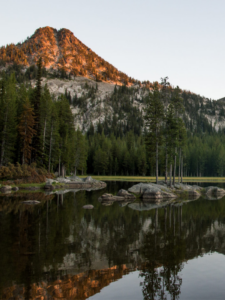
Located on the eastern edge of the Coast Range, Marys Peak’s characteristic hump defines the view west of Corvallis and its forests give rise to streams that feed both coastal and Willamette River systems. The peak, the highest in the Coast Range at just over 4000 feet, is also home to an island of old-growth noble fir.
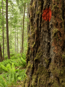
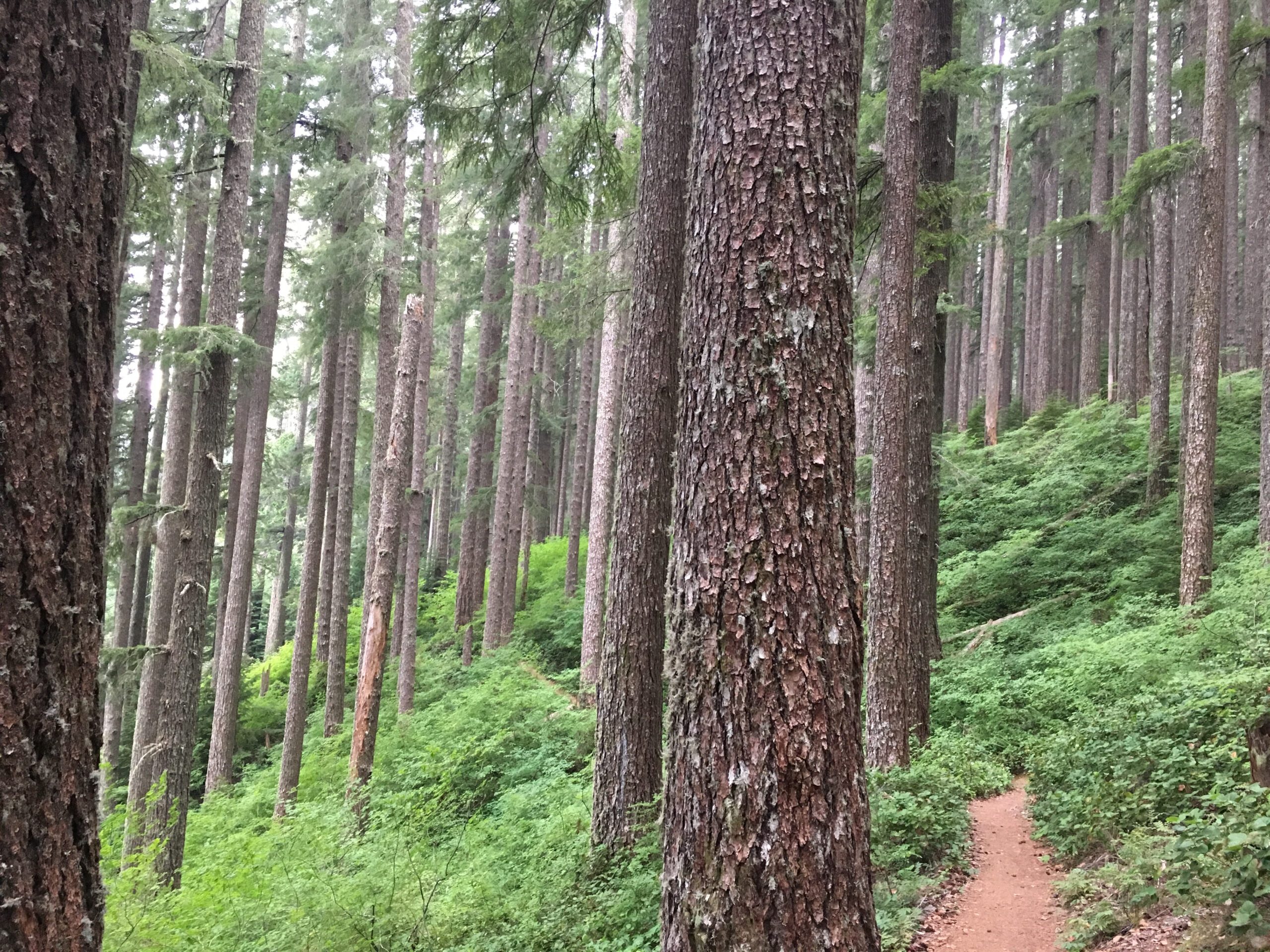
To begin the 5-mile loop from Conner’s Camp, take the East Ridge Trail through a younger forest that has been “thinned”—the most common form of logging on public lands these days—and then through a small grove of old trees before crossing a road marked by a sign for the municipal watershed. After a quarter mile of skirting the plantation, enter a tall, cathedral-like stand of Douglas-fir with a vine maple understory. Chinquapin, salal, Oregon grape, and young western hemlocks fill in the understory, and you’ll catch views to the northeast through the trees as the trail climbs steadily to a junction with the Tie Trail at 1.2 miles. Stay left here and go uphill on a series of long switchbacks that take you through the towering forest farther up the east-facing slope. As you gain elevation the forest gets messier, with snags, down wood, and a thicker understory. At 1.9 miles, the trail transitions to a north-facing slope with rocky outcrops and a steeper drop-off to the right. At 2 miles, there is an almost abrupt transition into a stand of noble firs, their blue-hued needles and gray bark markedly different from the Douglas-firs dominating the forest thus far. Openings along this slope include vine maple, elderberry, and thimbleberry.
Turn right in the noble fir forest at a sign for the Summit Loop Trail, 1.4 miles past the Tie Trail junction. Then pass through a blowdown patch of forest and come out in the Observation Point parking area. To complete the East Ridge–Tie Trail loop, find the trail at the west end of the parking area in the corner opposite the restroom. This segment of trail parallels the road for a quarter mile through a grove of old noble firs. As you descend a ridge to the north, the forest transitions to hemlocks by the time you get to a junction of the North Ridge and Tie Trails in about 0.6 mile. Turn right to get on the Tie Trail back to Conner’s Camp. From here, the trail traverses the northeast- facing bowl that gives rise to Chintimini Creek through a beautiful Douglas-fir and hemlock forest, with some real giants. After about 0.4 mile on this trail, you’ll cross the head of the creek, where water seeps out of the rocky hillside and feeds a peaceful western redcedar grove. Continue on, following the contour with a steep drop-off below, round a rocky outcrop, and then meet the East Ridge Trail after 1.2 miles. Turn left for the final 1.2 miles back to Conner’s Camp.
Other options:
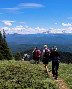
The 2-mile Meadowedge Trail loop and the Marys Peak summit can both be reached from the Observation Point parking lot on their own or as additions to the featured loop. From the Observation Point parking lot, walk up the road. In a quarter mile, turn right at a sign for the Summit Loop Trail and Meadowedge Trail. At the first junction go right to get to the Meadowedge Trail. (To reach the summit, turn left at this junction in the forest.) The Meadowedge Trail loop starts just below this junction at a large signboard. Heading left to do the loop clockwise takes you through a dense forest with little understory, though in places the forest floor is covered with oxalis and decomposing logs. Cross Parker Creek in a lovely woodland with some short snags left over from a previous iteration of this forest. The trail skirts the base of the large summit meadow, ducking in and out of the forest’s edge, around Parker Creek’s headwaters, and back to the start of the loop. Head back up to the road and turn left toward the Observation Point parking lot to continue the East Ridge–Tie Trail loop or to return to your car if you parked there.
Getting There
Take Oregon Route 34 (US Highway 20) west from Corvallis. From the far end of Philomath, turn left to stay on OR 34 toward Alsea/Waldport. Go 8.8 miles and turn right at a sign for Marys Peak Recreation Area just past milepost 48 onto Marys Peak Road (Forest Road 30). In 5.3 miles, FR 30 turns to the left, but continue on FR 3010 a short ways to Conner’s Camp on the right, just before a snow gate at 5.5 miles. The East Ridge Trail starts here from a large parking area. For the other hike options, continue past the Marys Peak Campground entrance to where the road ends at the large Observation Point parking lot.
Take Action
Mature and old-growth forests like those found on Marys Peak provide vital wildlife habitat, drinking water, and are an important natural climate solution. Take action to defend these forests here.