Highlights
Difficulty: Moderate
Distance: 5.8 miles round trip
Elevation Gain: 480 feet
Season: Spring through late fall, access dependent on snow
Notes: This hike is featured in “Oregon’s Ancient Forests: A hiking guide” – Get the book here!
Read more about the history of this area in Marina Richie’s blog post here.
About this Hike
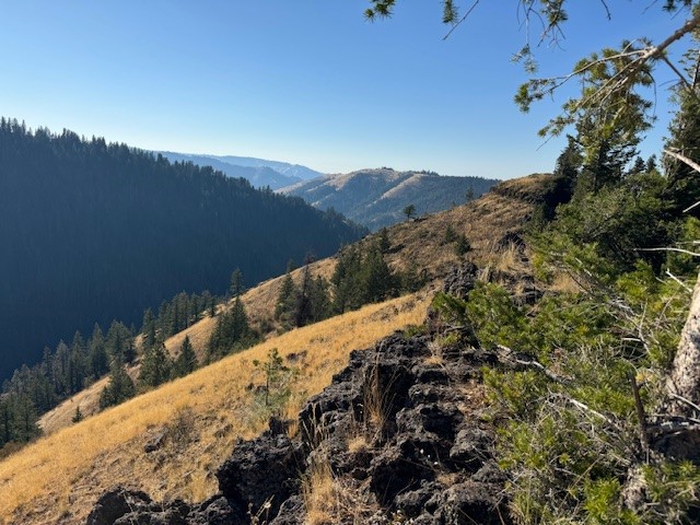
The North Fork Umatilla cuts through the wildlands of the Blue Mountains. The area appears arid and grassy but the trail along the North Fork is very lush and takes you through forests of Douglas-fir.
The North Fork Umatilla River Trail starts out in a healthy, cow-free riparian area with ample evidence of beavers. The trail showcases the diversity of this wilderness—from mixed conifer forests to sparse pine grasslands, and streamside wetlands to wildflower-laden rocky outcrops—as it rolls up and down along the north side of the river canyon, climbing gradually. Patches of younger forest with a lot of low shrubs, which likely had localized disturbance events, are interspersed along the trail. Look for tall snags indicating there may have been a fire or a localized disease patch. In places, such as at about 1.4 miles, the forest gets quite dense in the flatter areas next to the river. These areas have a closed canopy—large Pacific yews draped in moss and lichen and moisture-loving Engelmann spruce trees with their flaky gray-scaled bark. Several creek-crossings, as well as springs, mean there are patches of wet, muddy areas on the trail. Where the trail climbs to viewpoints of the river below, look for logjams forming pools as well as other habitat for native fish. From these high points, you can also get good views of the surrounding plateaus and their much more open grassland habitat. At about 2.4 miles, you’ll enter a forest with the biggest Douglas-firs and nicest old forest structure yet. This continues as you cross two small ravines, where there are tall snags and old trees with plenty of character. You’ll reach Coyote Creek at about 2.9 miles.
Getting There
From Pendleton, drive east 7 miles on Interstate 84 and take exit 216. Go left (north) for 2 miles to the blinking stoplight and turn right at this intersection onto Mission Road. After 1.7 miles turn left onto Cayuse Road, following signs for Bar M Ranch. Travel just under 16 miles and turn right onto Bingham Road (County Road 900).
From Walla Walla, Washington, or Milton-Freewater, Oregon, take Oregon Route 11 south of Milton-Freewater about 12 miles to just past the Athena junction and turn left on Pambrum Road. Travel 5 miles to the road’s end, turn left onto Spring Hollow Road, and go 6 miles. Turn left onto Bingham Road (CR 900).
Cross the railroad tracks on Bingham Road and follow it for 12 miles of paved and another 2.6 miles of gravel road, following first the railroad tracks and then the North Fork Umatilla River. At the national forest boundary, the road becomes Forest Road 32, which you follow for another half mile and then bear left (don’t cross the bridge to the right) into the Umatilla Forks Day-Use Area. Pass a restroom and continue to the trailhead with plenty of parking at the end of the road.
Take Action
The North Fork Umatilla Wilderness, 20,435 acres designated in 1984, offers a prime example of the Blue Mountains wild lands worthy of protection in this region. While there are several small Wilderness areas in the Blues, more roadless wild lands exist and are in need of protection. Oregon Wild has worked for years to ensure such special areas are considered and designated in forest management plans – an ongoing process. Take action here.


