Forest Service chooses 14-day comment period for logging project in the Wallowa-Whitman National Forest
By Jay Everett
Since January of 2021, the Forest Service has been planning the “Sufferin’ Springs” Project. If finalized, the project would authorize 10,189 acres of commercial logging within the Wallowa-Whitman National Forest. That’s roughly 16 square miles, or about three times the size of LAX—right next to the Eagle Cap Wilderness.
Although the Forest Service has been contemplating the Sufferin’ Springs Project for several years, the Forest Service only allowed the public to comment on the draft Environmental Assessment within a two-week window that ended earlier this year in March. Oregon Wild was able to submit a comment within that short window, pointing out the potential adverse effects on wildlife and diversity. However, the Forest Service’s chosen time frame likely precluded interested members of the public from being able to voice their concerns.
This is just the latest in a series of actions by the Forest Service to hastily liquidate Oregon’s forests for wealthy interests and bypass the opportunity for public engagement.
If realized, the Project would allow for the harvesting of large trees, and reduce dead wood habitat and forest density. These activities will directly and indirectly affect the viability of old-growth wildlife species such as goshawks, marten, and pileated woodpeckers (in that it will reduce and degrade these species’ habitat requirements, as well as habitat for their prey). Yet the Forest Service failed to analyze the extent to which these species will be affected—not just by this Project, but also in relation to the other projects in the Wallowa-Whitman National Forest.
Despite the intensity of the Project, the Forest Service chose to give the public only 14 days to comment on the Project’s Environmental Assessment—a document over 400 pages long. Allowing the public to review and comment on an environmental assessment is standard procedure for any forest management activity, and is meant to be an opportunity for the public to scrutinize the Forest Service’s methodologies and determinations, voice its concerns, or ask the Forest Service to look at different science or take an alternative approach. But 14 days is barely enough time for an organization like Oregon Wild to analyze the draft EA and provide comment, let alone any concerned member of the public—including the nearby residents in the Medical Springs Community, where the project has been a topic of concern.
Indeed, 14 days is likely not enough time to allow for concerned citizens to merely read the 400-page assessment, much less submit a thoughtful comment. This short comment period signals to the public that the Forest Service does not care about meaningful public participation, even though the law requires such engagement.
The Forest Service justified the 14-day comment period by determining that there is a “Fuels and Forest Health Emergency” warranting expedited action. But, rather tellingly, although the Forest Service could have declared an emergency anytime after November 2021 (and had been contemplating the Project for even longer), it did not declare an emergency until June 2025. This puts into question whether a genuine emergency exists, and more likely reflects the Forest Service’s intention to find any means to skip the public participation process and ignore criticism.
The Sufferin’ Springs Project is just one of many Trump administration actions threatening the ecological integrity of Oregon’s forests, rivers, deserts, mountains, and plains. The Trump administration’s explicit intent to hastily exploit our public lands to benefit the wealthy is anti-democratic and will be at the expense of Oregon’s ecological integrity and natural beauty, habitat for endangered species, biodiversity, clean water, and recreation.
With enough pressure, the agency could be convinced to reopen the project and allow the public more time to engage and comment. You can email the District Ranger and politely ask that the comment period be reopened.
If you would like to learn more about how the Trump administration is attacking our public lands—and how Oregon Wild is fighting back (and how you can too)—then check out our report, “Trump 2.0: Looting Oregon’s Treasures,” and consider sharing it with a friend.
America’s public lands–our National Parks, Forests, Wildlife Refuges, and Bureau of Land Management lands–have long been the common ground that unites us as a country. The bad news is that the division, chaos, and corruption that has marked the Trump 2.0 administration has spilled over in public lands policy, with so many attacks on basic conservation protections that it is hard to keep up.
Oregon Wild has been doing our best to keep track of the many attacks the Trump administration and anti-conservation Members of Congress have launched against America’s public lands, clean water, and wildlife. Below is a partial list of what we are keeping tabs on. Amid all the bad news and threats, there is also some good news, and some early signs that grassroots activism is working.
The Good:
Stopping the Sell-off of America’s Public Lands: Earlier this summer, Representatives Mark Amodei (R-NV) and Celeste Maloy (R-UT) tried to insert language in Trump’s Big, Ugly Tax and Spending bill that would have sold off 500,000 acres of America’s public lands in Utah and Nevada. A ferocious public backlash (including from Oregon, where Rep. Bentz ultimately came out against public lands sales) forced the House to withdraw it. Then, in June, Senator Mike Lee (R-UT) went even further with an awful proposal that would have mandated the sale of up to 3 million acres of public land (and paved the way for millions more to be privatized in the future). The backlash against Sen. Lee’s ploy was even stronger, and it was ultimately pulled.
While Trump’s bill ultimately passed the Senate (with plenty of awful anti-conservation and anti-environmental provisions in it), the backlash against public lands privatization is proof that even in this day and age, grassroots pressure works.
The Bad:
The Fell (Fix) Our Forests Act: The Fix Our Forests Act is a logging bill trying to pass itself off as a wildfire strategy, and unfortunately democratic Senators like Hickenlooper and Padillia are drinking the Kool-Aid and handing the keys of our national forests over to the Trump administration. The bill will make it easier to avoid environmental laws like The National Environmental Policy Act (NEPA) and the Endangered Species Act (ESA) — the bill uses emergency authorities to allow NEPA consultation after a project has been completed. It will allow even bigger loopholes through the expansion of Categorical Exclusions — 10,000 acres or 15 square miles — basically removing all public oversight of projects on federal forest land. And it will help to advance the narrative that commercial logging (and grazing) will protect communities from wildfire. The science is clear — we should be investing in proven community protection measures like defensible space, home hardening, and emergency planning. Unfortunately, the bill does not provide meaningful funding for these proven strategies.
Trump’s Big, Ugly Tax and Spending Bill: The Senate stripped out provisions to sell off public lands from its budget reconciliation proposal. However, there are some truly awful logging provisions in the version that passed the Senate, including:
250 Million Mandate: Increases timber production by a minimum of 250,000,000 board feet over previous years’ sale volume for the Forest Service and 20,000,000 million for Bureau of Land Management. This arbitrary increase in logging will occur regardless of the impacts it could cause, be it worsening wildfires due to clearcutting or reducing our federal forests climate and clean water benefits.
20-Year Logging Contracts: This bill calls for ramping up logging across federal forests, by mandating that the Forest Service enter into at least one long-term timber contract per year for 10 years in each region. A similar provision applies to the Bureau of Land Management. This might force harmful logging to occur that has negative impacts on drinking water, vulnerable wildlife, and mature and old-growth forests.
Trump’s Wildfire Executive Order: Trump signed an executive order aimed to combine major wildland firefighting programs across federal public lands agencies within 90 days, in an effort to streamline how the federal government approaches fires. He issued this order during the height of wildfire season after gutting the federal firefighting workforce. The administration’s poorly thought-out and reckless actions will place wildland firefighters at increased risk and will make communities and infrastructure more vulnerable to catastrophic fires.
The Ugly:
Recission of the Roadless Rule: The proposed rollback of the 2001 Roadless Rule jeopardizes nearly 58 million acres of backcountry forestland managed by the U.S. Forest Service, comprising around a third of the territory in our national forest system. In Oregon, the rule protects nearly 2 million acres of Oregon’s forests from destructive logging and development. These include beloved places like the Metolius River, Lost Lake, the Oregon Dunes, Mount Hebo, Hardesty Mountain, Tumalo Mountain, and the Upper Hood River Valley. Take action to protect wild Roadless Areas.
NEPA rollbacks: US Department of Agriculture, which houses the Forest Service, and Department of the Interior, which includes the Bureau of Land Management, have announced their intent to gut NEPA as it applies to national forests and BLM lands. There will be a 30 day public comment period for the Forest Service’s interim rule that is expected to close July 30th.
Trump’s logging Executive Orders (+ subsequent logging directives from his administration): President Trump issued two executive orders (EOs) to dramatically expand logging across federal public forests and increase timber output by 25%. Under the pretense of enhancing national security, these policies seek to weaken environmental protections to supercharge timber harvest and benefit wealthy corporate interests.
Changing the Definition of “Harm” to Endangered Species: For decades, America’s Endangered Species Act has defined “harm” to imperiled fish and wildlife to include the destruction of their habitat, such as building a dam with no fish passage and block salmon from accessing the habitat they need to spawn and reproduce. In April, the Trump administration proposed changing this rule to remove habitat destruction from the definition of “harm” to an endangered species. It is an incredibly cynical (and stupid) idea, and one that Oregon Wild is gearing up to challenge in court.
“Our responsibility as life tenants is to make certain that there are wilderness values to honor after we have gone.” – William O. Douglas
Snap snap, SNAP! Then came the whooooooosh and a thud that shook our popup camper by the Imnaha River in the predawn. Wes and I felt the reverberation from 150 yards away. Later, we found the Douglas-fir bridging a river channel near a beaver dam. The gunfire-like snaps were roots popping as the living tree tipped over and pulled up a wall of soil and roots 20 feet high, plus shaking loose a snaking section of the bank.
Curious to look at the tree’s crown, we waded across the frigid waters to the other side (with the help of two beaver-chewed sticks for balance). Among a whorl of green needles, I spotted something bizarre— brown fur, dainty hooves, and a skull. How had an elk calf ended up draped over a branch way up high in the fir?
Did a cougar climb to the topmost branches with his or her prey?
This tree had stories to tell. The Imnaha, too, whispers of wolf howl, salmon splash, and kingfisher plunge. The river runs through one of the largest intact wildlands remaining in the Pacific Northwest. It’s here where one of the world’s most famous wolves—OR-7 or Journey—romped as a pup with his Imnaha pack in 2009. He would head across Oregon tracing wildlands wherever he could all the way to California to find a mate.
Rob Klavins, eastern Oregon field representative for Oregon Wild, calls the Imnaha River a microcosm for all that’s at stake in the region—from habitat connectivity to big wildlands. The first moose spotted in Oregon was on the Imnaha River in 1960. The first wolf returning to Oregon crossed the Snake River in the vicinity. If grizzly bears find their way into the Wallowas, the Imnaha corridor beckons.
Threatened chinook salmon still spawn in the upper Imnaha after swimming some 550 miles from the ocean and navigating eight dams. White-headed woodpeckers nest in centuries-old ponderosa pine snags. Black bears feast on summer huckleberries. Bull elk bugle in fall when larches flame golden on steep hillsides. The lone wolverine of the Wallowas (named Stormy) roams the Imnaha country seeking a mate.
Within the homeland of the Nimiipuu, the Nez Perce, the Imnaha River flows 77 miles from headwaters at 8,000 feet within the Eagle Cap Wilderness (Oregon’s largest) to 950 feet at the confluence with the Snake River in Hells Canyon, deepest gorge in North America.
Designated a Wild and Scenic River in 1988, the Imnaha crosses boundaries of Wilderness, Hells Canyon National Recreation Area, and some private lands in the lower stretch. Passaging east and then north down through every ecosystem in the region, the Imnaha serves as a vast climate refugia in a warming world.
Fallen pine investigated by the authorElk calf remains in the upper branches of a giant fallen pine“Queen of the Imnaha,” painting by Robin Coen
Threatened Wildlands
Not all the wildlands of the Imnaha country are protected. Sadly, the Imnaha also is a microcosm for the increasing logging threats across the region under the guise of “restoration.” Logging and roading frays and fragments climate refugia. The key to cold, clear waters, biodiversity, wildlife corridors, and carbon storage of large trees is to keep wildlands intact.
The Morgan Nesbit timber project covers a staggering 87,000 acres adjacent to the Eagle Cap Wilderness and intruding into the Imnaha River wilds. Half the proposed commercial logging is within the Hells Canyon National Recreation Area. But thanks to organizing by Greater Hells Canyon Council and Oregon Wild in 2023, the offices of the Wallowa Whitman National Forest were flooded with comments opposing the logging. The planning process is ongoing, and activists know it’s not over while the trees still stand.
The fate of the Imnaha’s unprotected roadless areas buffering the Wilderness and the river is in our hands.
Larch trees in fall along the Imnaha River
Contemplating the high stakes today, it helps to turn to the past and be reassured. It’s always been hard, yet there’s camaraderie among all who stand shoulder to shoulder protecting wildlands and rivers. The wins of the past should give us hope for the future—no matter what the politics.
Past Successes Inspire: Oregon’s Biggest Wilderness
Without tireless advocacy, the 359,991-acre Eagle Cap Wilderness we know today would have been far smaller. In 1930, the alpine meadows, lakes, and peaks garnered recognition as a primitive area. In 1940, the Forest Service designated the area as wilderness with a small “w”, meaning that status could be lifted if political winds shifted to favor development. The Wilderness Act of 1964 assured protection under the National Wilderness Preservation System, but only for the Eagle Cap core. In 1972, Congress added the Little Minam River and expanded some of the Wilderness perimeter. However, those 73,419 acres came at a price—with certain lands declassified from an earlier protective status. The crown jewel of the Lower Minam was handed over to the Forest Service to study for potential Wilderness.
Enter the grassroots group “Save the Minam,” led by the inimitable Loren Hughes (worthy of an entire book!). The group prevailed. Congress added the Minam’s 67,711 acres under the Oregon Wilderness Act of 1984. The victory was far from easy. For example, Boise Cascade timber company put out a full-page ad focusing on northeast Oregon, calling the House Bill “An ‘Un-Natural’ Disaster! We can do without.”
Supreme Court Justice William O. Douglas
One famous champion of the Minam and Eagle Cap Wilderness was William O. Douglas who served longer than any other chief justice on the U.S. Supreme Court (from 1939-1975). He summered on the Lostine River, one of the main entryways to hike to the lakes basin and Eagle Cap.
It was Douglas who ultimately saved the Snake River from a dam that would have flooded Hells Canyon. He wrote the majority opinion for the 1967 Supreme Court favorable ruling on a Sierra Club challenge represented by a young lawyer named Brock Evans (still championing the wilds from La Grande). The fight to stop the High Sheep Mountain Dam led to the formation of Hells Canyon Preservation Council in 1967. Now the Greater Hells Canyon Council (GHCC), the grassroots group works to save wildlands throughout much of the Blue Mountains.
Seven years later, in 1974, Oregon Wild entered the scene as Oregon Wilderness Coalition, a scrappy group fighting for the wilds and taking on big timber—as they do today—50 years and many wins later and now with thousands of members. (Check out this video celebrating the anniversary!)
Imnaha RiverBeaver dam on the Imnaha River Boise Cascade anti-Wilderness ad
Hells Canyon: Troubled Waters, Threatened Forests
Both groups (now GHCC and Oregon Wild) worked hard for the passage of the 1976 Hells Canyon National Recreation Area Act that covers 652,488 acres with the deep gorge as the centerpiece. However, the first signs marking entries to the National Recreation Area (NRA) were not put up until 1984. In the intervening years, the Wallowa-Whitman National Forest’s most visible early management in the NRA was logging. From 1976-1986, the agency sold 78.6 million board feet of timber. Considering only a third of the area is forested, that’s a heavy dose. In 1982, loggers dragged trees through Lick Creek, a tributary of the Imnaha, right as salmon tried to spawn. In fact, the Columbia River Intertribal Fish Commission filmed logging in spawning grounds of the Imnaha protected by 1855 treaty rights.
When researching my investigative journalism thesis (Troubled Waters, Threatened Forests, Hells Canyon National Recreation Area, 1988), I interviewed Allen Pinkham, then chairman of the Nez Perce Tribal Executive Committee. “The treaty is very strong,” Pinkham said. We need to exert that power to preserve the fishing—not just the right to fish, but the right to have the fish back.”
Today, those words are more relevant than ever as the future of chinook salmon depends on removing the four dams on the lower Snake River and keeping spawning habitats safe from logging and other degradations.
Back in 1986 and ’87, perhaps the most egregious timber sale in the recreation area was called “Skook,” located above the upper Imnaha River area. Boise Cascade hauled out 3.2 million board feet on roads built at twice the width specified in the contract. They cut giant ponderosa pines, western larch, and standing dead trees. Environmentalists and tribes fought to save big trees , but it was a tough time. Hiking the hillsides above Imnaha near Skookum Creek today, there are still beautiful pines and larches remaining, even as stumps tell the story of what was lost.
Enter Mike Higgins: Friends of Lake Fork
Close to the Imnaha River is the Lake Fork Roadless Area, not far from Pine Valley, where Mike Higgins lived for decades before moving to Baker City in the summer of 2023. Higgins serves on the GHCC advisory board. In the summer of 1986, Mike and his wife Donna Higgins hosted a small group of like-minded folks at their home in Halfway.
While the subject was serious, the proposed logging of wildlands around Lake Fork Creek, there’s a humorous story that Mike Higgins likes to share about Tim Lillebo (eastern Oregon field representative of what was then Oregon Natural Resources Council), who initiated the gathering that would lead to a lasting environmental movement in Pine Valley.
“With an enthusiasm never before witnessed in the environmental community, the step that Tim took from the front porch of the Higgins home to the front yard, in pursuit of yet another map, imprinted an indelible mark on the Friends of Lake Fork Group,” Higgins wrote. Lillebo failed to notice a screen on the door and fell right through it, taking the screen with him.
Friends of Lake Fork convinced the Pine Ranger District to stop their logging plans, citing harm to elk and to late-season flows for irrigation, since unlogged forests hold and slowly release water. It was a great victory for the roadless area outside of the Hells Canyon National Recreation Area. However, within the boundary where protecting natural values was supposed to take precedence, the Forest Service continued to log and propose new sales.
I joined Higgins when he led a 1988 field trip to see freshly torn up muddy meadows, stumps, and slash in the aftermath of the Cold Grave timber sale, which cut down large spruce and grand fir growing among bogs and springs by Duck Lake Campground (just outside Lake Fork). Even the timber sale project officer Gerald Magera admitted they failed to protect the bogs as heavy logging equipment churned through delicate sphagnum wetlands within a forest of ideal habitat for lynx and fisher. Despite the damage, what remained of the delicate area would be designated a Research Natural Area in 2010.
Three environmental groups (Friends of Lake Fork, then Hells Canyon Preservation Council, and Oregon Natural Resources Council) sued the Forest Service to stop the next sale called Duck Creek and within the recreation area’s part of Lake Fork roadless area. That lawsuit went to the Ninth Circuit Court of Appeals and, in 1989, the ruling in favor of the appellants set a precedent. The Court found the agency negligent in writing rules and regulations governing timber cutting in the recreation area, and gave environmental groups the right to file for injunctions to stop sales until new rules were in place. Unfortunately, the agency logged Duck Creek as the case went through the courts.
Mike Higgins in the Snow Basin timber saleTim Lillebo looking at a massive pine marked to be cut in the Skook sale in 1986The author with a pine that was cut down in 2017 as a supposed hazard in the upper Imnaha River corridor
Making Progress
In the intervening decades, conservationists have achieved impressive feats in safeguarding this wild part of the region. For example, in 1994, Greater Hells Canyon Council (GHCC) won a lawsuit validating the ecosystem and wilderness protection priority of the recreation area. Other 1990s wins included protecting bighorn sheep from lethal diseases by eliminating domestic sheep grazing within Hells Canyon National Recreation Area. GHCC also defeated legislation that would have allowed unlimited jet boat use on the Wild and Scenic parts of the Snake River. A 2014 Snow Basin court case saved more than 40,000 large trees from being logged adjacent to the Eagle Cap Wilderness and led to strengthening the East Side screens to better protect trees 21 inches and larger.
Rallying for Wilds Today
As we prepare for this next Trump presidency and an all-out attack on the environment, we can take heart by looking to the past. The Imnaha River country holds immense promise if we can keep the wilds intact and enough people come to know and love this place to speak up for the future.
Returning to the Douglas-fir that fell across the Imnaha River on a July day and nourished the wild waters, I would add this reminder. Go out in the wilds. You never know what drama will unfold. Feel the power of wind, water, thunderstorm, and ancient forests exhaling oxygen. No matter where you live, become an activist. Every little bit we do matters, from saving trees in a local park to joining forces with Oregon Wild and local grassroots groups in defending wildlands.
See it for yourself:
Take the Hells Canyon National Recreation Area Scenic Corridor linking Joseph to Halfway. Stay in one of several campgrounds on the upper Imnaha River corridor. Hike the trail from Indian Creek Campground into the Eagle Cap Wilderness—also a section of the Blue Mountains Trail. Along the two miles leading to the Blue Hole, notice the way wildfire in the Wilderness has renewed meadows favored by hundreds of elk. This hike (as well as others in this Wallowas region) is featured in Oregon’s Ancient Forests, a Hiking Guide, by Chandra LeGue, Oregon Wild (Buy it here!)
“White-headed Woodpeckers,” painting by Robin CoenBlue Hole on the Imnaha River
It was 1979 at dawn when Bill Fleischman acted on impulse. Why not take the long way from his home in La Grande to Pendleton for the wilderness hearing? He’d hike a short way up the North Fork Umatilla River for a little fishing. What better way to get inspired to speak up for this obscure roadless area to be part of Senator Mark Hatfield’s proposed wilderness bill (a smaller-sized version before the Oregon Wilderness Act of 1984).
Sure enough, a half-mile upriver, he caught a 13-inch rainbow with extra shiny black spots. Lining his wicker creel with ferns, he lowered the wriggling fish inside and hurried back to the trailhead. The clock was ticking and he didn’t want to be late. But he would take time to clean the fish and have his catch with him at the hearing—adding a flare to his testimony. However, he had lined the creel so well the fish was still alive. That’s when things got interesting.
“I thought since the trout was fine, I’d fill the cooler with water and bring the fish along,” he said.
But when he got to the hearing, Tim Lillebo, then Oregon Wild’s eastern Oregon field representative, knew there was a problem. It’s illegal to transport a living wild trout without a permit. Problem solved: The regional director of the state wildlife agency was at the hearing and issued the permit on the spot.
Bill FleishmanRainbow Trout (photo by Bill Fleishman)
With the cooler by his side, Bill used a hardhat to swirl and aerate the river water. There was muttering and speculating when he lugged the cooler up on stage to join a panel of environmentalists that he recalled included Tim, the charismatic Loren Hughes of La Grande, and Beryl Stillman from Heppner. When Bill opened the cooler lid, Senator Mark Hatfield came right down off the dais, plunged his hands into the water, and held the trout —more excited by the living fish than anything he’d heard or would hear that day. “The timber industry was so pissed off,” Bill recalled with a chuckle. After the hearing the regional director suggested he put the trout right back where he caught it. Bill did.
I got the tip about Bill and the trout from James Monteith, who spoke at that 1979 hearing, too. One of the founders of Oregon Wild and a longtime executive director, James is convinced that famous fish made a difference in securing the North Fork Umatilla within the 1984 Oregon Wilderness Act.
Taking a live trout to a wilderness hearing is brilliant. It’s also just what my friend Bill, who I’ve known since the early 1980s, would do. He’s that kind of quirky creative genius and quite a fisherman, too. While happily living in Missoula, Montana, he’s still connected to Oregon’s wilds and is a natural storyteller. Bill’s also humble, insisting his part was minor.
Enter the Legendary Marilyn Cripe
To protect the North Fork Umatilla Wilderness did take years of tenacious activism, especially from a Pendleton group called MEOW (Maintain Eastern Oregon Wilderness). What no one knew then was how critical this area would become as an anchor of a wildlife corridor and as refuge from the extreme weather of climate change.
Earlier this fall, I hiked the river trail of the North Fork Umatilla Wilderness with Marilyn Cripe of Pendleton, founder of MEOW in 1970. At 82, she set a brisk pace for our group of four and only grumbled slightly about using trekking poles to prevent a fall, a concession to a setback from a stroke a year and a half earlier. I couldn’t have asked for a better guide on our six-mile round trip.
Marilyn’s passion for all things wild began in Ukiah (an hour south of Pendleton) where she rode her horse through forests from age six to nine before moving to Pendleton. Later, she and her husband Gene explored miles of backcountry on horseback. In the 1960s, they became alarmed by logging of roadless country. Soon after, Marilyn formed MEOW.
To join Marilyn is to see through her eyes the haven she’s known since first riding horseback up the precipitous Lick Creek trail with her friends the Bakers who owned the nearby Bar M Ranch. The Bakers would become fellow wilderness champions.
On this hike, we entered a wonderland of springs, maidenhair ferns, mosses and wide-bellied grand firs mingling with larch, water birch, alders cottonwoods, and Pacific yew. Wilderness enfolds the river, steep canyons, ridges, bunchgrass slopes, stringers of mixed conifer forests, and rocky rims with vast views. We followed a section of the 530-mile-long Blue Mountains Trail—created and overseen by Greater Hells Canyon Council, the grassroots group advocating for wildlands in this region.
Marilyn has saved a lot of files from her days as an activist. Before our walk, Marilyn handed me a 1980 MEOW brochure with the headline in all caps, “Save the North Fork of the Umatilla From Being Logged.” Then, the Forest Service had denied Wilderness Study status, and instead tallied a potential 135 million board feet they could log from 10,000 acres—much of it steep with sensitive soils. Timber sales were in the works.
1980 MEOW flyer about logging in the North Fork UmatillaMarilyn Cripe in the lush forest of the North Fork Umatilla WildernessMarilyn sharing old files at the author’s campsiteMEOW letterhead
In a 1981 Wilderness hearing in La Grande, Marilyn testified on behalf of the North Fork of the John Day, Elkhorns, Lower Minam, and the North Fork of the Umatilla River. In her statement, she lamented the “coming of roads and the going of forest.” She spoke of the years she had spent studying maps, timber sales, attending meetings, hearings, and documenting roadless qualities in the field whenever she had spare time from running an electric motor service business with her husband. That’s what tenacity looks like.
On the river trail, we paused often to marvel at the log jams and channels, a beneficial aftermath of floods in February of 2020. Downed trees add nutrients and shelter for fish. Cottonwoods need flooding for seeds to sprout. Marilyn pointed to a deep pool below the log jam as ideal for an idling bull trout. A threatened species in Oregon, the trout depends on cold, clear, and connected waters. Importantly, a number of tributaries to the North Fork Umatilla, outside of protected Wilderness, are included in the River Democracy Act.
A Lush Climate Refugia and Wildlife Corridor
Forty years ago, local environmentalists recognized the high values of the pristine North Fork feeding the Umatilla River flowing through Pendleton. The Confederated Tribes of the Umatilla—the Cayuse, Umatilla, and Walla Walla—have intimately known and respected the life-giving Umatilla River of their homeland since time immemorial.
But climate change? The term was absent in 1984. Today, this verdant canyon and forests form vital climate refugia, buffering extreme weather and offering cooler realms as global temperatures rise to dangerous levels. Wildlife and even plants are on the move northward and to higher elevations—if there are ecologically intact corridors available. The North Fork Umatilla Wilderness anchors several migration routes, including a key corridor north to the Wenaha-Tucannon Wilderness (177,737 acres designated in 1978). Wide-ranging animals, including wolves, elk, and cougars, traverse the linkages in multiple directions.
However, Wilderness areas across the Blue Mountains are too isolated from one another. A labyrinth of logging roads form barriers for wildlife. But add in roadless areas with strategic closing of old roads and the puzzle pieces fall in place. Permanent connectivity is possible, while in many other parts of Oregon, those pieces are missing. (To speak up for roadless areas and wildlife corridors, please weigh in on the Blue Mountains Forest Plan – see the Take Action area below.)
Nine Mile Ridge TrailThe author crosses a new log bridge installed thanks to the Blue Mountains Land Trust and partnersThe North Fork Umatilla River provides a lush corridor through the Blue MountainsMap of area wild lands (courtesy of Greater Hells Canyon Council)
Return to the Rim 40 Years Later
Back in 1984, I gathered with environmentalists (including Marilyn) on the 5,000-foot elevation plateau overlooking the canyon on a snowy day. We were there to dedicate the North Fork Umatilla Wilderness. Camping the night before in Woodland Campground, we’d also hiked partway down the Nine Mile Ridge.
Returning to the Umatilla rim with Marilyn the day before our river walk, I felt the tug of connection and pride for doing my part for the 1984 Oregon Wilderness Act back in my twenties. Now as a board member of the Greater Hells Canyon Council, I’m in awe of the mostly youthful staff—motivated, smart, and the best part? They laugh often and keep up their spirits no matter how hard it gets. I see that same get-er-done and have fun spirit in Oregon Wild.
And for us folks in our “third act”? We might take a cue from the vitality of Marilyn Cripe striding up the North Fork Umatilla River trail and still speaking up for the wilds. And when it comes to that fateful 1979 wilderness hearing, I believe no testimony could compete with a gleaming trout splashing in cold, clean river water.
Stay apprised and weigh in on the Blue Mountains Forest Plan revisions, which can have big impacts on future logging plans and protected areas. Sign up here.
Take a Hike:
The North Fork Umatilla Wilderness is featured in Oregon’s Ancient Forests, a Hiking Guide, by Chandra LeGue, Oregon Wild (Buy it here!)
Puckery sweet huckleberries lined the upper Badger Creek trail within easy reach. Ancient western red cedars flared branches like bird wings. Noble firs, Douglas-firs, and silver firs rose columnar and elegant among Engelmann spruce, western white pine, and mountain and western hemlocks. A Pacific wren dueted with a silvery stream. Badger Creek Wilderness, at 29,000 acres, protects many centuries-old trees and ecosystems of breathtaking diversity.
Chandra LeGue of Oregon Wild and I backpacked a round trip of 22 miles following Badger Creek to Badger Lake in early August, starting by the Bonney Crossing Campground on the eastern flank of the Mt. Hood National Forest. In our steady upward trek, beginning among white oak and ponderosas at 2,100 feet to Badger Lake at 4,400, we recorded 23 kinds of trees. It’s rare to hike within an intact canyon harboring immense trees. Thanks to Wilderness protection, Badger Creek is safe from the logging that has decimated so many low-elevation watersheds in Oregon and is still proposed (such as in the nearby Grasshopper Project).
Later, I would learn of one lucky break that likely made a key difference in Badger Creek’s inclusion in the Oregon Wilderness Bill of 1984. That story of a fateful aerial flight came from Dave Corkran, who volunteered on the Mt. Hood Forest Study Group (no longer active) and lives in Portland with his wife Char. A beloved history teacher at Portland’s private Catlin Gabel High School for 35 years, his environmental passion remains strong at age 89.
My phone call with Dave skimmed the surface of his lifetime engaged with the wilds—from surveying potential wilderness areas in Wyoming and Montana after passage of the 1964 Wilderness Act to fighting to save the Bull Run watershed (Portland’s drinking water) from logging. And yes, he knows the Badger Creek Wilderness.
“Have you been to the top of Lookout Mountain?” he asked, evoking that spectacular 360-degree view of Mt. Hood, St. Helens, Rainier, Jefferson, Adams, and Three-Fingered Jack from the 6525-foot-high summit. I admitted I had not—at least yet.
“Ruth and Ken Love were the most interested in our group in saving Badger Creek,” he said. The couple coauthored a Guide to Trails of Badger Creek, 92 pages of detailed hikes and a list of birds, butterflies, and lichens. The Portland couple founded a member group of Oregon Wilderness Coalition (OWC), the original name of today’s Oregon Wild. The Badger Creek Association consisted of themselves—Ruth and Ken. But size didn’t matter. OWC encouraged people passionate about specific wild areas to form a group and grow the coalition. The same tactic works today. There’s power in naming wild places under threat.
The story Dave would tell me about Ken’s flight over the proposed Badger Creek Wilderness with Representative Les AuCoin is one I’m betting few people have heard. If Ken were alive today (he passed in 2021), I think he’d be pleased more people know of this fortunate day. The flight was part of a successful effort by the Mt. Hood Forest Study Group to get the attention of politicians reluctant to clash with the timber industry.
“We finally persuaded Senator Mark Hatfield and Congressman Les AuCoin to look at all proposed wilderness areas around Mt Hood,” Dave said.
I imagine the small plane, miniscule beneath Mt. Hood, veering eastward. Representative AuCoin strained to hear Ken’s words above the noise of the propellers. Perhaps he was extolling the wild forests fed by three main creeks—Badger, Little Badger, and Tygh. He pointed to favorite peaks and trails. But the savvy legislator registered something else. He saw where the plane was heading—east to a treeless landscape somewhere toward Dufur.
“So instead of looking at the timber below him, he saw all that country without trees and figured this place wouldn’t impinge on logging,” Dave said. I heard him chuckling and could picture him shaking his head in amusement. He knew Ken hadn’t meant to give the congressman that impression, but that’s what Les AuCoin took away.
The final version of the 1984 bill included old growth forests in the Mt. Hood area in Badger Creek Wilderness as well as Salmon-Huckleberry Wilderness (44,600 acres). Oregon Wild and its long list of coalition members achieved a significant victory statewide—adding 21 new Wilderness areas and expanding eight existing ones. Every one of those areas has a story of people championing the places they loved. The 1984 Act added more than 860,000 acres to the Wilderness preservation system in Oregon. Today, the state total is almost 2.2 million acres.—with 350,000 acres added since 1984.
Before my conversation with Dave Corkran ended, I couldn’t resist asking him if he’d known Brock Evans, the legendary eco-warrior hired by Dave Brower in 1967 as the Sierra Club’s Pacific Northwest field representative— and still active as a board member of Greater Hells Canyon Council from his home in La Grande.
“Yes! We all knew him. Brock organized us,” said Dave. “He’d say, ‘draw a line around the roadless area. Start agitating for the area to be set aside. Draw a line. That was his message to us. Draw a line! So, we did.”
Wild areas are far more than lines on the map. They are headwaters of drinking watersheds, strongholds for great forests capturing and storing massive amounts of carbon, havens for biodiversity, corridors for wildlife, and sanctuaries for the human spirit.
Draw a line….Trace the wilderness boundaries on a map with your finger. Celebrate Wilderness—the green protected places free from roads, logging, and all that is motorized. And then? Draw the lines around Oregon’s more than five million acres of roadless wilds on national forests. Name them. Agitate for them. In this year of decade anniversaries—60 for the Wilderness Act, 50 for Oregon Wild, and 40 for the Oregon Wilderness Act—there’s no better time than now to pull out the maps and dream big.
It’s never been easy to save Wilderness. To keep up our spirits and remember why it’s all worth it I believe in revitalizing our spirits often. Dip into the wilds near and far. Closing my eyes, I am back on the Badger Creek trail picking huckleberries until my fingers stain purple. I kneel to notice the low-down way of vanilla leaf and twinflower. Run my fingers over ferns like feathers and into icy spring water trickling by a tipped-up tree root of a great fallen fir. Spread my arms wide around the buttressed trunk of a western redcedar. Watch bats fluttering among larch, fir, and pines before I zip open my tent beside Gumjuwac Creek, flowing under great downed trees to a confluence with Badger Creek.
I give gratitude to all that shapes wild forests and is so often misunderstood—fungi, budworm, mistletoe, beetle, ant, fire, and trees packed tight together in their way of companionship. Huckleberries sweeten every thought. Abundance. Generosity. What is the way of reciprocity? Draw a line. Honor the legacy of those who came before us. Learn from our elders. Save the wilds.
Take Action: Comments on the national old-growth protection amendment are due Friday, September 20. Add your voice now! And stay tuned for ways to weigh in on proposed changes to the Northwest Forest Plan that will impact millions of acres of forests on our National Forests.
Oregon’s Ancient Forests, a Hiking Guide, by Chandra LeGue, Oregon Wild—for several hikes in the Mt. Hood area outside of protected Wilderness, including Fifteen Mile Creek—just north of Badger Creek Wilderness. (Buy it here!)
Gumjuwac: The name originates from an early sheepherder called Gum Shoe Jack, known for tromping around in his rubber boots—or gum boots. This is not an indigenous name. Since time immemorial the Mt. Hood National Forest lands have been the home of many peoples, including the Cascade Chinook, Clackamas Chinook, Molalla, Warm Springs, and Wasco people.
Gumjuwac-Tolo Research Natural Area:Designated in 1996, the 3600 acres within the Badger Creek Wilderness Area encompass a high diversity of forest and stream ecosystems. Natural areas are tracts of wildlands that serve as prime examples of distinct natural features and ecosystems.
Badger Creek Trail to Lake – Chandra and Marina’s Tree Species list, including a few that might be considered shrubs but grew to tree size so we included them (elderberry). While we noticed orderly shifts of species by elevation (like mountain hemlocks, silver and noble firs up higher), we were struck by surprising companionships n this east-west transition zone.
When we hear about aggressive logging authorized by the Bureau of Land Management (BLM), one often thinks about the checkerboard of clearcuts found on either side of I-5 in Southern Oregon. However, such logging also occurs on public lands right outside of Portland. As a legal intern for Oregon Wild this past summer, I had the chance to review the BLM’s environmental assessment for the McKay Creek “Forest Management” Project and visit the impacted area.
The McKay Creek Project area encompasses forest stands as old as 119 years in parts of Multnomah and Washington counties. It spans the upper reaches of McKay Creek, a tributary of the Tualatin River, and also includes streams that flow east into the Multnomah Channel. To reach the project area from Oregon Wild’s Portland office, we crossed the St. Johns Bridge and cut through Forest Park. We then turned north on Skyline Boulevard, passing impressive homes tucked into the trees to the east and looking out toward the Coast Range to the west.
Visiting Some of the Last Mature Forest Near Portland
Large Douglas fir tree to be logged by the BLM in the McKay Creek project
We first stopped near the north end of Skyline Boulevard. Leaving the road, we walked into a classic moss and fern-filled Western Oregon forest. I found myself surrounded by towering Douglas firs and patches of red alder with spotted bigleaf maples and grand firs scattered about. It’s hard to imagine that these trees could be reduced to stumps, yet the BLM says it must convert these “overstocked” hardwoods and older conifers to younger stands for future “harvest.” As a result, fire hazard will be elevated for decades, and drivers passing by will see a wasteland with a few token trees left susceptible to wind.
The steep slopes in many parts of the project area bring another concern into sharp focus. The BLM plans to log sharply dropping hillsides using cable systems to haul logs out. The removal of large trees will strip away the root systems that hold the soil together. Without these natural anchors, the risk of landslides during heavy rains or after a fire will increase greatly. The potential for slope failure feels more like a certainty when standing on these fragile inclines, surrounded by trees that play a crucial role in keeping the land stable.
Particularly concerning is the emphasis on “regeneration harvest”—a sanitized term for clearcutting—rather than restoration thinning that could allow mature stands to develop more natural old-growth characteristics in time. Under the guise of controlling native fungus to promote forest health, the BLM intends to cut down even the biggest, oldest trees here. Such an approach prioritizes rapid “timber production” at the expense of ecological stability. It overlooks the value of mature forests, which store more carbon, provide critical wildlife habitat, and contribute to climate mitigation in ways that younger, smaller trees simply cannot. The BLM’s focus on maximizing board feet over sustaining biodiversity and climate mitigation reveals a narrow vision that sacrifices long-term resilience for short-term gains.
A Vision for the Future of Our Forests
As we made our way deeper into project area, the beauty of the forest contrasted sharply with its likely fate. The towering trees, quiet streams, and rich underbrush were a testament to the intricate web of life that has evolved here. But much of this could be lost if clearcut, replaced by stumps and increased fire hazards.
The McKay Creek Project exemplifies a broader issue in public land management: federal agencies prioritizing timber targets over holistic stewardship. The proposed clearcutting here and its ripple effects on fire safety, water quality, and biodiversity show a troubling disregard for long-term environmental integrity and community well-being.
Leaving the project area and heading south on Skyline Boulevard, I was left with a mix of admiration for this landscape’s potential and concern for its future. The restoration opportunities for these mature stands in Portland’s backyard are tangible, as are the looming threats of flawed land management practices. If we want to protect places like McKay Creek, we must push for more thoughtful, ecologically sound approaches from the BLM that prioritize the health of public lands, watersheds, and the communities that depend on them.
In July, Oregon Wild and our conservation allies negotiated a favorable resolution to a big timber sale in the Ochoco National Forest, near the Mill Creek Wilderness. The Forest Service issued its final decision adopting the agreement on August 12, 2024. We’re pleased that this decision will significantly enhance protection for old growth, roadless areas, and streamside forests in this part of the Ochoco National Forest, while allowing the Forest Service to do meaningful work to reduce small fuels and address the effects of past logging, road building, and fire exclusion.
In its original form, the Mill Creek Project proposed 23,000 acres of forest “treatments” that included 7,888 acres of commercial logging, and over 40 miles of temporary road construction, as well as fuel treatments, road closures, and stream restoration efforts. The project area includes large unprotected roadless areas adjacent to Mill Creek Wilderness, the Steins Pillar Recreation Area, old-growth forests, Riparian Habitat Conservation Areas, and important winter range for big game.
Roadless area adjacent to the Mill Creek WildernessSteins Pillar
When it was proposed, our concerns about this project were heightened because we worried the Forest Service would exploit the Trump Administration’s highly controversial amendment to the Eastside Screens to allow the removal of large trees. Thankfully, during the planning process for this project, we successfully litigated the Trump Screens amendment (with Crag Law Center and many allies) and they were vacated, leaving in place the rules protecting trees over 21 inches in diameter.
After commenting at various stages of project development, Oregon Wild officially “objected” to the Mill Creek Project when the draft decision came out in March 2024. In our argument, we attempted to highlight the ecological importance of unroaded areas that serve as refuges for diverse wildlife that evolved in landscapes with extensive patches of unmanaged forest and abundant mature and old-growth habitat that would be degraded by logging. We also showed that unmanaged forests are self-regulating systems that do not need human intervention, and will more often develop desired ecological conditions without logging and heavy equipment. The agreement to drop logging in most of the unroaded areas will protect this rare and valuable habitat and give more space for natural processes to flourish.
Oregon Wild’s objection also highlighted the Forest Service’s failure to accurately describe and consider the significant effects of logging on global climate change caused by killing trees, halting photosynthesis, and accelerating transfer of carbon from the forest to the atmosphere. The reductions in logging agreed to by the Forest Service will help keep forests growing and serving as natural climate solutions.
The road to the favorable decision by the Forest Service was a little bumpy. When the draft decision was released, conservationists were at first pleasantly surprised to see two nice changes from the initial proposal – no logging of large trees >21” dbh, and much reduced logging in streamside forests. However, after our objections were filed we learned that the Forest Service had not accurately described the extent of proposed logging in streamside forests. Instead of dropping most of that logging, the Forest Service notified us that they still intended to log more than 400 acres of streamside forests. This caused quite a commotion, because some concerned groups had relied on the inaccurate description and either not objected to the project at all or declined to raise specific concerns about logging in streamside forests.
Instead of building trust with less logging along streams, it appeared the Forest Service would break trust by misleading the public about its intentions. To make matters worse the Forest Service refused to issue a corrected draft decision and allow people to raise the issue properly. All of this controversy and misunderstanding was not a great way to begin the “objection resolution” process, but the Forest Service surprised everyone by making significant concessions toward conservation during negotiations. In the end, the changes agreed to by Ochoco NF Supervisor Shane Jeffries include dropping approximately 1,362 total acres of commercial logging, including:
352 unroaded acres near Steins Pillar
919 acres of logging in the roadless areas southwest of Mill Creek Wilderness
220 acres of logging in streamside forests
157 additional acres (units #122.3, #257)
Note: these add up to more than 1,362 acres because some acres are in more than one category.
The changes also included greater assurances that road closures will be implemented and effective, and clarification that there will be no logging in designated old growth.
The proposed decision included lots of logging in roadless areas southwest of the Mill Creek Wilderness (circled in red). Oregon Wild’s objecttion led to the Forest Service agreeing to drop most of the logging in the roadless areas adjacent to the Wilderness.
Oregon Wild would also like to congratulate and thank our allies in the efforts to protect the Mill Creek Watershed, including Great Old Broads for Wilderness, Central Oregon Land Watch, Juniper Group Sierra Cub, and Blue Mountains Biodiversity Project.
My favorite thing to do on a Saturday morning is connect with nature. Recently, I joined an Oregon Wild hike to the Fall River. The Fall River is a spring-fed stream that flows near Sunriver in Central Oregon. The trail is a 4.4-mile loop filled with old-growth trees, clear streams, beautiful wildflowers, and a lovely waterfall. Oregon rivers, like the Fall River, are essential for fish habitat, clean drinking water, and outdoor recreation activities.
Oregon Wild members and supporters on a hike along the Fall River, led by Oregon Wild’s Bend staff.
When we entered the forest, we were greeted by giant Ponderosa pine trees and various trails to choose from. Once we got a little deeper into the forest, our senses became alert to the sights of the crystal-clear Fall River framed by trees and wildflowers. The water was cold and refreshing. We saw several fly fishermen casting their lines and catching rainbow trout, enjoying the solitude the forest and river can provide. The sound of birds were out singing to one another while the fish were jumping and eating flies. We even saw signs of beavers chewing on the trees along the streambank! My favorite outdoor activity is hiking through the Oregon wilderness. These are the places I go to find calmness and relaxation in nature.
The Fall River is a key tributary of the Deschutes River and provides clean, cold water for fish and downstream communities. The ecosystem here appears healthy and strong. It is important to protect places like this so that we can continue to have natural spaces to enjoy. And it’s important to protect not just for ourselves, but for all of the wildlife that also depends on them, like the rainbow trout and beavers at the Fall River.
Right now, there are two big opportunities where you can help protect many rivers all across Oregon, including the Fall River: The River Democracy Act and the National Old Growth Amendments.
The River Democracy Act
The Fall River is one of many rivers across Oregon that are included in the River Democracy Act.
The Fall River, and 3,200 miles of other Oregon rivers, are included in Senator Ron Wyden’s River Democracy Act. All of these rivers would be designated as Wild & Scenic Rivers, which would protect fish and wildlife habitat, clean drinking water for over 1.3 million Oregonians, and outdoor recreation activities like hiking, fishing, and camping. The best way to advocate for the Fall River and these other rivers is to contact our members of Congress through email, phone, sending postcards, and writing letters to the editor. You can also show your support for the River Democracy Act by becoming a Citizen Co-sponsor and sending a message to Senators Wyden and Merkley telling them to pass the bill. If we all take action, we can make a difference and protect these treasured rivers.
National Old Growth Amendments
Massive old-growth Ponderosa pine trees are found all around the Fall River.
There is also a current opportunity for all us to tell the Forest Service to protect mature and old-growth forests all across the U.S., including the old-growth Ponderosa pine forest around the Fall River. These were some of the biggest trees I have ever seen and they are extremely important because they are naturally fire resistant, provide habitat for many animals and other wildlife, and one of our best tools to fight climate change. The last day to send a comment letter to the Forest Service is September 20, 2024. If enough of us send comments, we can make sure the protections in the Amendments are as strong as possible. Send your letter to the Forest Service here.
Speaking Up for Oregon’s Rivers and Forests
It was mid-afternoon when we stopped for lunch. I sat my pack down and explored around. I saw so many wildflowers lining the little islands on the fallen logs in the river. I could see little birds flying all around. My hands touched the water and it was so cold and refreshing. I saw lots of fly fishermen casting towards fish somewhere below the water. Just watching their motion was like looking at art, so calming and peaceful. I saw fish jumping and biting their flies and the smiles on their faces made me think of my father. My Father was a big fisherman. He was a strong believer that fishing and being out in nature can fix any problem. It was his way of connecting with nature and also being able to provide for his family. I never got to fish with him because of his old age but he still taught me everything I needed to know. Whenever I feel a part missing of him I go by a river and cast or watch people cast. Human beings have many different ways we show our love for nature, this way is my way.
Now we can help protect these amazing places in nature. Help be the difference. Your voice and actions are how we can make change. Help us protect these areas because wildlife habits, forests, our atmosphere, and human beings depend on it. I hope the River Democracy Act can be passed and strong forest protections are made so that people can continue to enjoy the future with nature in it.
Sara Pipinich is a Junior at Caldera High School in Bend, Oregon. She spent the summer interning with the Oregon Wild Bend office. Sara’s favorite wild place in Oregon is the Strawberry Mountain Wilderness.
Even a lover of ancient forests likes being on top of the world. Lingering on Mount June, I watch turkey vultures tipping wings at eye-level. The month of June is prime time for wildflowers, warblers, and verdant beauty in every shade of green. Oregon Wild’s Chandra LeGue and I bask in the Hardesty Mountain Roadless Area, the largest wild place within an hour of Eugene and Springfield at about 8,000 acres.
This rare gem of lowland Cascade forests is shaped by ancient forces, from wildfire to wind and flood. Many of the conifers are mature forests of 150-year-old hemlocks that grew after a major fire. Throughout are much older Douglas-firs and cedars. Elevations range from 900 feet to Mount June’s summit at 4,618 feet. To the northeast and below us, a sea of downy clouds crest upon Sawtooth Ridge leading to the wooded Hardesty Mountain (4,266 feet). On the far eastern horizon, Mount Bachelor and the Three Sisters shine in icy snow. At my feet, a penstemon blooms a startling magenta among traces of an old fire lookout.
Penstemon on the summit of Mount June
Chandra, senior conservation advocate, has chalked up more than two decades of expertise working for Oregon Wild out of the Eugene office. Reading the landscape of nature and threat with equal acuity, she’s the author of Oregon’s Ancient Forests, a Hiking Guide. Multiple treks in the book lead into roadless areas that lack Wilderness protection. It’s a book that inspires you to roll up your sleeves and do your part to help save every ancient forest remaining in Oregon.
Hardesty Mountain Study Group – Wilderness Campaign
In fact, it was a 63-page booklet called Hiking the Hardesty Mountain Wilderness, published in 1981 by the Eugene-based Hardesty Mountain Study Group (founded by Gail Gredler in 1978) that helped launch a wilderness campaign. As more people explored the 20 miles of the nine trails, they grew intimate with mossy glens, trickling streams, edible mushrooms, and sunlight filtering through tree canopies. Some would become ardent advocates.
A near final version of the 1984 Oregon Wilderness bill included Hardesty—a triumph to add old-growth forests coveted by the timber industry. In a political maneuver, Senator Mark Hatfield told Representative Jim Weaver to choose which area to retain —Waldo Lake or Hardesty. He picked Waldo as the larger of the two at 39,000 acres.
Since 2001, the roadless rule (protecting Forest Service inventoried areas of at least 5,000 acres) applies to 6,340 acres. However, the citizen inventoried roadless acreage (of 1,000 acres and more) tallies 8,078 acres. That puts some of Hardesty’s wilds at risk.
My connection to Hardesty Mountain dates to 1980 on a rainy University of Oregon field trip for an Oregon Wildlands class. I remember us gathered in a semi-circle around Ken Morton of the Hardesty Mountain Study Group. He stood in front of an immense Douglas-fir that shielded us from the downpour. There, he shared his knowledge, passion, and the dangers the wild forests faced from logging and roads. We returned ready to write personal letters to Congress asking for Wilderness with the big “W.”
Hiking Mount June – Vista Reminders of a Close Call
Chandra and I began our hike from the Mount June trailhead, ascending a mile and a half through a rain-imbued forest swathed in ferns, wood sorrels, trilliums, bleeding hearts, and fawn lilies. Hermit and Townsend’s warblers—birds that thrive in older, multi-storied forests—serenaded us from high among western hemlocks quilling the mist. Pacific wren song bubbled like a hidden spring within leafy vine maples and hemlock saplings.
Leading the way, Chandra alerted me to every banana slug and yellow-spotted millipede on the trail. Like I try to do, she walks with care and exclaims over small miracles, from Calypso orchids to slime molds. At one point, we kneeled by a bone-filled animal scat that seemed too big for a coyote. All wild places are corridors and havens for rare wildlife. We wondered…
View from summit of Mount June
Now above the clouds on Mount June, we breathe in this sanctuary among visible logging scars, including one fresh clearcut gash on distant private land. As we ate our lunch, Chandra pointed southwest to intact forests flowing like a tumbling green river off a ridge into a cradled valley above Cottage Grove. That’s the direction where Hardesty almost lost the integrity of 1,000 roadless acres in 1997. It’s hard to fathom road gashes, huge stumps, and clearcuts like ripped away skin. The years 1995-97 were brutal for Pacific Northwest ancient forests. A timber sale aimed at some of Hardesty’s oldest and biggest trees slipped through the cracks in late December of 1996, only eight days before the expiration of the “salvage rider,” a clearcutting binge targeting old-growth trees on national forests. Exempted from most environmental laws, sales were churning out fast and furious. Oregon Wild’s Conservation and Restoration Coordinator Doug Heiken was then in the thick of the onslaught. When I asked him about the Judie timber sale, he credited Francis Eatherington and urged me to contact her for the story.
Enter Francis Eatherington – Judie Timber Sale of 1997
Sold to the Seneca Jones Sawmill in December 1996, the Judie timber sale barreled onward until Francis took notice. By then it was summer of 1997. New road construction heading into the roadless area had begun and failed, causing landslides, and threatening the purity of Cottage Grove’s drinking water.
Some might have despaired. Francis instead set off an alarm that would ring all the way to the halls of Congress when at the last-minute Representative Peter DeFazio stepped in and finessed a buy back of the timber sale. Today, there’s a harsh reminder of the Judie timber sale. The road building obliterated a mile of the Old Hardesty Way Trail at the lower end.
Francis began her stellar environmental career as a volunteer in 1996 for the newly formed Umpqua Watersheds. Soon, she was conservation director and in 2010 took on the same position for Cascadia Wildlands. In 2015, she shifted to parttime advisor focusing on the Elliott State Forest. Francis lives west of Roseburg on a land collective, her home for the last 50 years. She’s still defending the Umpqua’s forests, and reaching out to children with environmental education, too.
Francis Eatherington and Chandra LeGue at Francis’ property
When we spoke on the phone, Francis was prepared with 207 emails related to Hardesty right at her fingertips. Archival record keeping is second nature to her and invaluable to the environmental movement. We learn from past tactics and take heart from courageous actions. While modest on our call, I am still learning of her awesomeness. Here’s what Cascadia Wildlands director Josh McLaughlin wrote in 2015, a tribute called “Marching in Francis’ Army”:
“I remember first meeting Francis Eatherington the day she rolled into an Earth First! road blockade high up on the Umpqua National Forest on her motorcycle. She was wearing a leather biking jacket, had a stack of timber sale maps under her arm, a compass dangling from her neck and a ruffled brow, shaking her finger in the air, furious that the Forest Service was intent on punching roads and logging units into the adjacent Mt. Bailey roadless area.”
Defending Hardesty Mountain roadless area was one tiny piece in her decades-long advocacy for the forests of the entire Umpqua Basin, from Crater Lake headwaters all the way from the Cascades to the Coast Range and the Oregon Dunes.
“When the salvage logging rider was putting forward old timber sales, I knew how to find them,” she told me. “It was pretty bad, They wanted to liquidate the old growth.”
She scrambled over mossy fallen trees through cathedral groves on the chopping block and far from public scrutiny—bringing them to light and helping to fuel public outrage over the desecration of national forests.
Francis was the ideal person to find and document spectacular groves people would never know otherwise. After working for the Hoedads (the legendary tree-planting collective that championed women in the forestry field) from 1979 to ’81, she started Three Sisters Forestry—climbing trees to pick cones and trekking through trail-less forests with map and compass in hand conducting timber stand exams.
She soon realized her mapping, forestry, and field skills were needed for Umpqua Watersheds to succeed in saving threatened forests. But she had to learn how to write appeals and apply the National Environmental Policy Act (NEPA). She made sure the Umpqua National Forest sent her notice of every planned timber sale.
How then could she have missed the Judie timber sale? In fact, the staff told her they forgot to send her the Environmental Assessment (EA). When she finally got her hands on the EA, there was not even a map. Clearly, the sale violated the salvage rider’s stipulation to avoid timber sales in inventoried roadless areas. Delving in more, she found the agency had arbitrarily moved the roadless area boundary on the Umpqua National Forest a few years earlier, cutting out half of the 2,500 acres on the forest. (The remaining roadless acres are on the Willamette National Forest with a small piece overseen by the Bureau of Land Management).
To top it off, the sale was smack dab in the Layng Creek municipal watershed for the city of Cottage Grove, where strict regulations prohibited people from swimming or overnight camping. Notice to the city was bypassed as well.
By August of 1997, Francis was sending out alerts to environmentalists and contacting reporters. In one activist email she described the 400-acre Judie timber sale as “punching 2.2 miles of new roads into the Hardesty Mountain roadless area…What the new roads can’t get to, helicopter logging will clearcut from deeper within the roadless area.”
She pointed out that the Forest Service was trading public old-growth for new logging roads by offering the timber company $254,000 in purchaser credits. When the road collapsed and sediment entered Layng Creek upstream from the intake valve for the city’s water, the timber company got an additional $495,300 to fix it. Geologists had warned of the unstable soils, but they were ignored.
The travesties kept coming. The Umpqua National Forest sold 23 percent more timber than they’d analyzed, offering 7.4 million board feet or 1,490 log trucks slated to be “rolling over the new roads, hauling away centuries-old forests from the municipal watershed,” as Francis wrote.
Those logs would have originated in the upper reaches of Herman Creek, harboring the oldest and biggest trees in the Layng Creek watershed –ranging in ages from 600 to 400, 250, and 100-years old. Multiple ages are signs of what make a wildfire-evolved ancient forest complex and dynamic. A that time, at least 18 pairs of northern spotted owls lived among the multi-layered forests featuring plentiful snags.
With time running out, the alarm Francis raised now rang through all the area’s environmental groups. By the fall of 1997, Representative DeFazio promised to do his best to save the roadless area. In December, he prevailed.
One lesson of the Judie timber sale is that it’s never too late to act and “make a ruckus” as Braiding Sweetgrass author Robin Wall Kimmerer recently advocated at an event in Bend I attended. The other? I’d say map and field skills. The work today of youthful activists ground-truthing timber sales is exciting in the resulting victories for our still threatened older forests. Before our call ended, I asked Francis how she might describe herself as a forest activist.
“I would tell people I was a typist and a professional complainer,” she said. “I enjoyed complaining about these timber sales. I was driven. That might be a better word for me.”
Francis joins a long line of advocates for Hardesty, like the Sierra Club Many Rivers Group that led a wilderness campaign from 2010 to 2015.
John’s Last Stand Timber Sale – Close Call of 2015-16
Chandra enjoying the Mount June trail
On our way back, Chandra and I add an extra three miles out Sawtooth Ridge toward Hardesty Mountain. Along that ridge with the map of John’s Last Stand timber sale in hand, Chandra identifies the steep slope right below us that came perilously close to being clearcut in 2016. The trail follows the divide between the Umpqua National Forest to the south and Bureau of Land Management to the north. The 2001 roadless rule does not apply to the BLM, which puts this piece of Hardesty at high risk. Chandra and other forest activists led field trips from the lower end of the sale. Environmental groups sprang into action.
After Oregon Wild, Cascadia Wildlands, the Sierra Club, and others commented, filed protests, and appealed—denied at every step—the BLM finally dropped the timber sale. It’s a reminder that roadless areas cross boundaries and public pressure is powerful. As we paused there, a hermit warbler gave his spirited uplifting song from the forest saved from logging
Soothed in the thrum of centuries-old trees on our descent to the trailhead, I listen to Pacific wrens, warbling vireos, western flycatchers, and hermit warblers that know no boundaries. Here, wildfires have burned at different intensities and in mosaics. High winds may topple certain trees and create open sunny gaps. Everywhere are the signs of cyclical life and death. The death of an old cedar, fir, or hemlock only marks another phase of life—as a giver of food and shelter for woodpeckers, owls, chickadees, nuthatches, squirrels, and even bears denning in the hollow bases of great trunks. Fallen trees ease into their new roles as mossy nurse logs for saplings and havens for salamanders.
Come to Hardesty Mountain Roadless Area. Open your senses to complexity, intricacy, and a resilient ever-changing forest shaped over thousands of years. Whether hiking or mountain biking, take time for the small wonders. Watch your step. Help protect every roadless area of every size. Speak up for Wilderness. And stand up for all mature and ancient forests at this pivotal time in history.
Current efforts to increase protections for mature and old-growth forests for National Forests are vital for forests like those in this roadless area. Take action here!
Visit
Oregon Wild’s Chandra LeGue will lead a Mount June Hike on Saturday, June 22. Register here.
Goodman Creek Trail is featured in Oregon’s Ancient Forests, A Hiking Guide, for easy access to big trees year-round and right off Highway 58, on the edge of the Hardesty Mountain Roadless Area
Spring wildflowers trickle like snowmelt from Lookout Mountain. By July, blooms will flood sagebrush meadows in lupine, paintbrush, penstemon, and scarlet gilia. Here, elk shelter within shady fir and pine forests. Pileated woodpeckers drum on life-giving dead trees. Colossal ponderosas grace the lower ridges. Juniper and mountain mahogany sculpt rocky outcrops. Songbirds bustle among leaves of aspen and alder by streams. Hawks, eagles, and ravens draft the shoulder of an open summit.
Gatherer of flaming sunsets over the Cascades, Lookout Mountain tops out at almost 7,000 feet, the highest in the Ochoco National Forest, east of Prineville in Central Oregon. Where once a fire lookout stood, the peak is like a beacon shining our attention on the roadless wilds.
In mid-April, I joined two friends for a trek to the top, about a nine-mile round trip from the trailhead at the lower parking area. This was my fifth time hiking the peak, and the first so early in the season. We crossed snowfields muffling meadows. Often, we bushwhacked as we found and lost the snow-covered trail. At the lower elevations, melting snow revealed a labyrinth of raised earthen tunnels, the architecture of voles. We paused to note buttercups with buds tight as fists. By our afternoon return on a sunny day, some buds had burst wide open into five-petaled yellow blooms. That’s the way my heart felt, too.
Lookout is the centerpiece of a more than 1300-square-mile forest at the western edge of the Blue Mountains ecosystem and a critical link to the Cascades. It was here that famous wolf OR-7, named Journey, found safe passage on his thousand-mile-plus trek from northeast Oregon to northern California. The beacon centers our attention, too, on vital wildlife corridors at risk from logging and roading.
The Quest for Wilderness
Forty years ago, the 1984 Oregon Wilderness Act added the first areas on the Ochocos to the national system—Mill Creek, Bridge Creek, and Black Canyon Wilderness. Not including Lookout Mountain’s almost 20,000 roadless acres seemed a puzzling omission.
To find out why, I called Don Tryon, now living in northeast Washington. Tryon was instrumental to the Ochoco’s new Wilderness. At that time, he worked for Oregon Wild (then Oregon Natural Resources Council) out of Prineville. I remember Tryon in the early 1980s as lean, soft-spoken, and at home in the forests he knew intimately from inventorying minerals for the Forest Service in prior years. Tryon’s easy-going manner cloaked an inner tenacity.
“My approach was to get congressional staffers on the ground. We’d pound around and have a good day,” he said. Once, he took Tom Imeson, then an influential aide to Senator Mark Hatfield, on a backpacking trip up Lookout and camped in a beautiful place. He was hopeful.
But later, Imeson told him that four wilderness areas would be too many for the Ochocos. Lookout Mountain, he reasoned, was then a “special management area” for dispersed backcountry recreation. But Wilderness is the gold standard for protection.
Note that today’s Black Canyon, Mill Creek, and Bridge Creek Wilderness tally only 36,200 acres, or four percent of the national forest. Still, adding three new wilderness areas in the Ochocos was a triumph. The Forest Service had recommended just one—Black Canyon.
Every Wilderness has a story of origin. Mill Creek roadless area, the closest to Prineville was not on the Forest Service radar. Tryon, however, knew the terrain well, and steered public attention to the stunning intact forests remaining in the upper watershed.
He recalled one tense moment after Mill Creek had made it into the legislation. A district ranger claimed the boundaries should be reduced after returning from a horseback field survey. Tryon met with the ranger and the forest supervisor and pulled out the map. The supervisor sided with Tryon after a close inspection of the drawn lines. The bill went forward with the correct map intact. Mill Creek Wilderness is the largest of the three at 17,000 acres.
When Tryon led Imeson and other congressional aides into Bridge Creek, a golden eagle soared and circled right overhead—as if on cue. There was no question this 5,400 acres of meadows, plateaus, springs, and forests of fir, larch, and lodgepole would be in the final bill.
I love it when nature bats for Wilderness.
Campaign: Ochoco Mountains National Recreation Area
Lookout Mountain’s wild beacon shone bright from 2014 to 2016 when Oregon Wild led a campaign for an Ochoco Mountains National Recreation Area –inspired as one way to honor the legacy of Oregon Wild’s Tim Lillebo. He had long defended the ancient forests of the Ochocos and was instrumental in the 1994 East Side Screens protecting trees 21 inches in diameter and larger (recently reinstated in a court victory).
If enacted by Congress, the national recreation area would enfold about 300,000 acres and include wilderness protections for 26,000 acres. Timing is everything. A win seemed on the horizon. Who would have predicted that the proposal would coincide with the violent takeover of the Malheur National Wildlife Refuge in early 2016?
Many of those extremists traveled more than two hours to Prineville to heckle and jeer at one terrifying public meeting at the Crook County Fairgrounds. They sabotaged a grassroots effort that epitomized local cooperation–finding common ground, compromise, and goodwill.
It was youthful Sarah Cuddy, then the Ochoco campaign organizer for Oregon Wild, who stood up without flinching in front of 600-plus people who were there to bully. Her bravery awed fellow environmentalists who attended, including Erik Fernandez of Oregon Wild, Amy Stuart of the Bitterbrush Chapter of the Great Old Broads for Wilderness, and Mathieu Federspiel of the Juniper Group of the Oregon Sierra Club. (All of them continue to advocate for the Ochoco wilds today.)
Police offered to escort Cuddy out for her safety, but she declined. After all, she was from Prineville. This was her home. She held her head high and was unafraid.
Sarah Cuddy. Photo by Joel Caldwell
Today, Cuddy lives in Baker City, working as a regional coordinator for Oregon’s Outdoor Schools. We serve together on the Board of the Greater Hells Canyon Council. At an April retreat, I sat down with her to learn more.
She had planned four meetings on different topics to gather ideas for the proposal that many local people had helped shape. The first two meetings went smoothly, she said, with about 40 people attending each. Then, the winds shifted for the worse. Looking back, Cuddy wished she had canceled the next two. In a local election fueled by the Malheur takeover, a candidate for the judge position used his anti-public lands stance as his platform. He won the election and fueled local distrust for the proposal that had not been present before.
That distrust culminated at the fairgrounds in late January of 2016. It was there that Cuddy stood up with a message of locals caring for the Ochocos. She spoke of coming of age in this forest and her hometown of Prineville. She learned to flyfish on tiny streams, camped at Walton Lake, and often climbed both Lookout and nearby Round Mountain with her family. “But people weren’t listening,” she said. “They were a hundred percent about the Malheur occupation. It was sad. You felt this positive community-supported vision taking root and then completely crumpling.”
Before the Malheur takeover, Cuddy said there was a feeling of unity. Then, two Crook County Commissioners listened to Oregon Wild with open minds and were intrigued by a proactive protection plan for the Ochocos. Many locals felt the Ochocos were changing for the worse. What brought them together was a Forest Service proposal to build a huge network of Off Highway Vehicle (OHV) trails. Nearby landowners, hunters, anglers, horseback riders, hikers, and mountain bikers hated the OHV plan, she said. (Ultimately the unpopular Forest Service scheme to add 137 miles of OHV trails through old-growth forest was defeated in district court in 2019.)
The challenge was to merge multiple visions for the future. Cuddy rolled up her sleeves, researching the Sawtooth and Hells Canyon National Recreation Areas. Both offered solutions and pitfalls. The resulting proposal benefited from Cuddy’s ability to bring people to the table over tough issues, including livestock grazing, logging, and closing roads to give wildlife shelter. Like others participating, Oregon Wild had certain “must haves” in the proposal, including protecting roadless areas and designating more wilderness. “There are very few places on the Ochoco where roads don’t exist,” said Cuddy. It remains imperative that the remaining roadless areas remain roadless.”
For historical perspective, in 2001 the Forest Service issued the Roadless Area Conservation Rule after 600 public hearings. Designed to protect 58.5 million acres of vital wildlands from roading and logging, the rule includes 2 million acres in Oregon. However, the Forest Service inventoried only roadless lands of 5,000 acres and larger. That leaves the smaller roadless areas highly vulnerable. Lookout Mountain is 14,000 acres according to the inventoried roadless area, but 20,000 acres reflects the actual size. Even the inventoried areas are at risk as administrations change.
To keep roadless areas roadless takes vigilance. Right now, a Forest Service proposed Mill Creek Dry Forest Restoration Project covering more than 23, 000 acres would log in the Stein’s Pillar citizen-inventoried roadless area. Oregon Wild and several other environmental groups watchdogging the Ochocos filed objections on multiple issues.
Meanwhile, Oregon Wild and others support protections for three streams that flow from its plateau. Canyon Creek, Brush Creek, and Lookout Creek are part of the proposed River Democracy Act.
And the Ochoco Mountains National Recreation Area proposal remains—ready to be taken up when the time is right. It would include roadless additions to the National Wilderness System: the east side of Lookout Mountain (reduced as a compromise with mountain bikers), Spanish Peak, and an expansion of Black Canyon Wilderness to include Rock Creek.
“People think if roadless areas are small, they are not important, but you have to take what’s remaining and grow the wilds,” Cuddy said, pointing to the significance of intact landscapes as headwater protectors, and wildlife havens and corridors in a time of drastic climate change. Those wild places are rare in the Ochocos, where about only 7 percent of the forest is beyond a half-mile from a road.
Lookout Mountain is Calling…
Lookout Mountain is one special place. Gently ascending trails pass through many of the 28 plant communities and the largest remaining old-growth forests in the Ochocos. Nature is rewilding the old Mother Lode Mine not far from the upper trailhead. A rustic wood shelter tucked in trees off the summit is barely noticeable. Present, too, are the invisible footsteps of indigenous peoples over 10,000 years or more. Central Oregon is part of the ancestral lands of the Wasco, Tenino, and Northern Paiute Tribes.
As the east side Cascades become crowded, more recreationists are discovering Lookout Mountain for hiking, trail running, mountain biking, and horseback riding. In turn, this wild beacon calls all who clamber up her sides to treat her well. Go lightly. Do not take her for granted. Be part of a legacy of preservation. Each one of us has the power to make a difference. All the wild Ochocos are calling on us to engage on behalf of threatened wilds in this 50th anniversary year of Oregon Wild and the 60th anniversary of the 1964 Wilderness Act. Take heart from wildflower buds opening brilliant petals to the sun.
We ended our conversation on a note of optimism for the proposal that reminded me of the famous words of Martin Luther King: “We shall overcome because the arc of the moral universe is long but it bends toward justice.”
Sunlight strikes a chord across the Metolius. An American dipper, perched on a fallen tree in the water, sings a melody of whistles, riffs, and churrs. The river gives the beat and the hum on a late winter’s day. The great forests seem to rise even higher as if lifted from their roots by the wild aria. I stand still at the Allen Springs Campground, transfixed by a small gray bird dipping and dipping.
On that mostly cloudy day, the river flowed like polished obsidian. Under blue skies, the swift currents can dazzle in turquoise, jade, and whitewater. Deep clear pools. Icy cold. Refuge for the wily native bull trout. Legendary for flyfishing. Haven for centuries-old ponderosa pine, incense cedar, Douglas-fir, grand fir, and western larch.
One of the largest spring-fed rivers in the United States, the Metolius flows 29 miles north to Lake Billy Chinook. At the Head of the Metolius viewing area, you can see the birth of the river. Emergence. Frigid waters bubble up through mossy rocks whispering of origin 1.4 million years ago. Then, Black Butte erupted to blockade the ancestral headwaters of the Metolius in today’s Mount Washington Wilderness. Yet the river found her way, seeping into porous fractures in the lava rocks. Fed by Cascade snows and rains, two springs converge to enter the light-filled world at rates that range from 67 to 130 cubic feet per second. The river soon strengthens from more springs originating in the Mount Jefferson Wilderness.
The melody that is the Metolius rushes into our hearts as if to whisper—protect…protect…precious freshwater. Fortunately, people who love this river and the interwoven great forests continue to heed the message. The legacy extends back in time, including a 1931 designation of a Forest Service Research Natural Area for ancient ponderosa pines near the river–the first in the Pacific Northwest.
The Omnibus Oregon Wild and Scenic Rivers Act of 1988 Act added the Metolius River as part of legislation that still holds the record for adding the most river miles of any state at one time—54 rivers and four tributaries. To be part of the system assures the rivers will remain free-flowing and never dammed. Much later in 2009, the Metolius Basin earned special status as Oregon’s first and only “Area of State Critical Concern,” putting an end to plans for destinations resorts that would have tapped into groundwater and impacted the headwater springs.
The Metolius we know today would be very different if people had not turned their passion to activism. Like the critical feeder streams entering the river from headwater springs in the Mt. Jefferson Wilderness, acts of heroism merge in the free flow to be forgotten, unless we pluck the stories from the main channel. Tell the tales in the way of oral traditions passed down over generations. Tales that are best repeated and expanded upon around a campfire.
Part of environmental storytelling is to draw attention to what we have saved as reminders never to take the status quo for granted—like the treasured national forest campgrounds of the Metolius River. For those who have come to know them well, the names evoke a halcyon day: Riverside, Camp Sherman, Allingham, Smiling River, Pine Rest, Gorge, Lower Canyon Creek, Allen Springs, Pioneer Ford, Lower Bridge, and Candle Creek.
An Untold Story: Paving Paradise?
However, there was a time in the late 1980s when the Deschutes National Forest planned to pave the roads, install flush toilets, and build huge pads for RVs. To do so, they would have cut down many of the centurion trees. Gorge Campground with the most glorious ponderosas of all would have been unrecognizable. The industrialization didn’t stop there—with schemes for a paved bike trail right on the riverbanks and fish cleaning stations (despite the fact the Metolius is catch-and-release only). This is an untold story.
Bob Warren and Mary Maggs Warren enjoy the Metilous River
Enter Bob Warren, longtime environmentalist and early days’ Oregon Wild board member. He and his wife Mary Maggs Warren love the Metolius. Every year, they head east from their home in Eugene over Santiam Pass to camp there for a week or longer. They’ve come to know individual sites for their immense ponderosas, cedars, and firs, each with the lull of the Metolius close by.
At the time of the despicable plan, Warren served as the natural resource policy advisor to Congressman Peter DeFazio. When he got wind of the scheme from Penny Allen of Friends of the Metolius, he went straight to DeFazio who was shocked. He, too, knew the campgrounds as sacrosanct. It didn’t matter that the river was outside his district. He gave his approval for Warren to do whatever he could to stop the proposal steaming along with little public knowledge. Despite the risk to his career from powerful business interests pushing for development, Warren never hesitated.
“My philosophy has always been simple,” he said. “If you find yourself in the right place to do the right thing at the right time, then do it.”
To win for the Metolius, he relied on locals with intimate knowledge like Allen who ran the House of the Metolius, a private nature resort. He strategized over beers at the Deschutes Brewery with Tim Lillebo, then the eastern Oregon field representative for Oregon Wild.
For Warren, protecting the Metolius from irreversible harm was intensely personal. He even wrote a letter to Forest Supervisor Norman Arseneault in the imagined voice of his then 16-month-old son.
“This appears to be nothing less than the planned destruction of a place my Dad loves, a place I hope to visit when I’m older.” The words I find most prescient from the copy of the typed letter he shared with me are these: “Quality is what will be rare in my lifetime. Theme parks will be easy to find.”
Towering ponderosa pines reach far above the tree canopy into a blue sky
Warren wasn’t about to let down his son. On behalf of DeFazio, he arranged a Metolius field trip for the Oregon congressional staff. Both the staff of Republican Senators Bob Packwood and Mark Hatfield were there. The magic of the Metolius has a reputation for erasing most partisan divides. Missing from the field trip was the aide for Republican Representative Bob Smith, despite the Metolius falling in his district. After that two-day outing (involving the Forest Service and separately a trip led by Penny Allen), Warren said the sentiment was unanimous. All wanted the riverside campgrounds to stay as simple and humble as possible with all the big trees standing and protected.
Meanwhile, in Washington, D.C., DeFazio applied his influence on the Forest Service Chief, then Dale Robertson, serving under President George H.W. Bush. Next came a forceful letter from DeFazio and signed by the Oregon delegation (absent Representative Smith) directing Robertson to drop the “recreation” plan for the Metolius. Done. Game over.
The Deschutes National Forest withdrew the plan. Warren learned from the Forest’s public affairs officer that many fellow employees applauded DeFazio’s letter. They, too, shared a reverence for the Metolius. Today, the simple campgrounds continue to merge with nature. The noble trees stand. Riverside—once slated for the biggest development of all—is a walk-in, tent only campground.
“Peter DeFazio really did “save” the Metolius from the Forest Service,” Warren said. “It was my deal, and I put it together, but only on his authority. The management plan would have destroyed the character of the place while putting in motion an unstoppable transition to tourist development. Visiting the area today I marvel at how much it has not changed from that first time I visited in 1985.”
Every advocacy story has a lesson. We must always be vigilant. Cultivate sources who know a place intimately. Sometimes we need to go right to the top. All federal agencies depend on the public to call them to task when needed. In fact, they rely on us. When it comes to politicians and their staff, take them to the field—away from offices and cell phones. And most of all? Apply the power of love, as Warren did with the letter from his son.
What’s Next? River Democracy Act
The quest to fully protect the Metolius is far from over. The splendor of the Metolius River cannot continue without caring for the entire watershed. Designating the mainstem of the Metolius as a national wild and scenic river system was a first step. While immensely important for preventing dams and other safeguards along a half-mile corridor, allowed activities vary depending on whether termed wild, scenic, or recreational. “Wild” is strictest and “recreational” the least limiting. The first 11.5 miles of the Metolius are “recreational” and the next 17.1 are “scenic.” While the Forest Service interpreted the Act to allow for the outlandish campground scheme, Warren said the designation gave them leverage to stop it.
Today, Senators Ron Wyden and Jeff Merkley’s River Democracy Act would add more than 3,215 miles to Oregon’s 2,100 miles of designated rivers (now comprising just two percent of the state’s river miles). Many streams are included, a recognition that all rivers depend on their tributaries. Oregon Wild is working hard to return rivers and streams removed from an earlier version of the bill– honoring the work of thousands of Oregonians who nominated favorites.
Fortunately, the current version does include four Metolius tributaries: Jack, Canyon, Candle, and Brush Creek. A protective half-mile buffer would offer wildlife safe passage through intact forests between the Mt Jefferson Wilderness and the river. Where the creeks enter the river, wildlife gathers. At one confluence, I witnessed a belted kingfisher, river otters, and a bald eagle within five minutes.
A Metolius Wilderness
There’s another grand opportunity waiting in the wings—a Metolius Wilderness that Andy Kerr (another early Oregon Wild staffer and renowned environmentalist) proposed in his 2004 book, Oregon Wild, Endangered Forest Wilderness.
In this 60th anniversary of the Wilderness Act, it’s time to brush off that fine book filled with excellent maps and details for new wilderness. So far, the roadless areas included in the Metolius proposal are intact, according to Oregon Wild’s Erik Fernandez, based in Bend. The 39,411 acres (62 square miles) feature Black Butte, additions to the Mt Jefferson Wilderness, the Metolius Breaks, and Green Ridge.
Map from Oregon Wild, Endangered Forest Wilderness, by Andy Kerr
Green Ridge Logging Threat
Always there’s the dance of defending the status quo to keep designated wilderness possible. Enter the Green Ridge Project, a 25,000-acre sprawling logging plan of the Deschutes National Forest within habitat for the northern spotted owl, protected under the Endangered Species Act. As part of so-called restoration thinning, the project targets enormous grand firs and Douglas-firs that are critical for the owl. The logging boundaries are adjacent to part of the proposed wilderness and some dip into de facto roadless areas.
A cedar along the Metolius River steams in the early morning sun
Thanks to the vigilance of Oregon Wild, Central Oregon Land Watch, Blue Mountains Biodiversity Project, and others, the Forest Service might be scaling back. But it’s not enough when 5000 acres appear to be slated for commercial logging of trees greater than 21 inches in diameter. Logging would take place in riparian areas. New roads would fragment habitat.
While the trees still stand, it’s never too late to save them.
Returning to the riverside of the singing dipper on the next morning, the sky is clear. I pause by a cedar and ponderosa fused at their bases and living this way for centuries. Nearby, a lofty ponderosa pine forks forty feet up and then splits into six vertical trunks. The day is warming. Mist rises from the Metolius. Trees wet from melting snow are misting, too. Breathing. Exhaling. A dipper lilts into a jazz riff.
Marina Richie is the author of Halcyon Journey, In Search of the Belted Kingfisher, winner of the 2024 John Burroughs Medal for distinguished natural history writing. She lives in Bend and serves on the board of the Greater Hells Canyon Council. www.marinarichie.com
Hiking into a designated wilderness on a national forest, I often pause to admire the boundary sign. The organic shape blends like a great gray owl merging with a grand fir. Routed in the wood is the name of the wilderness and the national forest. When a sign is within easy reach, I might trace the lettering and whisper my gratitude.
Crossing the portal, my steps lighten. Here, I will not round the corner to see stumps or the gash of a new road. I will not encounter a mechanized vehicle. I will not worry about the latest timber sale to “improve” forests with chainsaws. Instead, I will open my senses to self-willed nature that is complex, entwined, and ever-changing.
What is not on the entry sign is how that wilderness came to be protected. You might call it a love story, because love is the most powerful of motivations for ordinary people to step up with extraordinary courage to advocate for wilderness with a big “W.”
Oregon has a rich and often unheralded legacy of local heroes who took great risks to keep roadless areas roadless, wild rivers free-flowing, and ancient forests safe from logging. Without their efforts, we would have far fewer wilds left today. We would also have far fewer wolves, wolverines, spotted owls, marbled murrelets, fishers, martens, salmon, steelhead, salamanders, and a myriad of life forms dependent on our last intact wildlands and rivers.
As Oregon Wild celebrates 50 years and the Wilderness Act turns 60 this year, I’m delving into a few of the stories of protection and celebrating the leadership of an organization I’ve known and supported since I was a student at University of Oregon, from 1977 to 1981. Even when living in Montana full-time from 1988 to 2015, I felt the tug of the wildlands, wild coastlines, peaks, and forests I’d come to know intimately in Oregon. In 2016—following a year as a roving naturalist—I returned first to La Grande and a year later to Bend, my home today.
Throughout 2024, look for my upcoming blogs featuring the following wildlands (listed from west to east): Hardesty Mountain, Middle Santiam Wilderness, Metolius River, Lookout Mountain, North Fork Umatilla Wilderness, and Imnaha River.
The Middle Santiam and North Fork Umatilla fall within our national system of wilderness areas. The Metolius and Imnaha Rivers are part of the National Wild and Scenic Rivers system. The upper Imnaha flows from headwaters within the Eagle Cap Wilderness to a confluence with the Snake River in Hells Canyon National Recreation Area. Hardesty and Lookout Mountains are roadless areas not yet protected as wilderness.
The Wild and Scenic Imnaha River
All the chosen wildlands harbor big trees and ancient forests, vital for storing carbon and biodiversity. All have critical associated wildlands in need of protection. With the exception of Middle Santiam Wilderness, the selected wilds appear within Oregon’s Ancient Forests, A Hiking Guide, by Chandra LeGue of Oregon Wild.
Writing these pieces for Oregon Wild informs a new book in progress, one that links my passion for birds with saving our threatened ancient and mature forests of the Pacific Northwest. I’ve also teamed up with watercolor artist Robin Coen to research and write prose for an exhibit called “Refugia of the Blue Mountains” (for the Wild Blues Artist in Residence of Greater Hells Canyon Council). I’m pleased that most of my writing is now interweaving like the mycelial network of roots in a wild forest.
For a sense of what to expect in the series, see the blog Drift Creek Wilderness—a Tribute (appeared in Oregon Wild’s November newsletter). I wrote of my October hike threaded with memories and the drama of a decade-long fight to save the big trees coveted by the timber industry. Designated under the Oregon Wilderness Act of 1984, Drift Creek is the largest remaining protected ancient forest in the Oregon Coast Range. On that day, I witnessed chinook salmon spawning in clear waters.
Environmentalists in 2024 are part of a long continuum of advocates who have never had it easy. Losses hit hard. Victories are sweet and often short-lived before we must roll up our sleeves again. Today, we have far more tools in our hands with social media, drones for filming from above, and even Light Detection and Ranging (Lidar), a remote sensing technology that can reveal a three-dimensional forest. No matter our advances, there’s nothing better than people out in the field as guardians, watchdogs, and for that ultimate reason—to fall deeply in love with a wild place.
Oregon Wild has grown from a scrappy grassroots group located in an old Civilian Conservation Corps building across from Hayward Field in Eugene to a vibrant organization with a staff of 20, four regional offices, dozens of volunteers, more than 4,000 members, and even more subscribers and followers.
I’m grateful for Oregon Wild’s unflagging advocacy over 50 years— protecting almost two million acres of Wilderness, and more than 2000 miles of Wild & Scenic Rivers. What’s harder to measure is what would have been logged, roaded, and degraded without vigilance, winning lawsuits, passing legislation, working hand in hand with other grassroots groups, and rallying people to take action.
The author takes a selfie in front of an old-growth tree
All our remaining wilds in Oregon form one unfinished symphony. The music grows more resonant with every roadless piece we protect, every existing wilderness we expand, every wildlife corridor we link, and every wild river and tributary added to our national wild and scenic river system.
Please contact me if you have stories to share from your experiences in the featured wildlands or know parts of the history. Thanks for coming with me on the virtual journey. Maybe I’ll see you on the trail! Look for my upcoming blog on the Metolius River next month.
Join Our
Newsletter.
Staying informed is the first step to becoming a public lands and native wildlife advocate.
Cookie Consent
We use cookies to improve your experience on our site. By using our site, you consent to cookies.
Cookie Preferences
Manage your cookie preferences below:
Essential cookies enable basic functions and are necessary for the proper function of the website.
Name
Description
Duration
Cookie Preferences
This cookie is used to store the user's cookie consent preferences.
30 days
Google reCAPTCHA helps protect websites from spam and abuse by verifying user interactions through challenges.
Name
Description
Duration
_GRECAPTCHA
Google reCAPTCHA sets a necessary cookie (_GRECAPTCHA) when executed for the purpose of providing its risk analysis.
179 days
Statistics cookies collect information anonymously. This information helps us understand how visitors use our website.
Google Analytics is a powerful tool that tracks and analyzes website traffic for informed marketing decisions.
Contains information about the traffic source or campaign that directed user to the website. The cookie is set when the GA.js javascript is loaded and updated when data is sent to the Google Anaytics server
6 months after last activity
__utmv
Contains custom information set by the web developer via the _setCustomVar method in Google Analytics. This cookie is updated every time new data is sent to the Google Analytics server.
2 years after last activity
__utmx
Used to determine whether a user is included in an A / B or Multivariate test.
18 months
_ga
ID used to identify users
2 years
_gali
Used by Google Analytics to determine which links on a page are being clicked
30 seconds
_ga_
ID used to identify users
2 years
_gid
ID used to identify users for 24 hours after last activity
24 hours
_gat
Used to monitor number of Google Analytics server requests when using Google Tag Manager
1 minute
_gac_
Contains information related to marketing campaigns of the user. These are shared with Google AdWords / Google Ads when the Google Ads and Google Analytics accounts are linked together.
90 days
__utma
ID used to identify users and sessions
2 years after last activity
__utmt
Used to monitor number of Google Analytics server requests
10 minutes
__utmb
Used to distinguish new sessions and visits. This cookie is set when the GA.js javascript library is loaded and there is no existing __utmb cookie. The cookie is updated every time data is sent to the Google Analytics server.
30 minutes after last activity
__utmc
Used only with old Urchin versions of Google Analytics and not with GA.js. Was used to distinguish between new sessions and visits at the end of a session.
End of session (browser)
Marketing cookies are used to follow visitors to websites. The intention is to show ads that are relevant and engaging to the individual user.
Facebook Pixel is a web analytics service that tracks and reports website traffic.
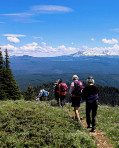
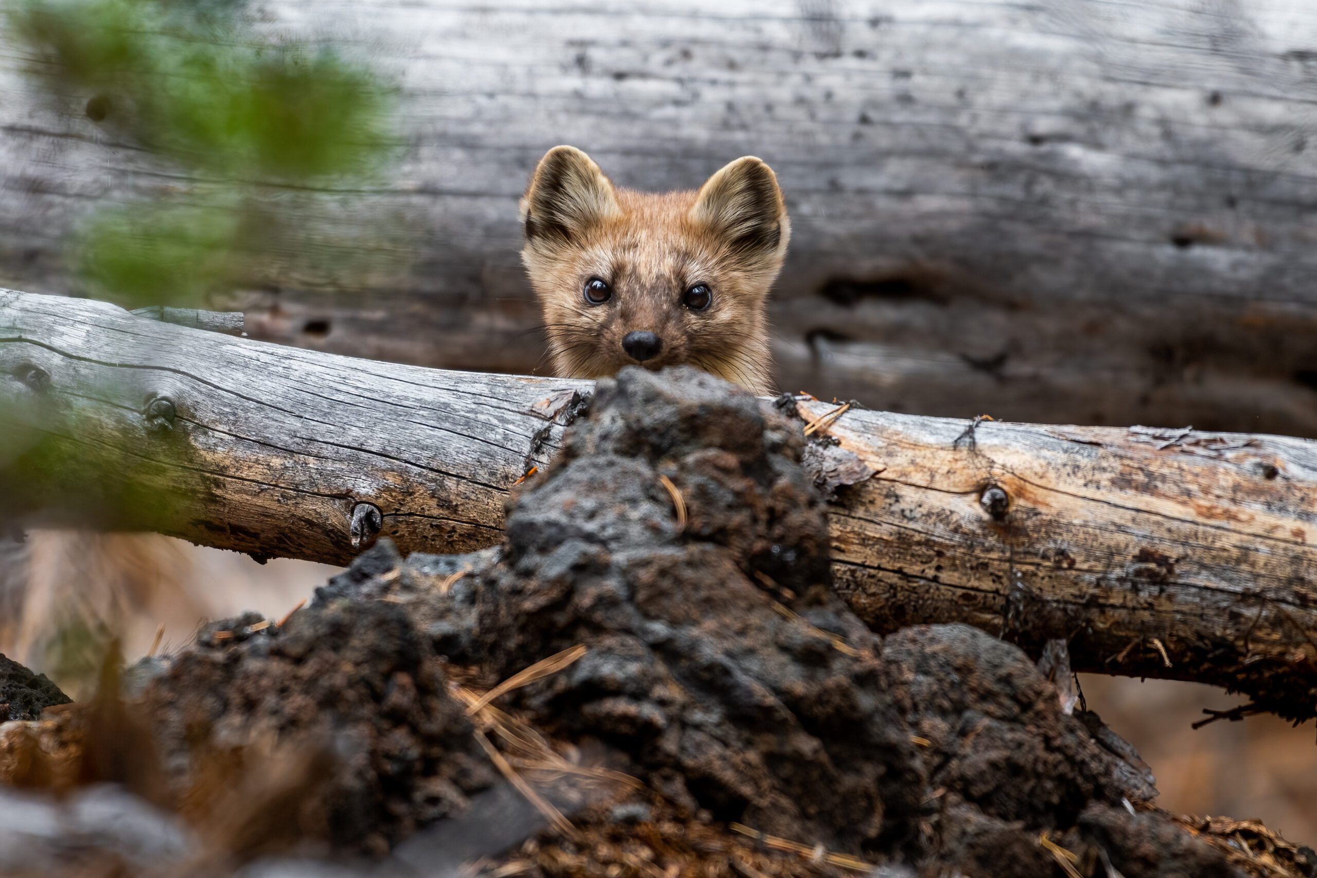
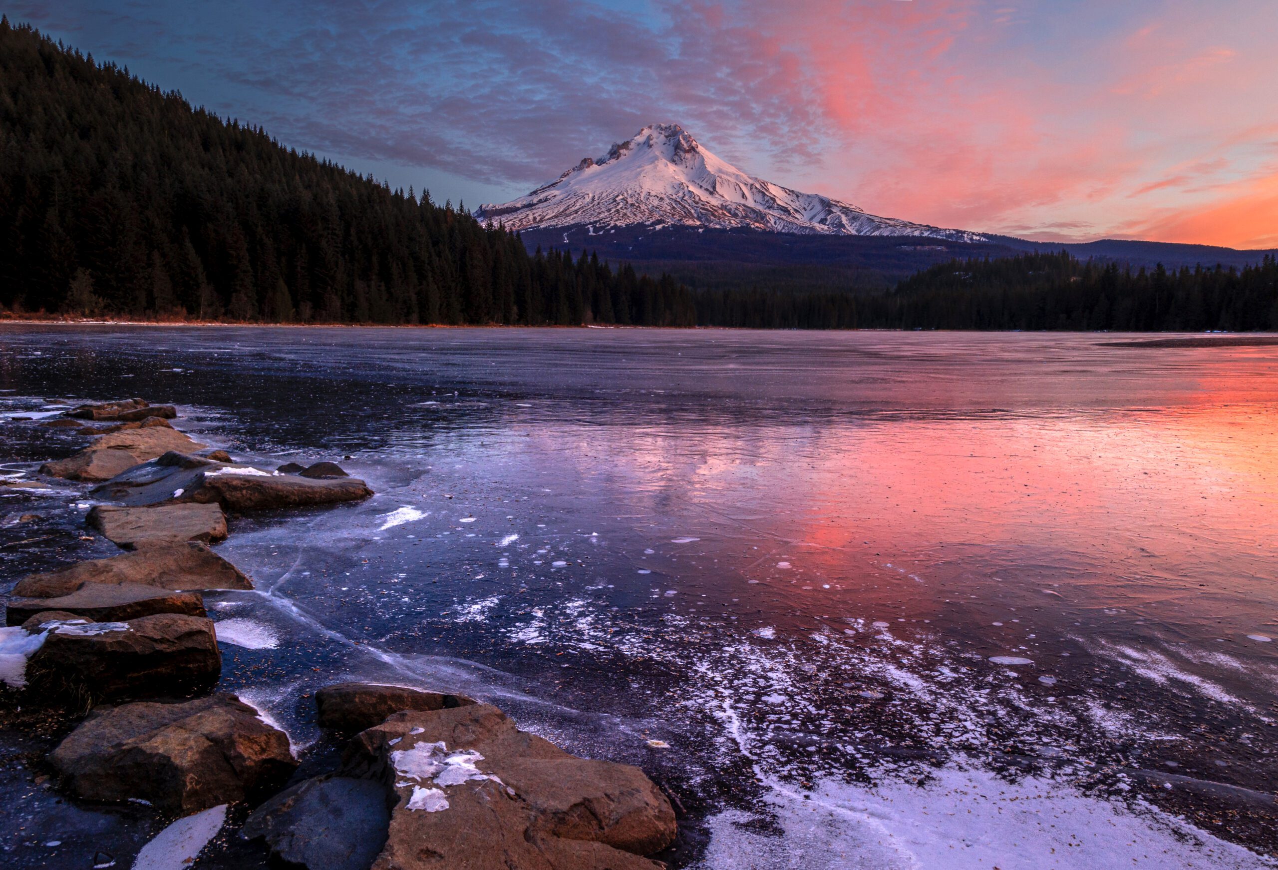


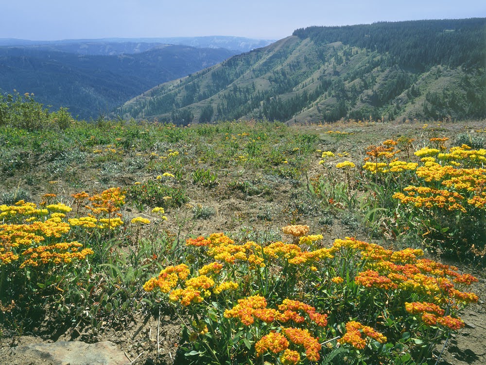
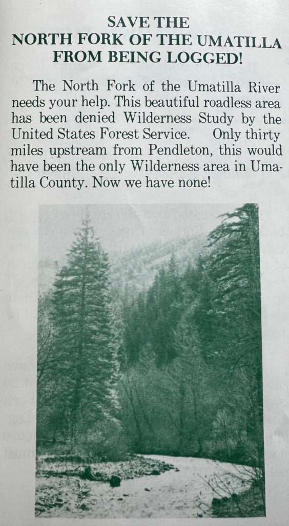
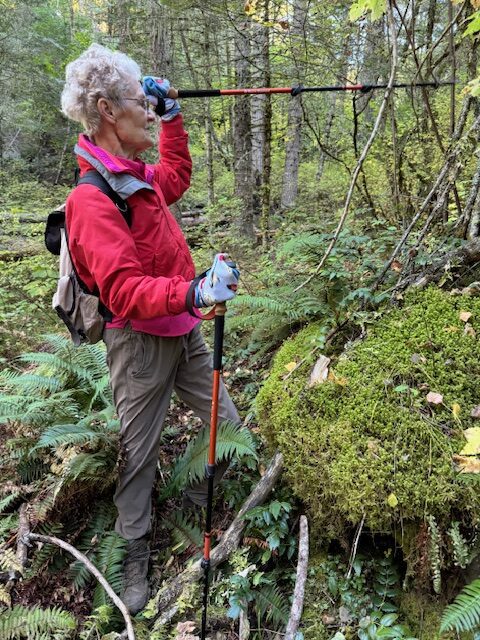
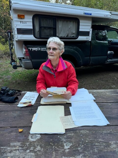
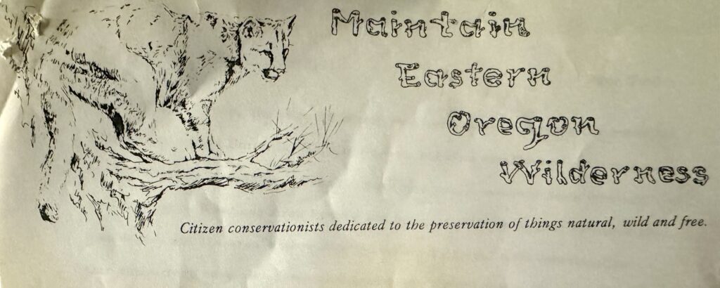
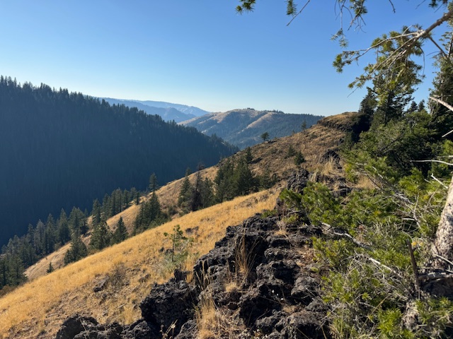
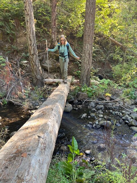
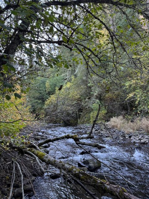
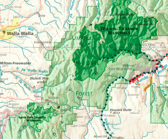
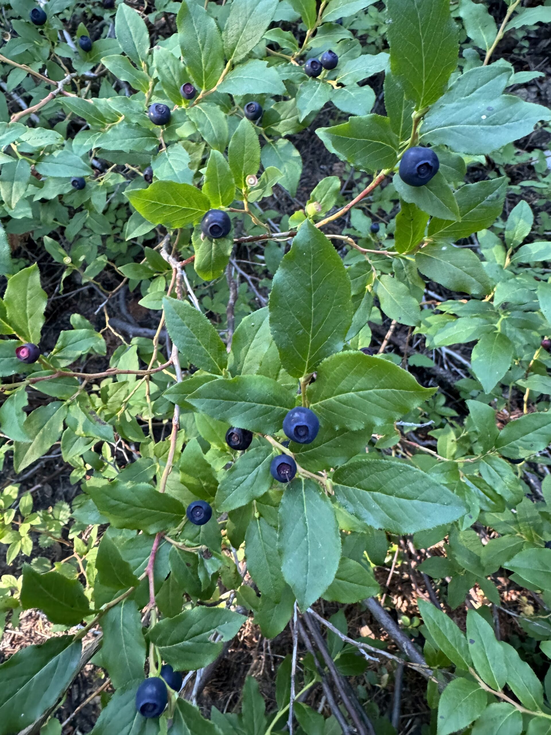
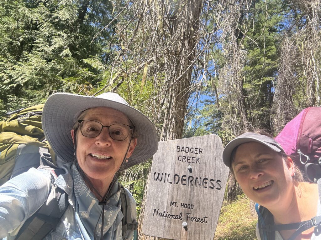
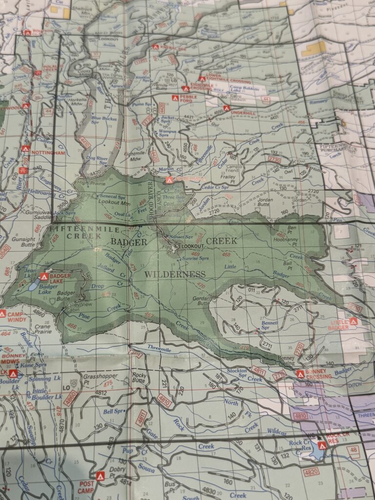
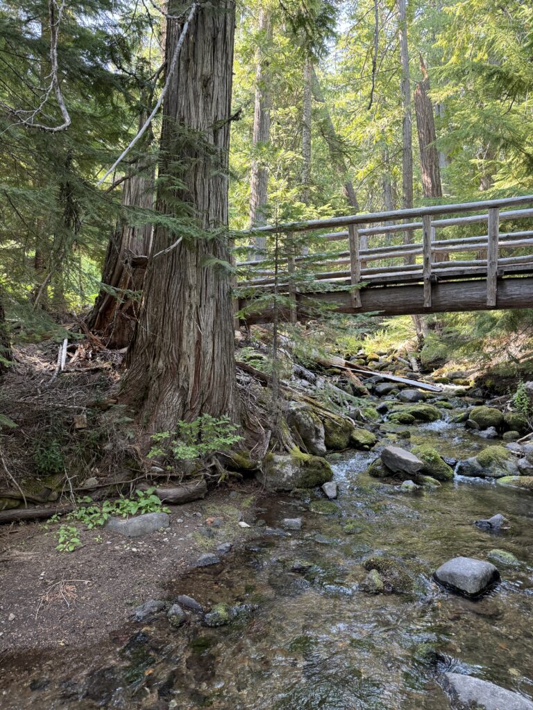
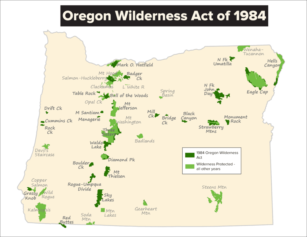
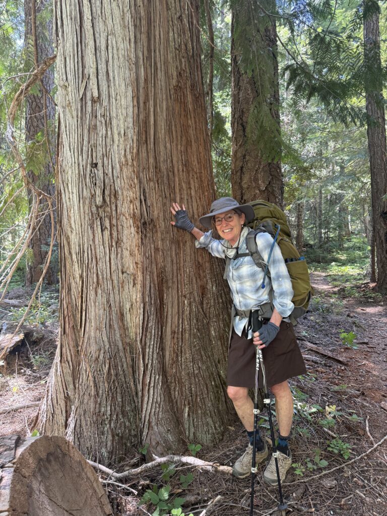
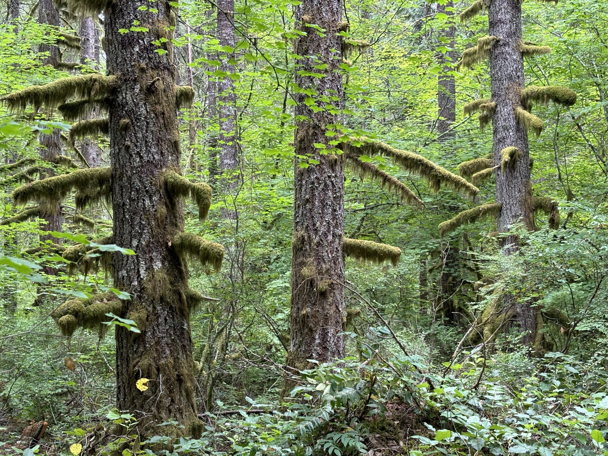
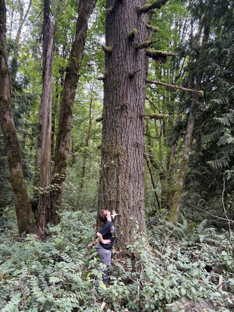

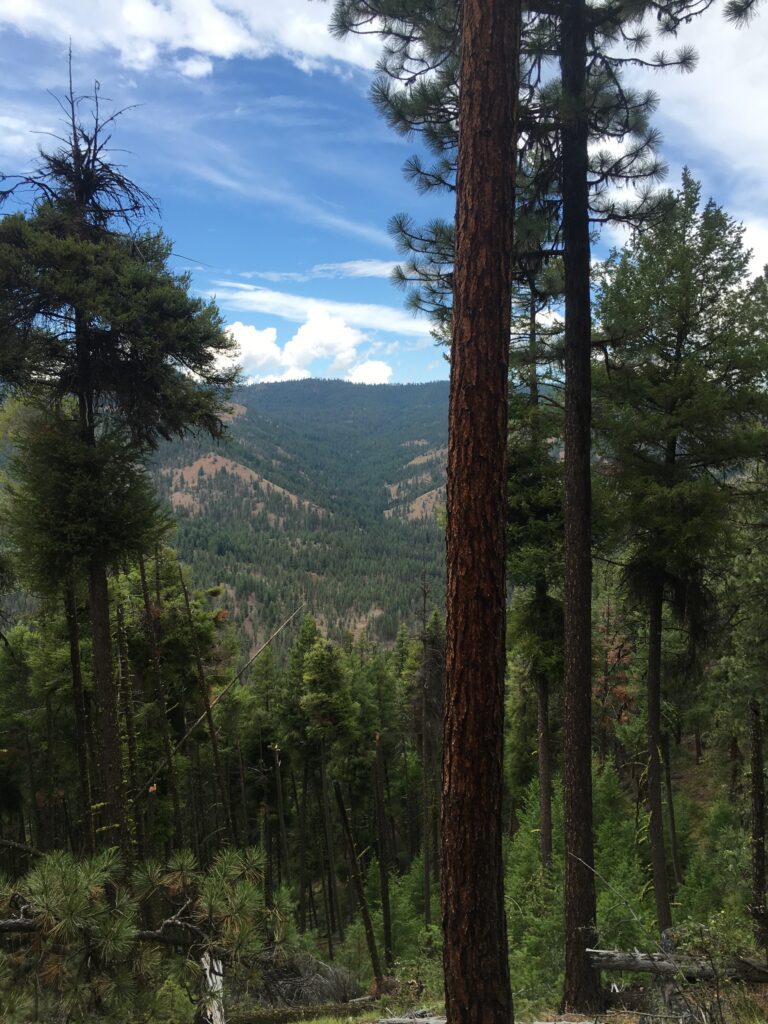
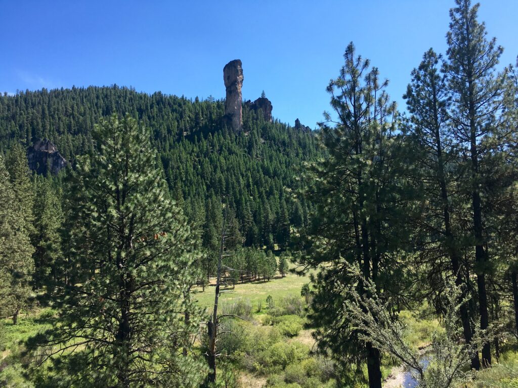
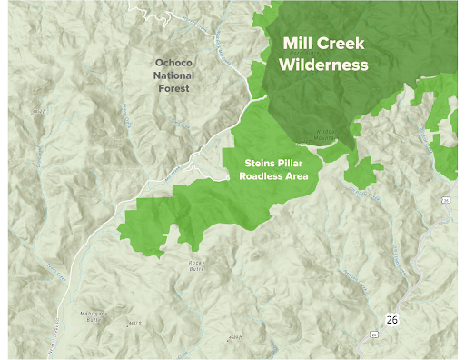
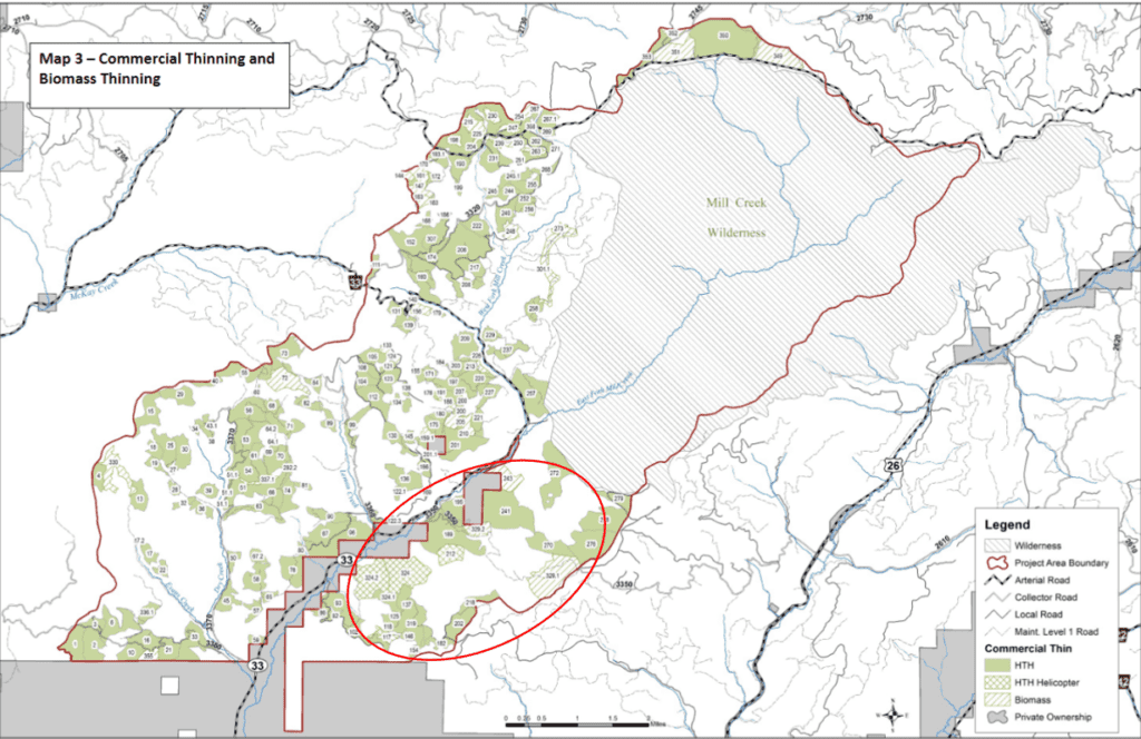
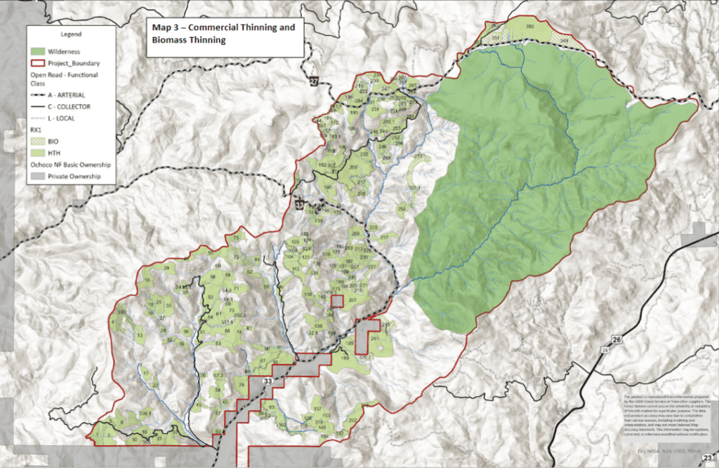
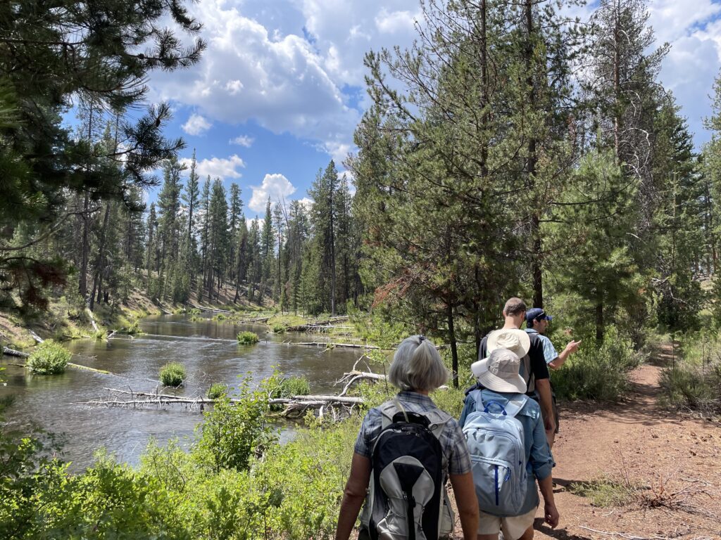
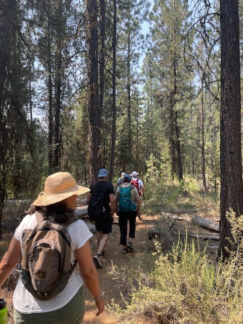
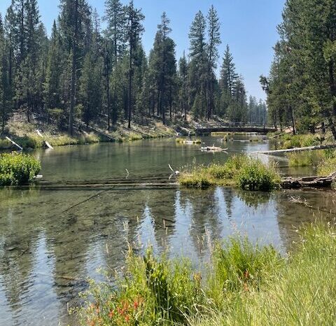
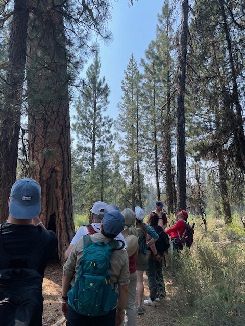
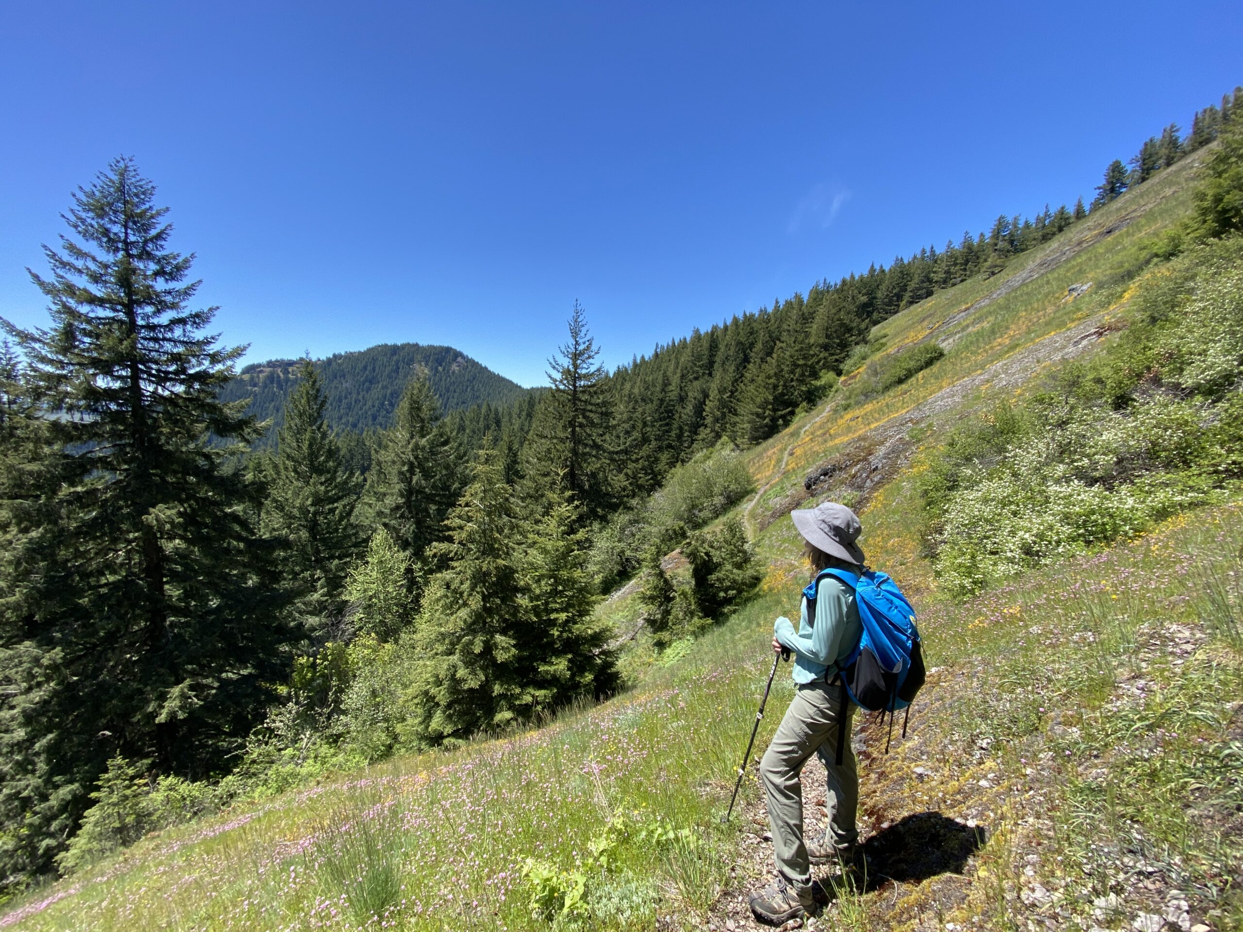
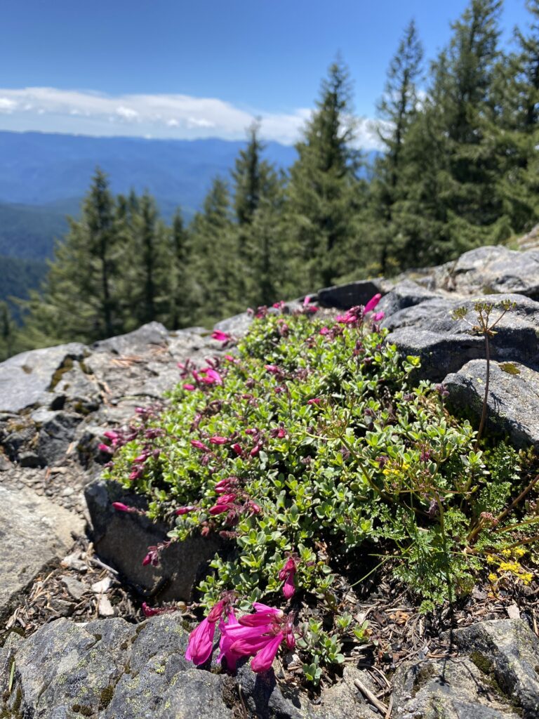
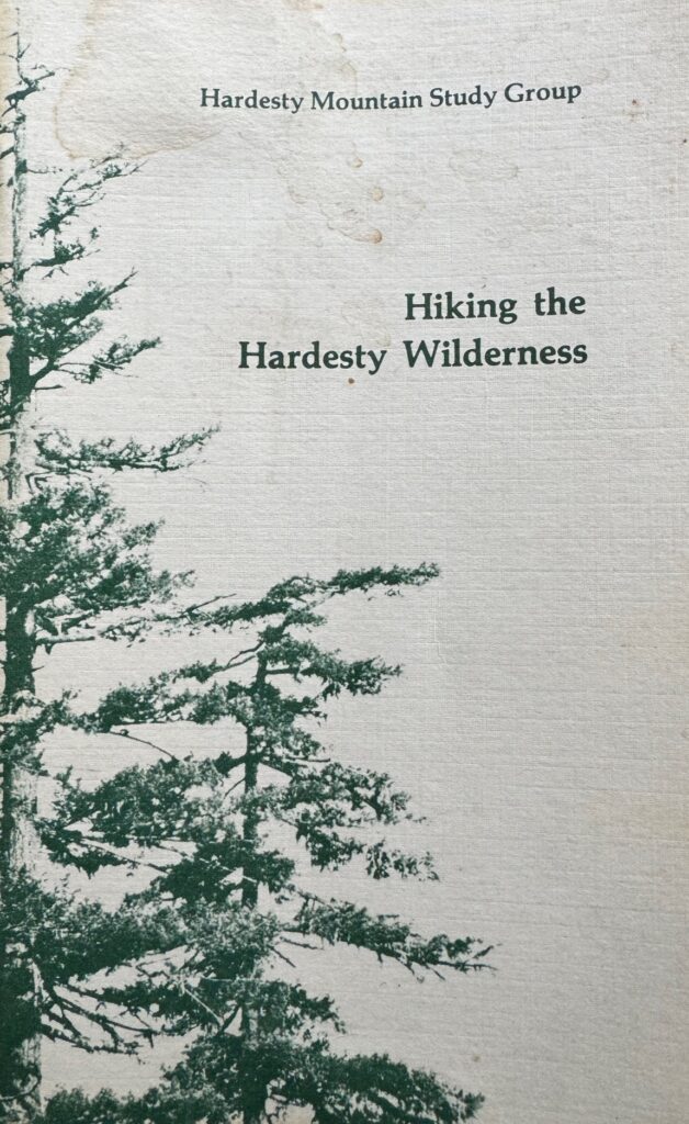
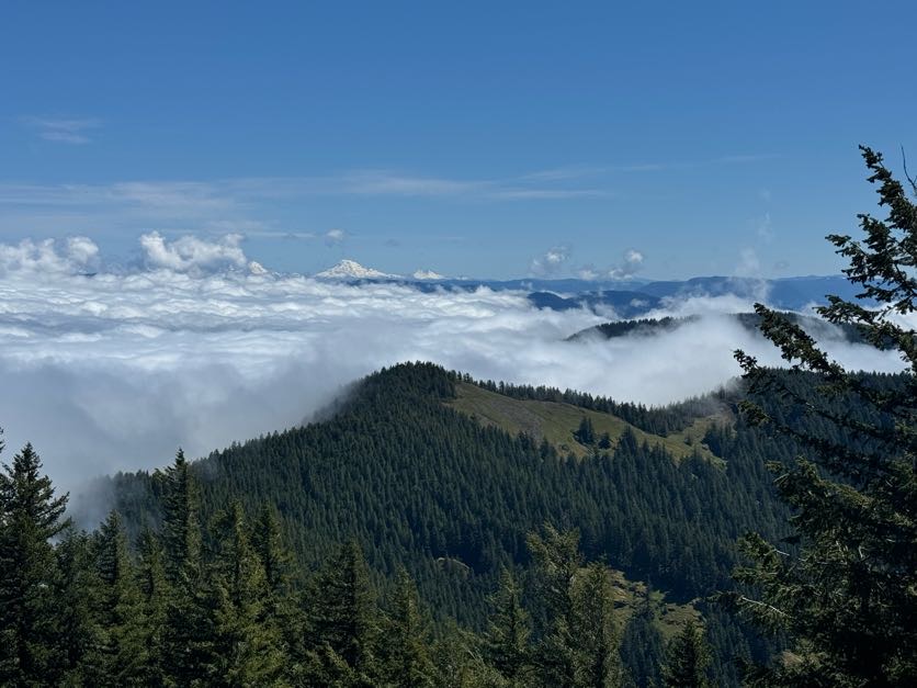
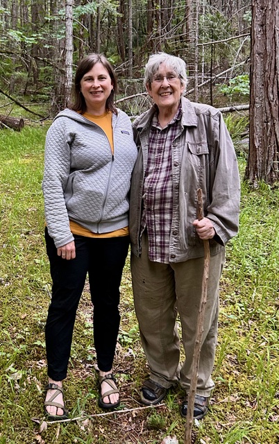
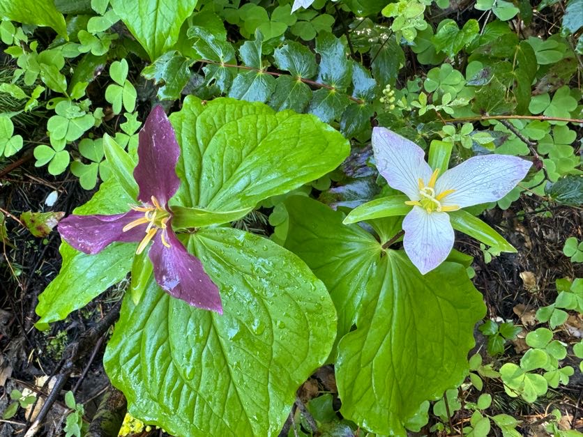
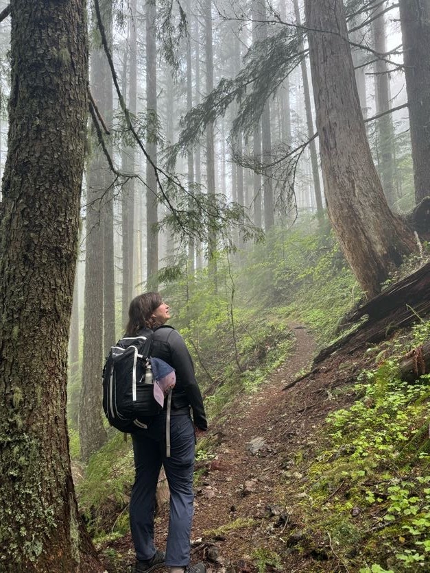
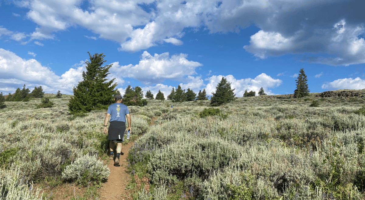
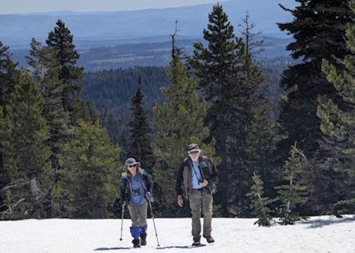
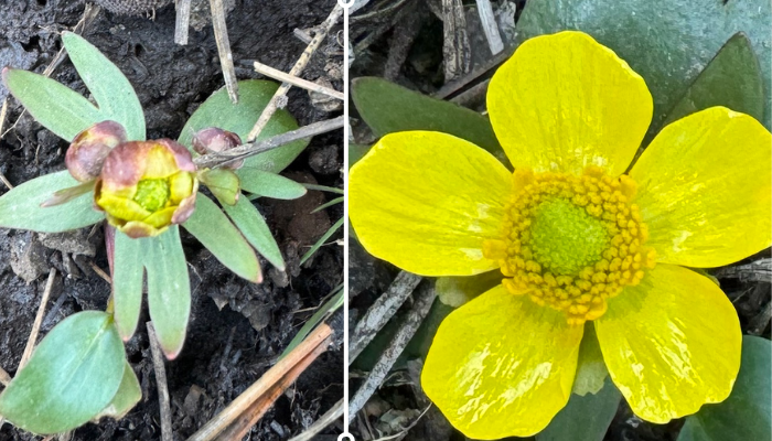
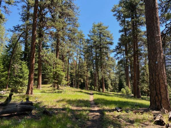
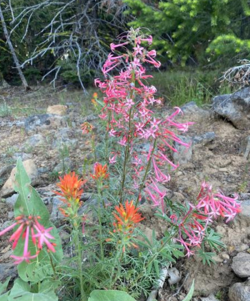
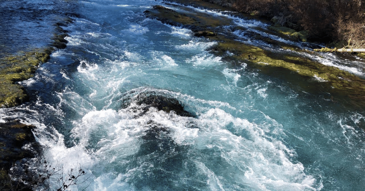
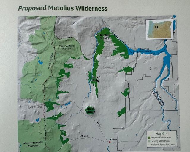
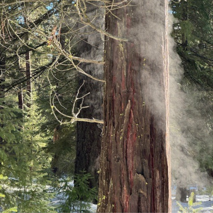
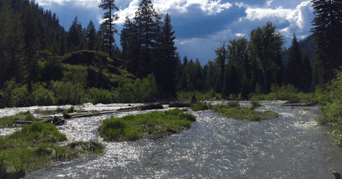 The Wild and Scenic Imnaha River