(C) GREG BURKE
Contact:    
Sami Godlove, Oregon Wild

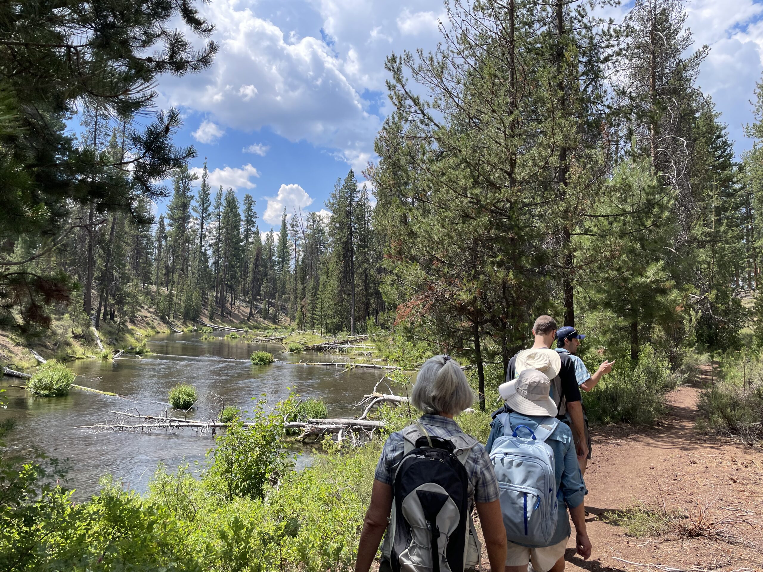
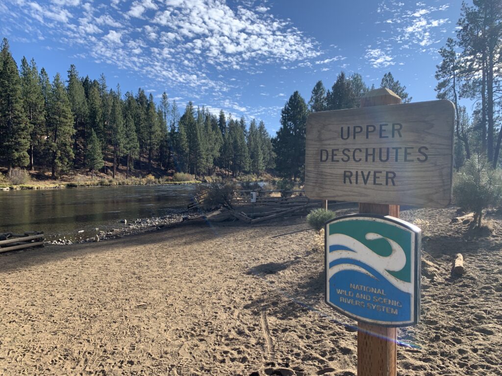
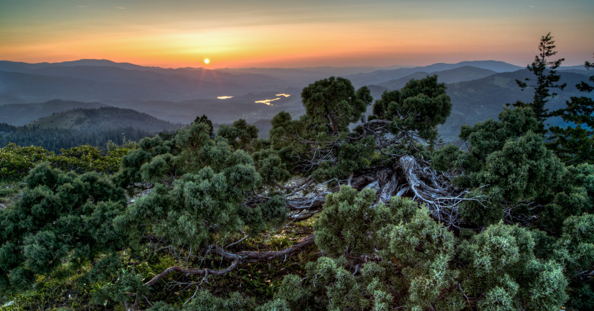
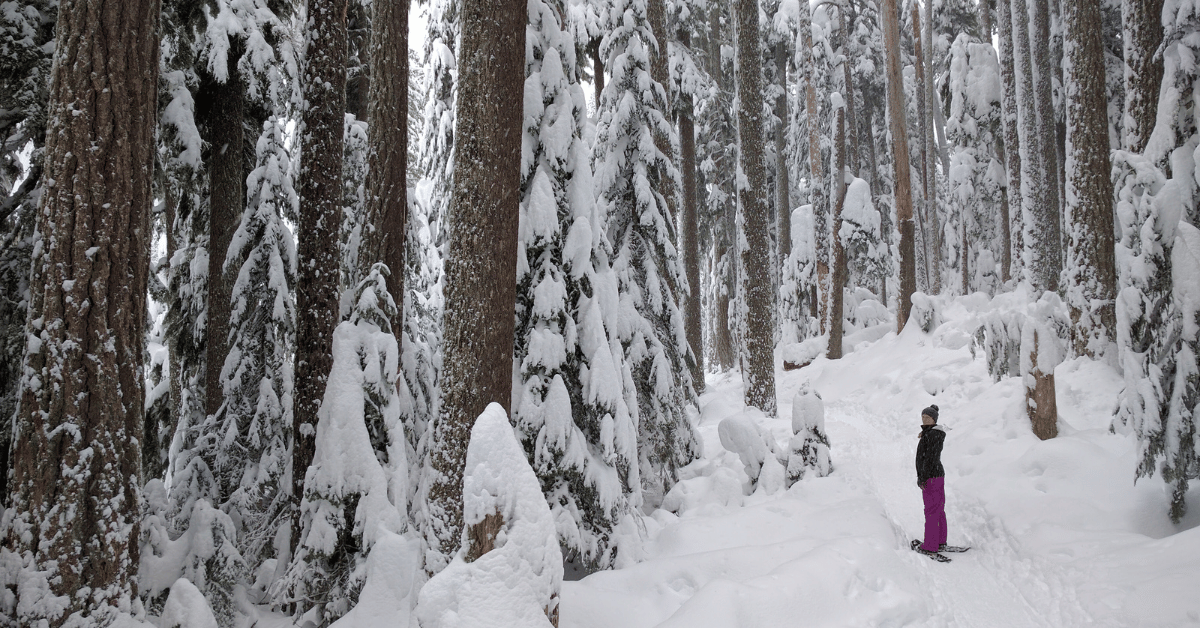
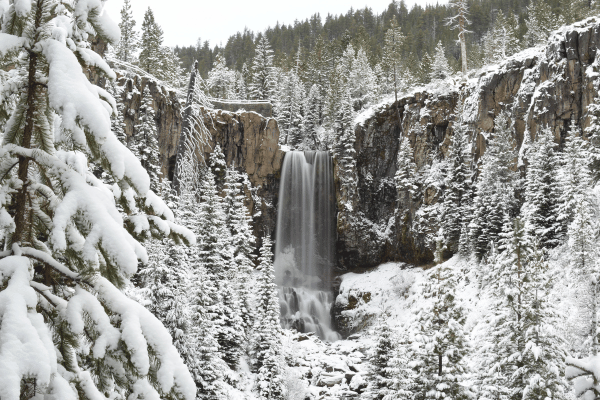
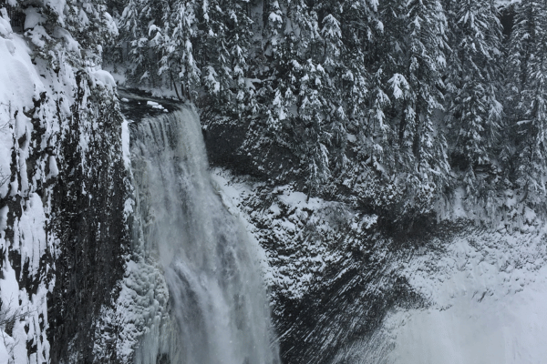
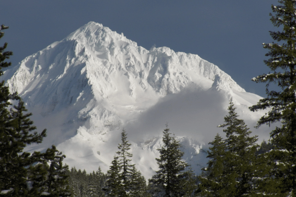
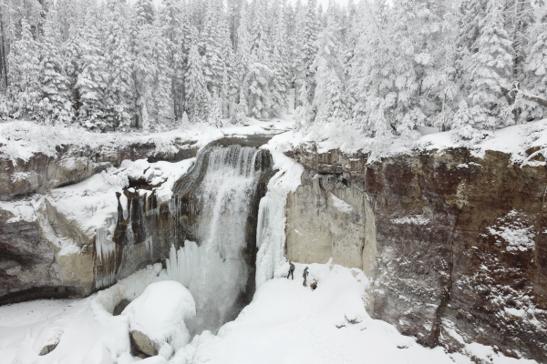
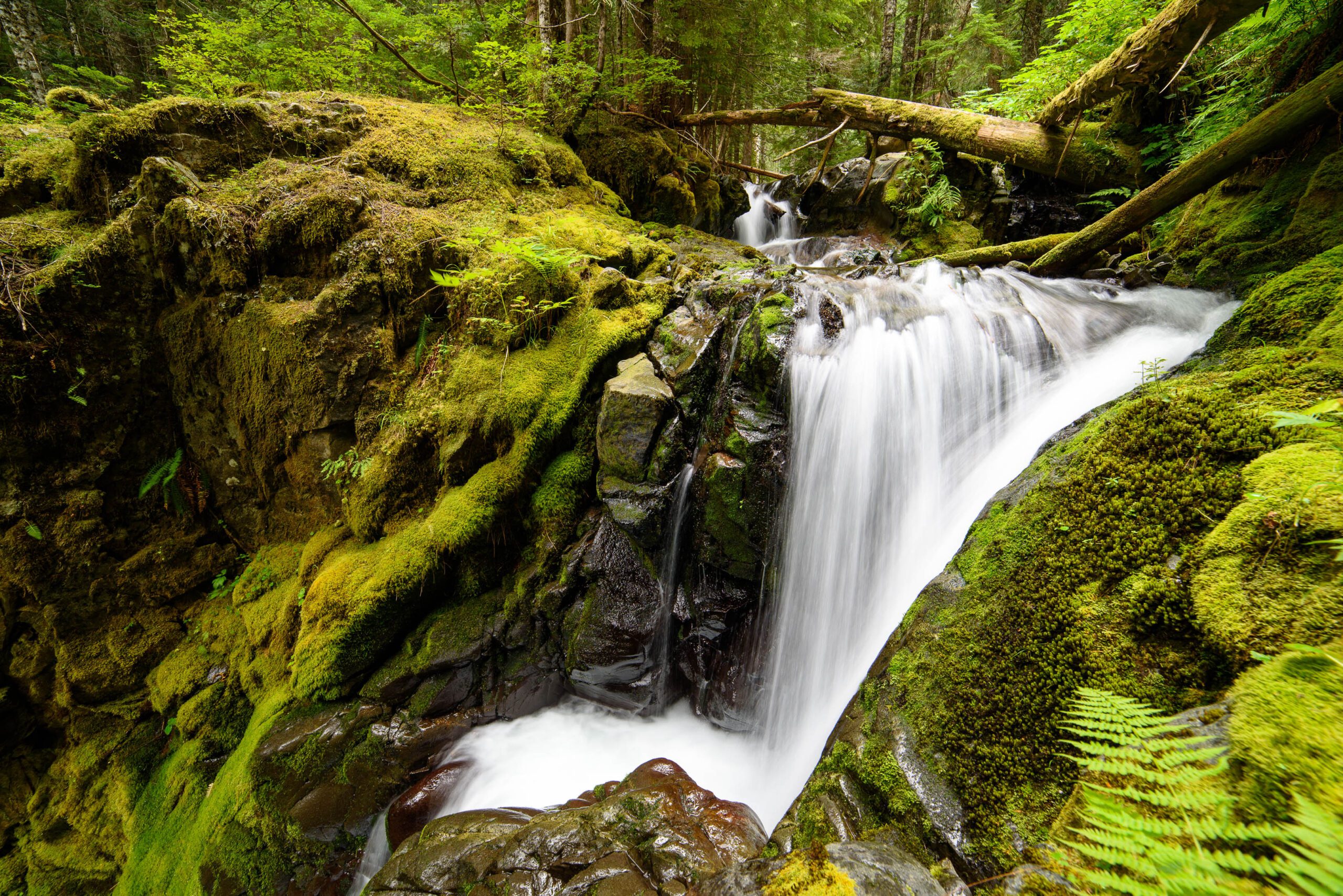
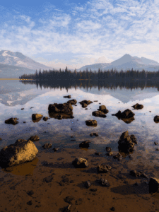
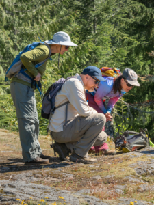
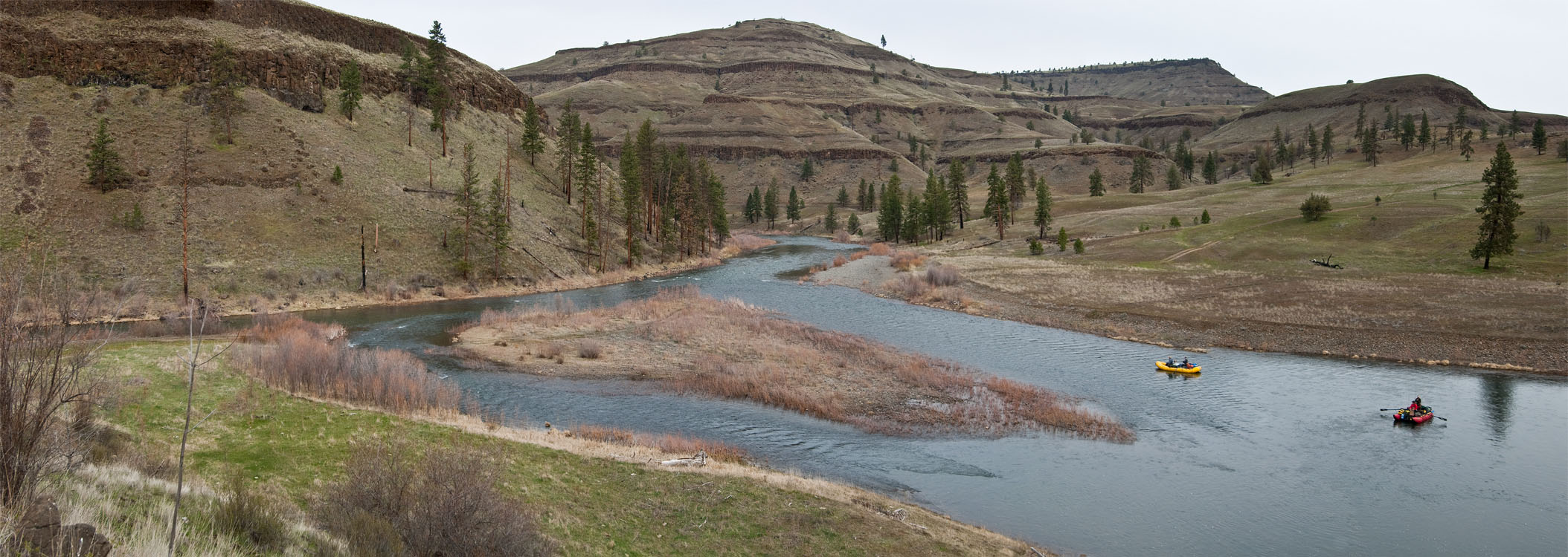
BEND, OR — As the busy summer season kicks off over Memorial Day weekend, outdoor recreation businesses, guides, nonprofits, and industry leaders across Oregon have come together in a unified show of support for the River Democracy Act, legislation that would add over 3,200 miles of Oregon rivers and streams to the National Wild and Scenic Rivers System.

According to a recent poll, 71% of Oregonians support additional Wild & Scenic River designations like those proposed in the River Democracy Act

In a letter sent today to Oregon’s congressional delegation—Senators Ron Wyden and Jeff Merkley, and Representatives Suzanne Bonamici, Cliff Bentz, Maxine Dexter, Val Hoyle, Janelle Bynum, and Andrea Salinas—these businesses and organizations highlighted the critical importance of Oregon’s rivers to the state’s economy, culture, and environment.

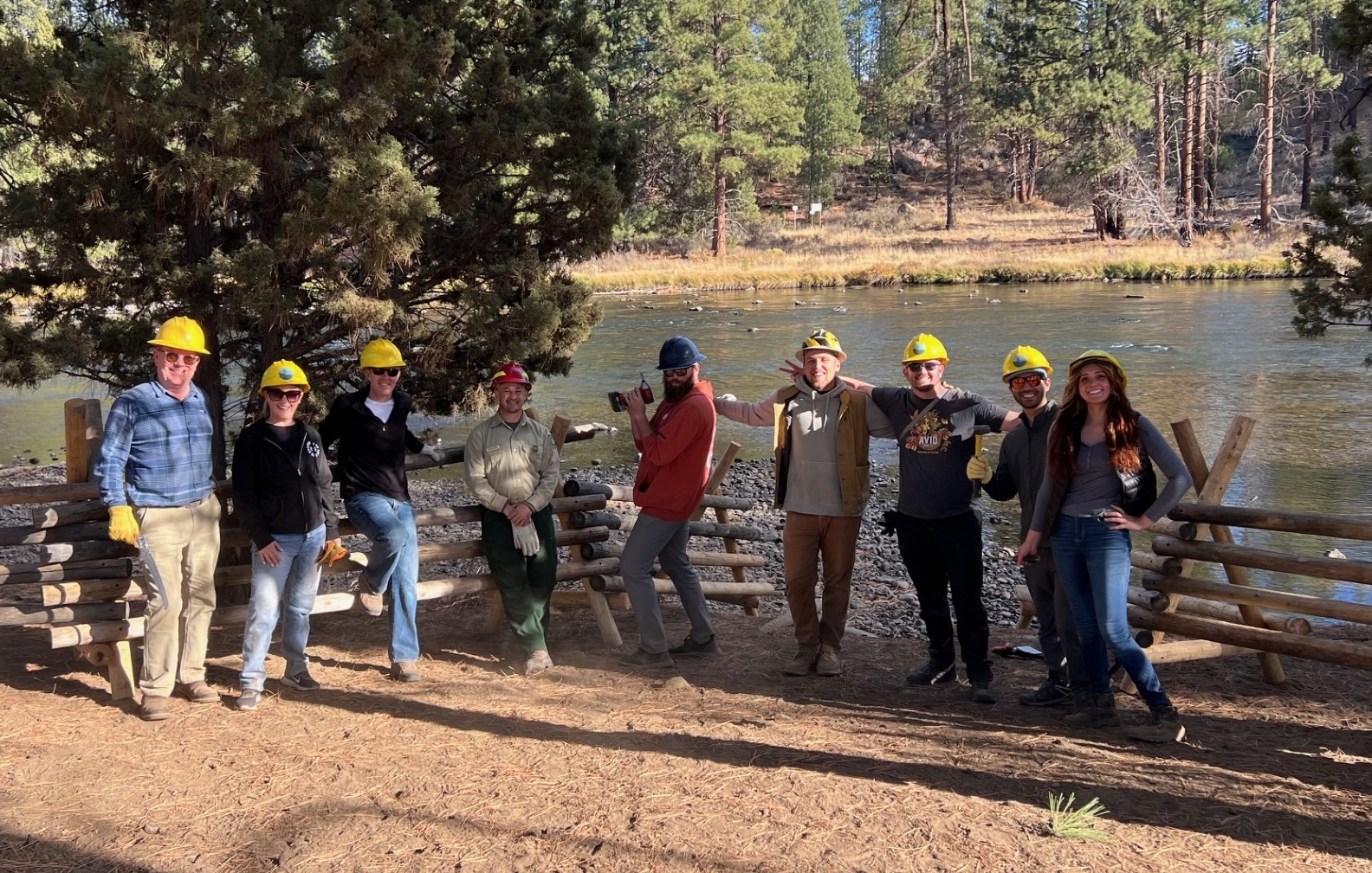
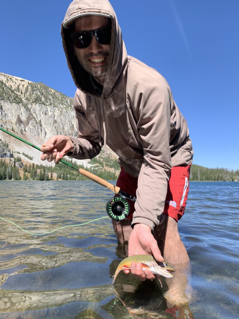
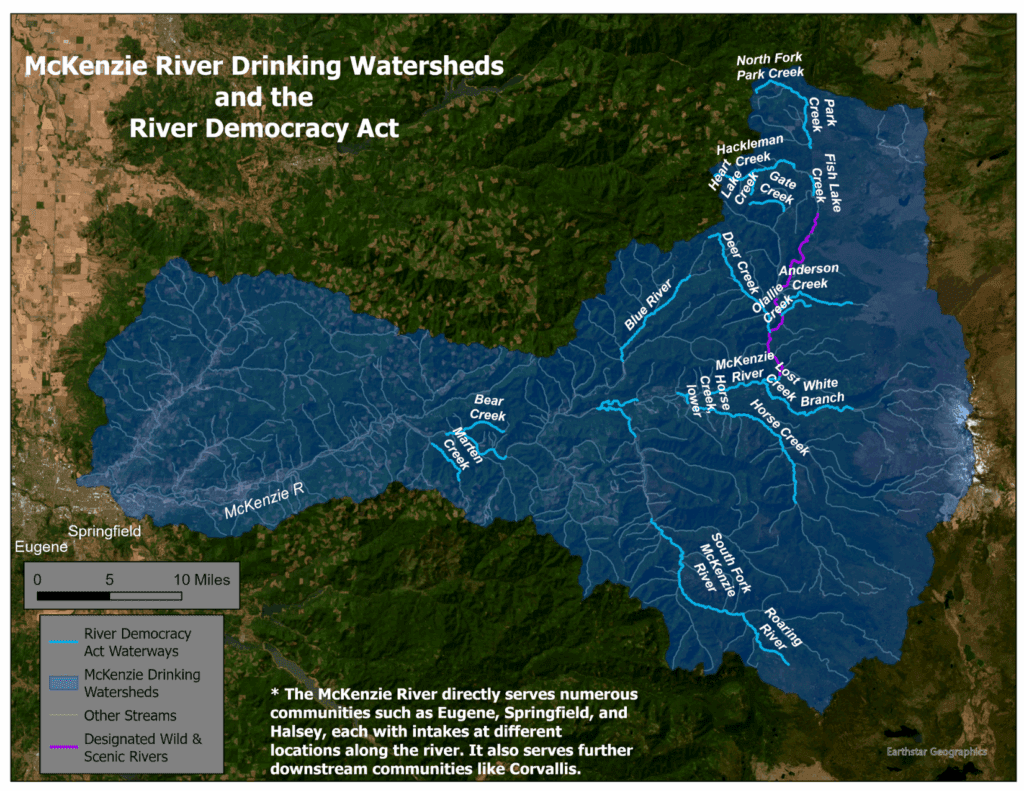
“Outdoor recreation is one of Oregon’s premier economic drivers,” the signers wrote. “In 2022 alone, spending on outdoor recreation in Oregon exceeded $16 billion and supported 192,000 jobs. Many of these jobs exist in rural communities where iconic rivers like the Rogue, Deschutes, and McKenzie attract visitors from around the world.”

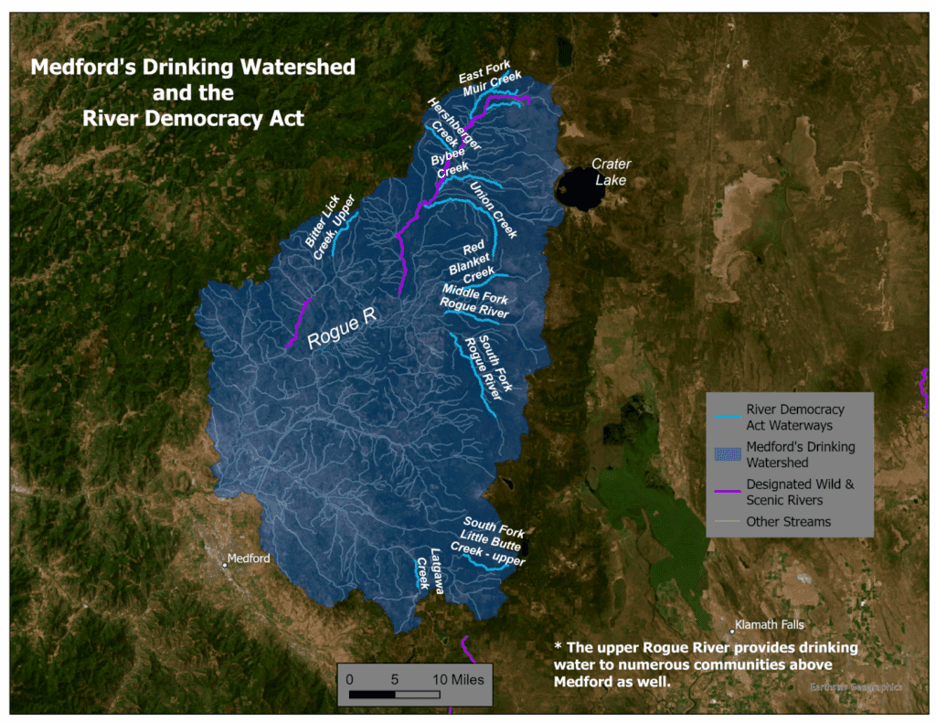
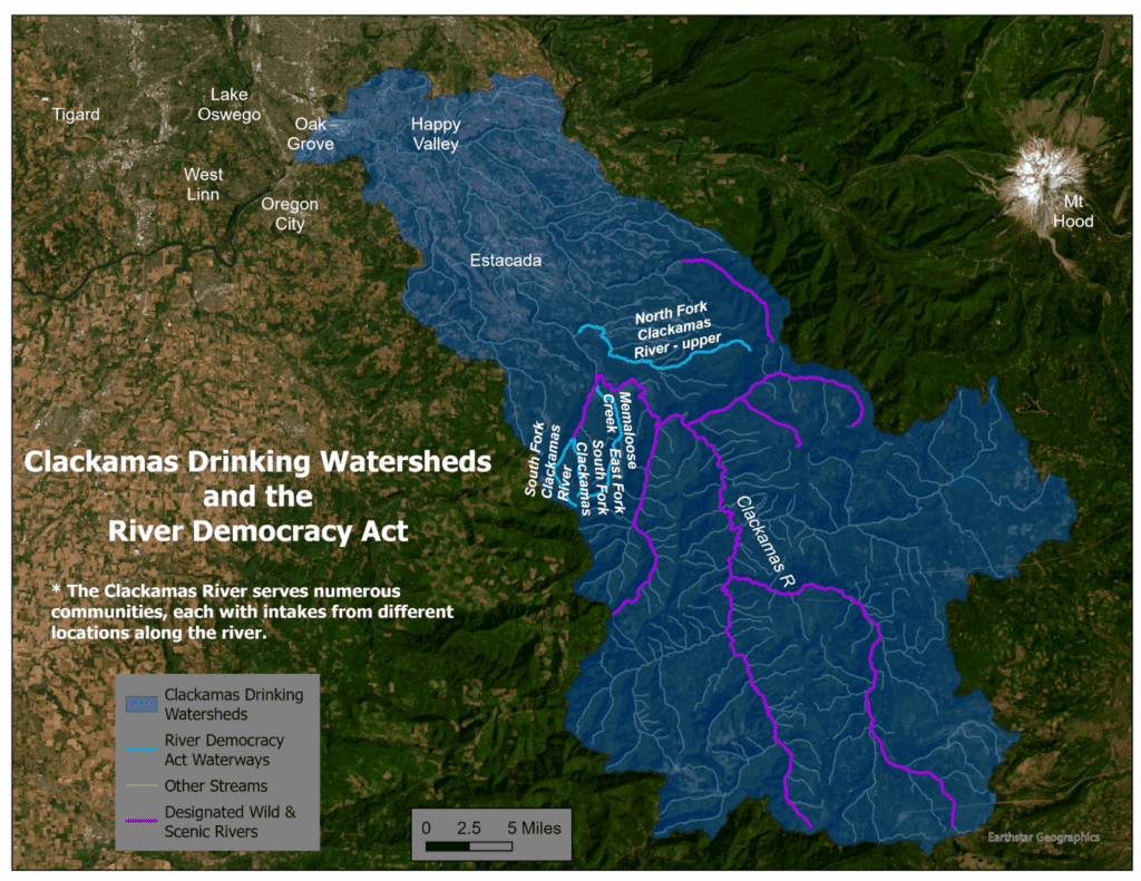
The River Democracy Act, championed by Senators Wyden and Merkley, seeks to safeguard thousands of miles of river segments across the state by granting them Wild and Scenic designation—offering permanent protections against damming, pollution, and development. 82% of Oregonians think Wild & Scenic designations are very important or somewhat important for protecting community drinking water.

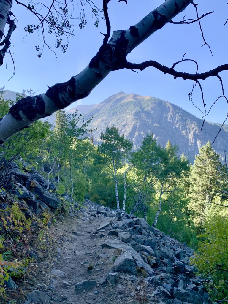
The proposal comes at a time of increasing threats to public lands and water resources, both from climate impacts and shifting federal priorities.

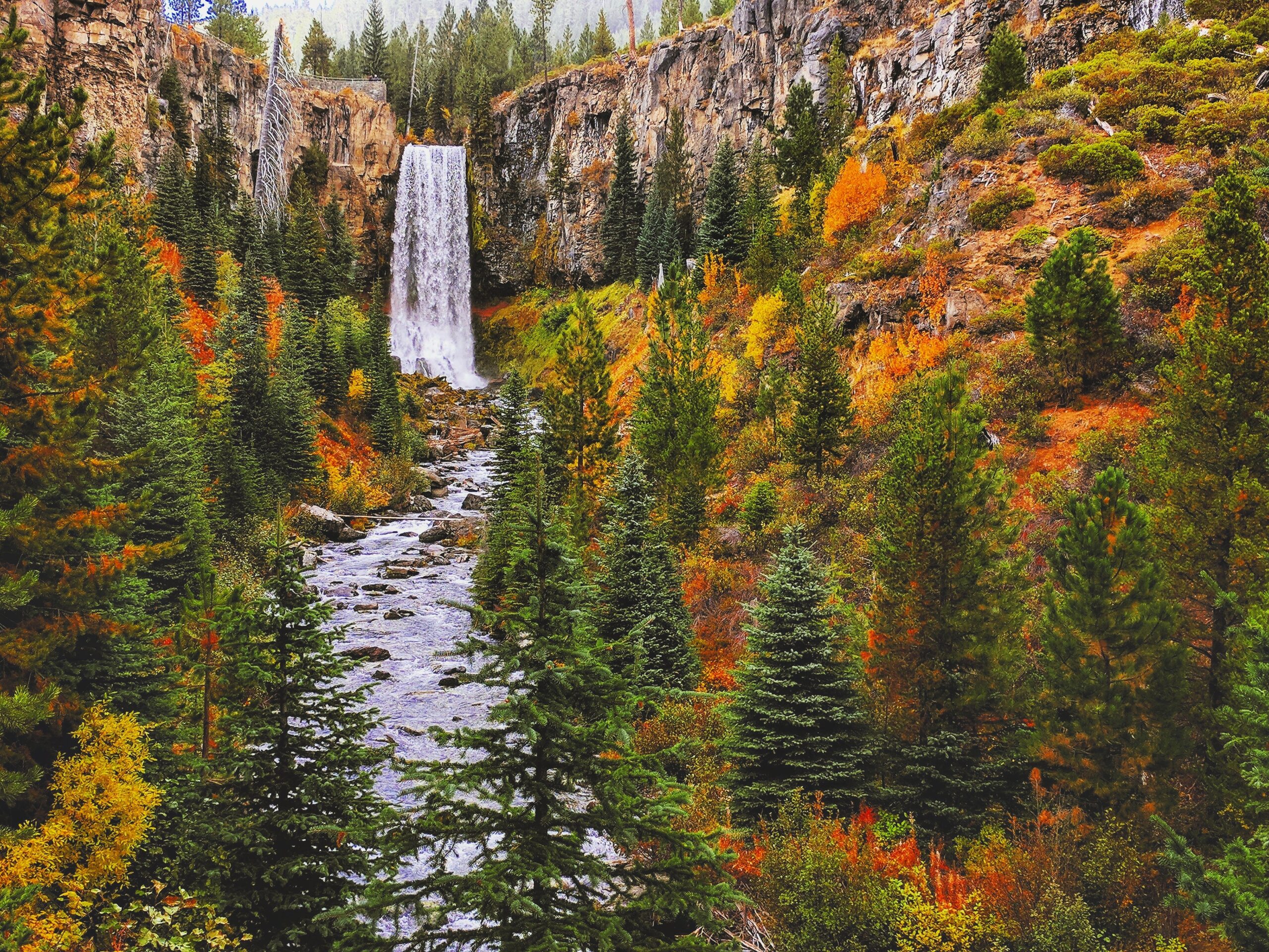
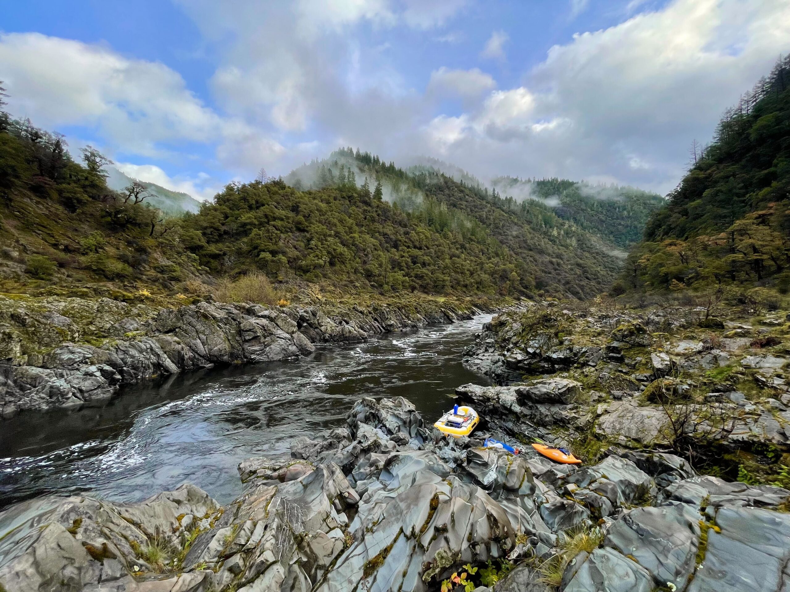
“Our way of life in Oregon is deeply connected to our rivers and public lands,” the letter states. “Whether we’re fishing, guiding, paddling, or simply enjoying the natural beauty, these rivers power both our economy and our identity as Oregonians.”

The signatories—from fly fishing guides in Madras to eco-tour companies in Gold Beach—are calling on Congress to pass the legislation and provide adequate resources to the federal agencies charged with protecting these waters, such as the U.S. Forest Service, Bureau of Land Management, and U.S. Fish and Wildlife Service.

“Even as we work to enact strong, permanent protections for these rivers, it’s vital that we support the people on the ground—the federal land managers who safeguard these places every day,” the letter notes.

The coalition praised the efforts of Senators Wyden and Merkley in advancing the legislation and urged the full Oregon delegation to prioritize passage of the River Democracy Act as a critical investment in the state’s recreation economy and natural legacy.

Signatories include:

  • Fishing and hunting groups like Backcountry Hunters & Anglers and Trout Unlimited Chapters across Oregon
  • River guides and outfitters from Bend, Eugene, Roseburg, La Grande, and more
  • Lodges, tour companies, outdoor brands, recreation organizations, and trail alliances from across the state

Full list of signatories:

Backcountry Hunters & Anglers

Blueback Chapter of Trout Unlimited, Corvallis

Blue Dream Wildlife River Tours, Roseburg

Central Oregon Running Klub, Bend

Clackamas River Trout Unlimited, Gladstone

Cog Wild Bicycle Tours, Bend

Dave Smith Decoys, Lebanon

Deschutes Redband Chapter of Trout Unlimited, Bend

Earthwell, Portland

Folklord, Portland

Go Wild: American Adventures, La Grande

GRAYL

Lake Creek Lodge, Camp Sherman

Leon Werdinger Photography, Joseph

Mazamas, Portland

Mecca Flat Fly Fishing Park LLC, Madras

Minam River Lodge, Wallowa County

Mountain Provisions, Ashland

OARS

Oregon Chapter of Backcountry Hunters & Anglers

Oregon Council Trout Unlimited

Ouzel Outfitters, Bend

Protect Our Winters, Bend

Recreation Leader, Bend

Redsides Chapter of Trout Unlimited, Springfield

River Drifters, Maupin

ROW Adventures, Eugene and Grants Pass

Sisters Trails Alliance, Sisters

South Coast Tours, Gold Beach

The Caddis Fly Angling Shop, Eugene

The Fly Fisher’s Place, Sisters

The Gear Fix, Bend

Trailkeepers of Oregon

Tualatin Chapter of Trout Unlimited

Tumalo Creek Kayak and Canoe, Bend

Vamonos Outside, Bend

Wallowa Llamas, Baker City

Wanderlust Tours, Bend

The Little Lava Fire burned through parts of the Deschutes National Forest in the fall of 2024.

They say a picture is worth a thousand words, and the photo below tells quite a story.

An aerial image of the Little Lava Fire burn area showing that a commercially logged forest burned much hotter than an adjacent, mostly unlogged one.
Aerial images of the Little Lava Fire burn area show that a commercially logged forest burned much hotter than an adjacent, mostly unlogged one.

This aerial image shows two adjacent forest stands within the Little Lava Fire burn area, in the Deschutes National Forest, just SE of Mount Bachelor. Single-selection thinning was done in both stands in 1978. This is when just a few individual trees within the stand are removed. The stand on the left side of the road was then commercially logged in 2019, which, as you can see in the photos, significantly reduced stand density and opened up the forest canopy. The stand on the right was undisturbed over the last 40 years.

When the Little Lava Fire burned through here last fall, much of the forest that was logged in 2019 resulted in high tree mortality. On the other side, the fire only burned and killed a few trees on the perimeter of the stand, but most are still green and alive.

Aggressive logging often makes fire risk worse

All too often, aggressive logging projects remove the large, mature trees that are the most fire resilient and leave behind smaller, younger trees that are more flammable. These projects also open the forest canopy, allowing more sun to reach and dry out the forest floor. Add in hotter, drier summers caused by climate change, and all of this can add up to increased fire risk and more flammable forests.

On the other hand, mature and old-growth forests across Oregon have unique adaptations to survive–and thrive–in fire-prone landscapes. Fire is natural and necessary for the health of these forests and the wildlife that depend on them for habitat. Larger and older trees, especially species like Ponderosa pine that are prevalent across forests in Central Oregon, develop thick, fire-resistant bark and self-prune their lower branches as they age, making them more resistant and resilient to wildfire. These forests also have more canopy cover than logged forests, creating cooler and wetter conditions on the forest floor that can reduce the risk of intense fire. Take a look at the top photo again; in the unlogged stand on the right, you can still see patches of snow (this photo was taken in late-April 2025). On the left, the soil in the open stand dried out much faster due to increased sun and wind exposure.

Despite the timber industry’s claims that more “active management” and “fuels reduction” are needed to prevent catastrophic wildfires, the science shows that logging is not preventing large wildfires. In fact, logging can often make fire risk and severity much worse. One Oregon study found that corporate-owned tree plantations burned at 30% higher severity than adjacent older stands on public lands. 

This has become a common talking point for the timber industry, who claim that forests are overgrown (and, thus, more susceptible to high-severity fire) due to a lack of management and that management (aka logging) is our best tool against climate-driven wildfires. This simple claim is driving much of the current national forest policy and an increase in poorly designed logging projects that are spreading like wildfire across the country.

Last fall’s Little Lava Fire, in the Deschutes National Forest, allowed us an opportunity to visit a recent burn area and see how forests that were commercially logged fared in the fire compared to adjacent forests that have not been logged as aggressively, and still maintain mature forest characteristics.

Touring the Little Lava Fire

Much like the other severe wildfires that have erupted across the west in recent years, this fire was driven by climate change–namely, high winds and drought-like conditions. 

The fire started near Little Lava Lake, the headwaters of the Deschutes River, from lightning strikes in early September 2024. High winds and dry conditions allowed the fire to quickly spread east towards the town of Sunriver, burning through logged forest, unlogged forest, and even fields of lava rock that are common in the area. 

Oregon Wild staff visited the burn area in April 2025 and sent up our trusty drone to take aerial photos of the burned forest. After referencing the photos with historical logging data, we found that previously logged forests still burned at high-severity and did not stop the fire.  We also found that, in some cases, logged stands burned much hotter than adjacent, unlogged stands.

An aerial image of an aggressively logged forest that burned with high severity in the Little Lava fire
Previous logging did not help prevent the spread of the Little Lava fire.

Parts of the forest burned extremely hot, killing nearly everything. The above photo shows stands that were aggressively logged in the 80s and 90s. The forest in the photo underwent a “shelterwood cut,” a term that describes a very aggressive form of logging. Imagine a clearcut, but with a few “seed trees” scattered throughout the stand that are left standing, and you have a shelterwood cut. Like a clearcut, most of the fire-resistant mature and old-growth trees are removed, and what we are seeing here is the consequences of a younger, drier, and more flammable forest.

When thinning can help

No, logging (or “active management,” “fuels reduction,” etc) does not prevent large fires and, as the Little Lava Fire demonstrates, it can (and often does) make these fires more destructive. However, there are certainly circumstances where some lighter-touch thinning makes sense and can create healthier and more resilient forests.

While the timber industry, land management agencies, and many politicians like to use logging as a one-size-fits-all blanket policy solution for all forests, the answer is not quite as clear-cut (see what I did there?) as they would like.

In reality, Oregon’s forests are incredibly diverse and have evolved differently with fire. In some places, natural low-intensity fires were common, and Indigenous peoples managed fires to promote the growth of certain foods and habitats. In other places, natural and Indigenous use of fire was rare. Decades of logging and fire suppression have left some dry forest types, like many in Central Oregon, unnaturally dense.

Restoration-based thinning and prescribed burning projects that focus on removing small trees and brush (that have grown in due to a lack of natural fires) near communities and seek to restore old-growth conditions can be beneficial in these dry forests. Efforts like the Glaze Meadow restoration project near the town of Sisters have reduced fire risks while improving habitat for fish and wildlife.

Current proposals to expand logging on public forests

Unfortunately, several concerning proposals are making their way through Congress and the Trump Administration that would increase and expand logging projects on public lands.

One of the largest is the so-called “Fix Our Forests Act.” Despite its name, this bill is merely a timber industry giveaway that would allow more logging on public lands and remove public oversight, scientific review, and environmental analysis of those logging projects. The bill passed the House of Representatives in January and is now in danger of being voted on by the Senate and sent to President Trump’s desk.

Earlier this spring, the Trump Administration issued an Executive Order and secretarial memo focused on expanding industrial logging across 60% of our National Forests–including millions of acres of roadless areas, old-growth forests, wilderness-protected lands, and critical wildlife habitat.

These proposals have nothing to do with reducing wildfire risk, and everything to do with handing control of our national public lands over to private industries that stand to profit off them.

What can you do

Contact your Senators today and tell them to oppose the Fix Our Forests Act. Reach out to your members of Congress and let them know that more logging is NOT the answer.

Advocate for the solutions that do work and do protect communities:

  • Funding and investment in home hardening, defensible space, and community preparedness (learn about how you can make your home safer from fire
  • Cultural and prescribed burning in forests that have become unnaturally dense due to fire suppression 
  • Redirect resources used to log backcountry forests to restoration-based burning and small-diameter tree thinning projects in areas near homes and communities.

To learn more about fire and forests in Oregon, check out our blog about the Ten Things Oregonians Should Know About Forest Fires.

Some of Oregon’s best hikes can be found along some of the more than 2,100 miles of designated Wild & Scenic Rivers across Oregon – from the Rogue River headwaters to its famous lower stretch; Fifteenmile Creek on the east slope of Mount Hood to Central Oregon’s treasured Metolius and Deschutes; and the Ponderosa-pine lined Malheur and Imnaha Rivers in eastern Oregon.

Of course, there are many more rivers and streams in Oregon that are deserving of Wild & Scenic River protection. The River Democracy Act, one of Oregon Wild’s priority campaigns, would protect an additional 3,215 miles of Wild & Scenic Rivers across the state. Developed with an extensive public process, Senator Ron Wyden first introduced the bill in Congress in 2021. Under the Act, each Wild & Scenic River segment would gain a protected buffer of ½ mile on each side – enhancing the recreation experience, as well as safeguarding fish and wildlife habitat, clean drinking water, and preventing reckless and exploitative development like logging and mining. 

At a time when we are seeing unprecedented attacks on public lands and waters, protections for Oregon’s rivers and streams are more important than ever.

Let’s get hiking!

Many of the waterways proposed as Wild & Scenic Rivers in the River Democracy Act feature trails that wind through the wild forests and meadows along their shores. Want to experience some of these places for yourself? We’ve developed a trail guide to 20 streamside hikes (plus suggestions for 16 more) to help you explore, enjoy, – and most importantly – advocate for these special places all across the state. 

Download the RDA hiking guide here!

Before you head out on a hike, be sure to download a good map, and be well prepared. Check out Oregon Wild’s resource library for what you need to know!

Oregon Wild staff also lead guided hikes throughout the year, including some in this guide. Check here for upcoming guided hikes.

Learn more and take action

Hordes of people were out and about along the Deschutes River, enjoying a warm, sunny day in Bend, Oregon. Some were on bikes, others were with their dogs. And others–well, at first, you might not know what they were doing. 

They were wearing hard hats and carrying long wooden beams and posts. Most looked to be struggling under the weight and awkwardness of their loads, audibly sighing in relief once they could drop them at their intended destination right next to the riverbank. Others in the group configured these posts and beams into a fence along the river’s edge. Enthusiastic smiles and high-fives were passed around, and then a few of them started up the hill again to retrieve more beams and posts.

In case you were one of the confused onlookers that day walking by this odd sight, this was, in fact, a group of Avid Cider, Oregon Wild, and U.S. Forest Service staff working to build fencing to protect sensitive riparian vegetation and streambanks along a popular section of the Wild & Scenic Deschutes River.

Volunteers put together a fence to protect a riparian area along the Deschutes River.
Volunteers from Avid Cider Company put together a fence to protect a riparian area along the Deschutes River. Photo: Aaron Staylor

Northwest Is Our Core: Cider for a Cause

This Fall, Avid Cider partnered with Oregon Wild and Conservation Northwest to launch the Northwest Is Our Core program, an initiative to raise awareness and funds for wildlife and forest conservation across the Pacific Northwest. A portion of cider sales and 100% of profits from some very cool merch were donated to these conservation causes.

Avid Cider has been a proud partner of the Oregon Brewshed Alliance© since the Spring of 2024 and we were honored when they reached out to Oregon Wild asking us to be their conservation partner for the first year of this campaign.

Cider and conservation? We’ll drink to that!

Putting in the (restoration) work on the Upper Deschutes

To celebrate the end of the Northwest Is Our Core program, Avid, Oregon Wild, and local staff from the Deschutes National Forest teamed up to continue building fencing along the Deschutes. This restoration work, focused on a designated Wild & Scenic section of the Deschutes near Rimrock Trailhead (aka GoodDog), has been ongoing for several years in an attempt to protect sensitive vegetation in the riparian area. Due to the high popularity and traffic at this area, the trails and streambanks have become significantly eroded in recent years. Fencing helps direct people (and dogs) to designated trails and river access points, reducing the amount of erosion from off-trail use.

Volunteers put together a fence to protect a riparian area along the Deschutes River.
Photo: Aaron Staylor

The Upper Deschutes River was designated Wild & Scenic in 1988 for its incredible ecological, scenic, and recreational values. Hundreds of miles of trails run along the river and within its adjacent forests, visitors from all over flock to the Deschutes for its world-renowned whitewater and fly fishing opportunities, and locals enjoy the vast physical and mental health benefits of a stroll or picnic along a wild river. The river corridor also provides important habitat for mule deer and elk, eagles and osprey, native trout, threatened species like Oregon spotted frogs, and a whole host of other wildlife. 

Unfortunately, climate change, drought, development, and poor upstream and downstream water use activities have threatened this special river and those (human and non-human) who rely on it. Trail work and restoration work like the Avid/Oregon Wild/USFS crew did that day helps. Oregon Wild is also working to pass Senator Wyden’s River Democracy Act, which would protect over 3200 miles of stream all across the state, including many within the Upper Deschutes watershed. By protecting these critical headwater streams of the Deschutes, we help protect clean water and wildlife habitat downstream.

Thanks to businesses like Avid Cider and everyday Oregonians who care about this special river, we can safeguard the Deschutes and the important values it provides. Become a Citizen Co-sponsor of the River Democracy Act today and tell your members of Congress to pass this historic bill.

For a wilder Deschutes.

"Upper Deschutes River" Wild and Scenic River sign along the river.

Last weekend, I hiked to Aneroid Lake, deep in the Eagle Cap Wilderness in Northeast Oregon. Our hike started at the busy Wallowa Lake–its cabins, lodges, and campgrounds full of families enjoying the holiday weekend and last days of summer. A couple of miles and a few switchbacks later, we were high above the lake and crossing into the Eagle Cap Wilderness. We came across several other hikers and backpackers on the trail, but the quietness was noticeable. As we caught our breath, we marveled at the immense walls of granite towering above us. Songbirds called out and darted between the firs and hemlocks. The sudden snap of a downed branch quickly drew our attention; a moment later, a deer walked out into a lush meadow, framed by stands of lodgepole and the peaks above. 

At the lake, we enjoyed a charcuterie lunch on a beach to ourselves and spent the afternoon fishing for trout eager to sample anything floating on the surface. During the hike up, and especially as we lounged and fished at this scenic alpine lake, I kept thinking back to the law that permanently protected this place and many others like it. A law written and passed by forward-thinkers who believed our few remaining wild and undeveloped landscapes should be set aside and safeguarded from the ever-encroaching reach of development and extraction. It was fitting that just days before the 60th birthday of the Wilderness Act, I was visiting Oregon’s largest, and one of its first, designated wilderness areas.

Aneroid Lake in the Eagle Cap Wilderness
The clear, blue waters of Aneroid Lake in Northeast Oregon’s Eagle Cap Wilderness.

The Wilderness Act is signed

On September 3, 1964–60 years ago today–President Lyndon B. Johnson signed the Wilderness Act of 1964 into law, officially creating the National Wilderness Preservation System. With the stroke of a pen, nine Wilderness areas in Oregon, including the Eagle Cap, were designated–and many more across the U.S.

Oregon’s Wilderness Expansion: A Landmark Achievement

And then 40 years ago, in 1984, Oregon’s largest expansion of wilderness protections was enacted when the Oregon Wilderness Act of 1984 was passed in Congress. This added 21 new wilderness areas to Oregon and expanded eight others. These newly protected areas included ecologically vital habitats like the old-growth forests of the Badger Creek, Bull of the Woods, Drift Creek, and Middle Santiam Wilderness areas. Other gems such as the Waldo Lake, Rogue-Umpqua Divide, and Mount Thielsen Wilderness areas were also established. In total, this bill added 878,000 acres of ecologically important Oregon watersheds to the Wilderness system in Oregon.

A map of the Wilderness areas protected in Oregon.
The Oregon Wilderness Act of 1984 added 21 new wilderness areas
to Oregon and expanded eight others.

The Gold Standard: Why Wilderness Protection Matters

At Oregon Wild, we often refer to Wilderness designation as the “gold standard” for public lands protections, meaning it is the highest and strongest level of protection we can provide. While there are many other designations and levels of protection for our public lands, we strive for Wilderness because that is the most effective and time-tested tool available to protect natural and ecological values in our state’s wildest and most special places. Wilderness prohibits logging, development, new commercial mining, oil and gas extraction, and motorized recreation. It allows many different low-impact forms of recreation such as hiking, hunting, fishing, camping, kayaking, rafting, trail running, bird watching, skiing, snowshoeing, and more (but as Erik Fernandez, our Wilderness Program Manager, likes to say, “you just have to leave your chainsaw and bulldozer at home”). 

In addition to the benefits for quiet recreation and solitude, protecting wild and undeveloped landscapes is now more important than ever as we face the impacts of the climate and biodiversity crises. Natural, wild landscapes like those found within our National Wilderness System act as carbon sinks, sequestering and storing atmospheric carbon and slowing the impacts of climate change. Oregon’s ancient forests are among the most carbon-dense in the world, storing carbon for centuries in the trunks of mature and old-growth trees and the soil. Wilderness areas also represent our most intact ecosystems–these places are free from roads and other development and activities that can degrade habitat and isolate populations. For many species, protected Wilderness is one of the last remaining refuges.

But to truly combat the rapid acceleration of climate change and biodiversity loss, we need more Wilderness. And that is especially true in Oregon.

While Oregonians are fortunate to have numerous incredible Wilderness areas in the state, only 4% of Oregon’s land mass is currently designated as protected Wilderness. This lags far behind our neighboring states of Washington (10%), California (15%), and Idaho (10%). Since that 1984 bill, only 350,000 acres of additional Wilderness have been designated in the state. Over 5 million acres of wild, forested, roadless lands in Oregon are still unprotected, and even more can be found in our desert landscapes. Beautiful and ecologically vital landscapes like the Crater Lake backcountry, Hardesty Mountain, half of the Wild Rogue, the Owyhee Canyonlands, and thousands of acres of ponderosa forests in eastern Oregon are just a few examples of our stunning yet unprotected wild lands.

Wilderness areas protect intact habitat and act as wild refuges for native species.
Credit: David Herasimtschuck.

Oregon Wild’s Ongoing Commitment

Many who have followed along with Oregon Wild this year know that we are celebrating our own big anniversary–50 years as an organization. But many of you might not know that–before Oregon Wild and the Oregon Natural Resources Council–our original name was the Oregon Wilderness Coalition, and we worked to protect and designate Wilderness areas across the state. 
Since 1974, we have played a major role in protecting our existing Wilderness areas, from the 21 Wilderness areas designated in 1984, to the Copper Salmon and expansions of Wilderness around Mount Hood in 2009, to the Devil’s Staircase in the central Coast Range in 2019–Oregon’s newest Wilderness. We are currently working to expand Wilderness protections for the Wild Rogue and Mount Hood, and we are working to pass the largest public lands and river conservation bill in Oregon history–the River Democracy Act. And we’ll never stop fighting to protect the wild in our beautiful state.

How You Can Help

But it’s time to finish the job and permanently protect these special places for good, and that’s where we need your help. In honor of these 3 big anniversaries, please consider making a gift to Oregon Wild today to support our efforts to protect Wilderness and to keep Oregon wild.

Catching trout at Aneroid Lake.
The East Fork Wallowa River trail leads deep into the Eagle Cap Wilderness.
Tumalo Falls in the fall

RIVER DEMOCRACY ACT RE-INTRODUCED

Oregon rivers received big news in recent weeks when Senators Ron Wyden and Jeff Merkley re-introduced the River Democracy Act in Congress! This historic bill (S. 4449) would expand Oregon’s network of Wild & Scenic Rivers by 3,215 miles, providing new safeguards for clean drinking water sources, recreational opportunities, and wildlife habitat in key watersheds across the state like the Deschutes, Rogue, Grande Ronde, John Day, Clackamas, McKenzie, and many others. The bill also had a successful subcommittee hearing shortly after reintroduction. 

The River Democracy Act is the result of a groundbreaking grassroots river nomination process, years of vetting, and the work of hundreds of activists and river enthusiasts advocating for their backyard rivers, drinking watersheds, fishing holes, hiking trails, kayak routes, and love of the wildlands and rivers of Oregon. In the course of developing this bill, Senator Wyden received 15,000 river nominations from the public! 

PROTECTING RIVERS FOR FUTURE GENERATIONS

1.3 million Oregonians will see increased safeguards for their drinking water from this legislation. This includes cities like Bend, Eugene, Medford, Oregon City, and many more. Also protected are numerous popular fly fishing streams like the Fall River and North Santiam, world-class whitewater runs in the Rogue River basin, and miles and miles of critical salmon and wildlife habitat.

When passed, the River Democracy Act would become Oregon’s largest river conservation feat to date, more than doubling the mileage of protected streams in the state. That would mean families could create new memories fishing for salmon on the South Fork Alsea River, the water managers for Eugene won’t need to worry as much about runoff and increased filtration costs from clear-cuts in the McKenzie watershed, and kids can glimpse their first elk migrating through a protected wildlife corridor along Tumalo Creek near Bend.

Oregonians have made their voices heard. Over 300 Oregon businesses, 50 breweries, 75 community organizations, 26 fish biologists, hundreds of anglers, and thousands of individuals have signed on in support of the River Democracy Act. 

TAKE ACTION

With the current and impending threats of climate change, mining, aggressive logging, and unchecked development impacting Oregon’s rivers and watersheds, the time to act is now. The River Democracy Act is a once-in-a-generation opportunity to do that. Join us in thanking our Senators for their efforts to advance this important legislation, and urge them to get this bill across the finish line.

Rafting the Wild Rogue by Hanna Anderson.

Ahead of Memorial Day weekend and the busy summer season, a coalition of outfitters and guides is calling on Congress to pass critical legislation aimed at increasing safeguards for the Wild Rogue Wilderness. Thirteen guiding businesses that rely on the Rogue River for their operations sent a letter this week to Senators Ron Wyden and Jeff Merkley, and Congresswoman Val Hoyle, urging them to protect the Rogue–one of Oregon’s greatest natural treasures.

The proposed Oregon Recreation Enhancement Act (S. 440) and the Wild Rogue Conservation and Recreation Enhancement Act (H.R. 7509) have been pending in Congress for over a decade, and these businesses say the time to act is now.

The Rogue River, renowned for its breathtaking scenery and untamed beauty, cuts through the Siskiyou Mountain Range and is one of Oregon’s premier recreational destinations. It draws tens of thousands of visitors each year, playing a vital role in the local economy.

Economic Impact of Outdoor Recreation

Outdoor recreation is a significant economic driver in Oregon. A recent study by Travel Oregon revealed that 95% of Oregonians participate in outdoor activities annually. In 2019, outdoor recreation generated $15.6 billion in spending and supported 224,000 jobs across the state. The ripple effect of this economic activity is particularly pronounced in rural areas like the Rogue River region, benefiting restaurants, hotels, recreation providers, and retail businesses.

A Legacy for Future Generations

Protecting the Wild Rogue Wilderness is about more than conserving land. It’s about preserving the legacy of natural beauty and adventure for future generations. By passing this legislation, Congress can ensure that our children and grandchildren have the opportunity to explore and enjoy these pristine lands just as we do today.

Supporting Voices

This letter was signed by a wide range of local outfitters and guides, all businesses that depend on the health of the Rogue River:

Zachary Collier, Northwest Rafting Company
Tim Thornton, River Drifters
Kelsey Helfrich, Helfrich River Outfitters
Tyler Wendt, The OARS Family of Companies
Brian Sykes, Ouzel Outfitters
Dave Lacey, South Coast Tours
Kait Sampsel, Humble Heron Fly Fishing
Hugh Hague, Noah’s Wilderness Adventures
Will Volpert, Indigo Creek Outfitters
Kory Mahr, Orange Torpedo Trips / Briggs Rogue River Trips
Pete Wallstrom, Momentum River Expeditions
Alyssa WarrenWood, Rogue Infinity Outfitters LLC
Peter and Jonah Grubb, ROW Adventures and Sea Kayak Adventures

Take Action

Join these businesses and hundreds of other Oregonians by taking action to support protections for the Wild Rogue

In celebration of Earth Week, the Bureau of Land Management (BLM) unveiled its new Public Lands Rule! This new policy marks a significant milestone in the ongoing effort to protect our nation’s public lands. The Public Lands Rule elevates the importance of conservation alongside resource extraction activities like grazing and mining on BLM-managed lands, ensuring the preservation of vital ecosystems, wildlife habitats, and cultural resources for present and future generations.

The BLM oversees 245 million acres of public lands, more than any other land manager in the US. In Oregon, these landscapes include areas of incredible wonder like the Owyhee Canyonlands, the Greater Hart-Sheldon, and the Cascade-Siskiyou National Monument, as well as two and a half million acres of backyard “O&C Lands” forests.

Opportunity for Underserved Communities

Once implemented, this rule holds promise for revitalizing and harmonizing the diverse interests on BLM land while also paying long-overdue attention to underserved communities. 

According to the America the Beautiful Coalition, which consists of over 250 organizations across the country–including Oregon Wild, the BLM manages more than 20 million unprotected acres within 10 miles of the most socially vulnerable and nature-deprived census tracts. “BLM lands offer tremendous opportunity to close the “nature gap” and address longstanding inequities.”

In addition to conserving public land, the rule provides new tools to engage with community-led and Tribal conservation proposals, restore degraded landscapes, and respond to climate change impacts. 

Industry Opposition to Conservation

Industry-backed politicians have opposed the Public Lands Rule, arguing against safeguarding public lands for wildlife, drinking water, recreation, and as a natural climate solution. Extractive industries like grazing, logging, and mining view public lands as theirs to degrade, leaving the public to clean up and deal with the consequences. 

These industries are also the ones that are contributing the most to climate change and habitat degradation. In an age of extinction and global warming, we know we need to do things differently, and our public lands are one of the best places to do that. The Public Lands Rule is an effort to strike a new balance.

Backyard Forests Left Out

One of the best solutions for fighting climate change – the protection of mature and old-growth forests on O&C lands – was elevated as an important natural climate solution in the Public Lands Rule, alongside habitat connectivity. While highlighting the importance of these essential natural climate solutions is laudable, the language is not something we can use to actually enforce protections for our mature and old-growth trees from the threat of logging. This is especially concerning considering the Oregon BLM continues to clearcut the forests they manage for profit, including aggressively logging of mature and rare old-growth trees.

Even though many of our favorite hiking trails are covered in snow, winter is still a great time to get out and enjoy Oregon’s wild places. From the iconic Crater Lake National Park to the well-maintained trail systems outside of Bend, the state offers a plethora of breathtaking snowshoeing destinations. In this blog post, we’ll guide you through five places to strap on your snowshoes and embark on a winter adventure through Oregon’s public lands. 

All the trails in this article follow streams that would be protected as Wild & Scenic under Senator Ron Wyden’s River Democracy Act. We may generally think of Wild & Scenic Rivers as summer destinations, but they can be just as–if not more–enchanting in the winter (with a fraction of the people!). These streams offer year-round recreation for Oregonians and visitors alike, and the River Democracy Act offers an incredible opportunity to protect these treasures for the invaluable benefits they provide to us and wildlife.

Tumalo Creek Falls

Located just outside of Bend, Tumalo Falls is one of central Oregon’s most visited destinations in the summer. In the winter, the out-and-back trail from Skyliner Sno-Park provides a perfect snowshoeing experience through a snow-laden forest alongside Tumalo Creek, with the reward of witnessing the majestic 97-foot waterfall framed by ice and snow. 

In addition to being home to one of the most scenic waterfalls in the area, the Tumalo Creek watershed also supplies clean drinking water to over 100,000 people in the city of Bend. The River Democracy Act would safeguard this local favorite for its water quality, scenic beauty, important wildlife habitat, and incredible recreation opportunities. 

  • Distance: 6 miles roundtrip
  • Difficulty: Moderate
  • How to get there: From Bend, travel west about 10 miles until you reach Skyliner Sno-Park. Follow the Tumalo Creek Trail west for about 3 miles until you reach the Falls. Alternatively, you can make it a loop by hiking back along the snow-covered road on the north side of Tumalo Creek.
  • Recreation passes/fees: Sno-Park pass

Salt Creek Falls

Situated just off State Highway 58 in the Willamette National Forest, Oregon’s second-highest waterfall–Salt Creek Falls– transforms into a mesmerizing icy spectacle during the winter months. The short Salt Creek Falls Trail offers stunning views of the 286-foot waterfall and includes observation areas at the top and bottom of the falls, providing ample photo opportunities along the way. 

For a longer loop hike, follow Salt Creek upstream until you reach the Diamond Creek Falls Trail, which takes snowshoers through a tranquil old-growth forest and provides viewpoints of Diamond Creek Falls and Salt Creek. Make sure to follow the trail markers (they look like blue diamonds), as route-finding can be more difficult when the trail is covered in snow. Read our blog post on snowshoeing at Salt Creek Falls and Diamond Creek Falls for more information about this snowshoe hike.

The River Democracy Act would protect over 14 miles of Salt Creek–including the falls–as Wild & Scenic, protecting the area for future generations to enjoy.

  • Distance:  About 1-mile roundtrip to Salt Creek Falls; 4.5 miles for the Diamond Creek Falls loop
  • Difficulty: Moderate-Difficult
  • How to get there: From Eugene, follow Highway 58 southeast through the town of Oakridge. Go another 23 miles, and about a mile past the tunnel, at mile post 57 and a sign for the Sno Park, turn right. Then turn left to cross a bridge and continue to the parking area, where you’ll find a vault toilet.
  • Recreation passes/fees: Sno-Park pass

Lost Creek/Old Maid Flat (Mount Hood)

As one of the most iconic peaks in the Pacific Northwest, Mount Hood transforms into a snowy playground during the winter months. Numerous sno-parks and trails in the area cater to snowshoers of varying skill levels. The scenic beauty, combined with the thrill of exploring the snow-covered slopes, makes Mount Hood a prime destination for winter adventurers.

One of the more off-the-beaten-path snowshoeing destinations in the area is Old Maid Flat in the Wild & Scenic Sandy River drainage. Lost Creek, a tributary of the Sandy River, would be protected as part of the River Democracy Act. This trail offers scenic views of the creek at the beginning and spectacular views of Mt. Hood along the way as Oregon’s tallest peak towers over the surrounding forest. This relatively easy snowshoe trail eventually becomes steep and difficult, and a nice turnaround point is just below the switchback where the Horseshoe Trail turns uphill and east. Make sure to bring a map and GPS to guide you as the trails and roads here are not well marked when covered in snow. 

Lost Creek and nearby Clear Fork are both included in the River Democracy Act.

  • Distance: About 3 miles roundtrip
  • Difficulty: Easy-Moderate
  • How to get there: From Highway 26 in Zigzag, turn north onto Lolo Pass Road and drive 4.5 miles to the sign for the Mt. Hood National Forest; turn right toward Ramona Falls and park where the plowing ends (this can vary sometimes depending on recent snowfall). Snowshoe on the snow-covered roads until you get to the Horseshoe Trailhead and head up the Horseshoe trail as far as you like. Lolo Pass road is not always plowed as quickly right after a storm, so you might want to give it a day or two before heading up after a big snow. 
  • Recreation passes/fees: None

Paulina Creek Falls

Nestled in Newberry National Volcanic Monument, Paulina Falls is a captivating winter destination for snowshoe enthusiasts. The Paulina Creek Falls Trail takes you through a serene forest, offering glimpses of the icy Paulina Creek and leading to the breathtaking viewpoint of the falls. When the falls are frozen over after several days of cold temperatures, it also becomes a popular ice-climbing destination! 

Follow the trail a little further past the falls to reach the outlet of Paulina Lake and enjoy the scenic splendor of a volcanic caldera turned winter wonderland. On weekends in the winter, the Paulina Lake Lodge restaurant is open to thaw you out with a hot drink or warm meal. Be wary of nearby snowmobiles.

Over 8 miles of Paulina Creek, from its source at Paulina Lake to near its confluence with the Little Deschutes River, would be protected by the River Democracy Act. 

  • Distance: About 7 miles roundtrip to Paulina Lake and back
  • Difficulty: Moderate-Difficult
  • Parking: 10 mile Sno-Park
  • Recreation passes/fees: Sno-Park pass

Hackleman Creek

For those seeking a quiet and secluded snowshoeing experience, Hackleman Creek offers a hidden gem in the Willamette National Forest. The Hackleman Old Growth Trail, accessible year-round, takes hikers through an enchanting old-growth forest of ancient Douglas fir giants and western red cedar. The peaceful ambiance, combined with the pristine beauty of the snow-covered landscape, creates a magical setting for winter exploration.

While this trail is right off the highway, use extra caution in route-finding as the trail and trail markers may be completely hidden under the snow. However, even while taking care to follow the trail, don’t forget to look at the expansive canopy of the forest above. 

The entire 7 miles of Hackleman Creek (and the surrounding old-growth forest) would be protected under the River Democracy Act. Despite its small size, the Hackleman drainage is home to an impressive array of biological diversity, including the Hackleman trout–a subspecies of cutthroat trout that only survives in this creek. Learn more about this unique and special watershed here.

  • Distance: 1 mile
  • Difficulty: Easy-Moderate
  • How to get there: Park just off the highway at the Hackleman Old Growth Grove Trailhead, about 2.5 miles east of Tombstone Pass on Highway 20. 
  • Recreation passes/fees: none

Snowshoeing is one of the easiest and safest ways to get out and enjoy Oregon’s public lands in winter. Even if you have hiked these areas in the summer, visiting in the winter can provide a whole new perspective! However, there are still hazards to watch out for while snowshoeing. Here are some tips to keep in mind:

  • Winter weather can be unpredictable! Be sure to check weather and road conditions (tripcheck.com) before heading out, and be prepared with snow tires, chains, and emergency gear if necessary.
  • Carry the 10 Essentials for Hiking (the winter version: add extra layers, hot cocoa, and extra warm gloves!)
  • You may be surprised at how warm you get while snowshoeing, bring plenty of warm clothing, but layer accordingly so you can remove some when necessary. Try to avoid getting sweaty as wet clothing can lead to hypothermia.

Lost Creek Falls, Mount Hood National Forest, Oregon

Oregon is renowned for its wild rivers, lush forests, and breathtaking landscapes. These natural wonders not only provide opportunities for recreation but also serve as the primary source of drinking water for a majority of the state’s population. In fact, approximately 71% of Oregonians rely on streams and rivers, referred to as “surface water sources,” for their drinking water.

However, Oregon’s surface waters are some of the most polluted in the nation, a result of widespread clearcut logging, agricultural runoff, mining, damming, and industrial development in watersheds. A 2022 report from the Environmental Integrity Project found that Oregon has the most miles of impaired rivers and streams in the nation. That means those rivers do not meet Clean Water Act standards for drinking water, recreation, or for aquatic life.

The River Democracy Act: A Beacon of Hope

We know that aggressive logging, mining, and dams can all pollute drinking water. But what can we do about it? 

Oregon Wild recently released a comprehensive report analyzing the significant positive impact the River Democracy Act would have on drinking water sources for communities across Oregon. This report highlights the potential role the River Democracy Act could play in safeguarding Oregon’s pristine rivers and watersheds, which are vital to the well-being of its residents and the state’s economy. We found that over 1.3 million Oregonians would receive increased protections to their drinking water under the River Democracy Act, including those who live in Eugene, Bend, Medford, much of Clackamas County, and many other communities all across the state. 

The River Democracy Act, introduced by Senators Ron Wyden and Jeff Merkley, aims to designate 3,200 miles of Wild & Scenic Rivers across Oregon, increasing the percentage of Oregon’s waterways protected as Wild & Scenic from 2 to 5%. Protected watersheds are crucial to clean, safe drinking water, and many Oregonians–1,315,000 of them to be exact–will benefit from this important legislation.

By designating a buffer on each side of the river (either ¼ mile or ½ mile) Wild & Scenic River designations prevent new dam construction, new mining claims, clearcut logging, and other activities that would degrade the river’s water quality and natural values. Additionally, each Wild & Scenic river will have its own “Outstandingly Remarkable Values” (ORVs) identified. These values may include water quality (e.g. for clean drinking water), fish, wildlife, recreation, scenery, geology, cultural, wildness, or other values. Any activity that would degrade water quality or drinking water is prohibited in designated Wild & Scenic Rivers if “water quality” is listed as an ORV. 

Highlighted Drinking Watersheds in the Report

The River Democracy Act represents a critical step toward protecting Oregon’s clean drinking water. The report highlights a number of watersheds that would receive additional safeguards and the communities that would benefit from these increased protections, including but not limited to:

McKenzie River Watershed: 211,000 Oregonians

Tumalo Creek Watershed: 103,000 Oregonians

Rogue River Watershed: 140,000 Oregonians

Clackamas River Watershed: 317,000 Oregonians

Speak up for Oregon’s waters and communities

Healthy watersheds contribute significantly to Oregon’s rural and urban economies. Beyond providing safe, cost-effective drinking water, these waterways support local agriculture and Oregon’s thriving craft beer industry. The recreational opportunities along these waterways, from fishing to paddling, mountain biking to hiking, bolster Oregon’s outdoor recreation economy. The River Democracy Act doesn’t just protect water; it safeguards jobs, industries, and the well-being of our communities. Don’t just take our word for it, support for the bill includes over 50 local breweries, 250 additional Oregon businesses, 75 community organizations, 26 fisheries biologists, hunters and anglers, and thousands of Oregonians. 

While the River Democracy Act won’t solve all of our drinking water issues in Oregon, it is a bold step towards providing additional safeguards to drinking water for over a million people across the state.

Join Our
Newsletter.

Staying informed is the first step to becoming a public lands and native wildlife advocate.

Skip to content