Oregon Wild uses GIS (Geographic Information Systems) technology to accurately map all of Oregon’s most treasured forests and natural areas.
Proposed Wilderness and Wild & Scenic River Maps
- River Democracy Act – Proposed Wild & Scenic Rivers
- Interactive map of all potential forest Wilderness in Oregon
- Potential forest Wilderness in Oregon map
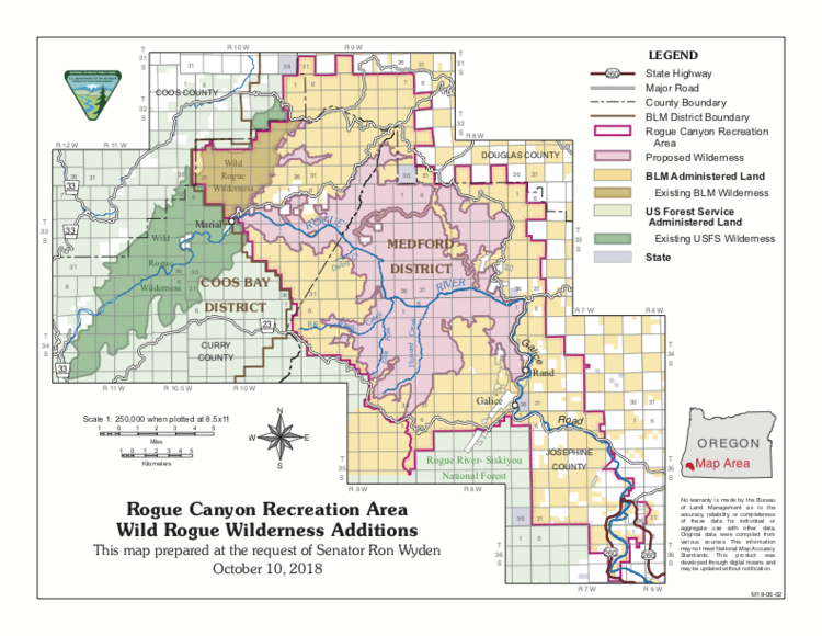
- Wild Rogue Wilderness Proposal Map
- Crater Lake Proposed Wilderness
- Proposed Ochoco Mountains National Recreation Area
- Proposed Mount Hood Wilderness
Wildlife Maps
- Map of Journey (OR-7) and Oregon’s Wolves (2012)
- Wildlife Trees Map – highlights overlap with roadless and wilderness
- Current and Historic Spring Chinook – Klamath River
- Proposed Wilderness areas and ODFW Wildlife Management Units
- Oregon Inventoried Roadless Areas and ODFW Wildlife Management Units
- Wild Rogue Proposed Wilderness and Elk Management Areas
- Wild Rogue Proposed Wilderness and Salmon, Steelhead habitat (USFS data)
Wilderness and Wild and Scenic River Maps
- Oregon Wilderness Protection by Year Map
- Interactive Map of Oregon’s Wild and Scenic Rivers or pdf
- Newly Protected Nehalem River State Scenic Waterway (2019)
- Devil’s Staircase Wilderness 2019
- Molalla Wild & Scenic River 2019
- Lewis and Clark Mount Hood final Wilderness map 2009
- Soda Mountain Wilderness map 2009
- Copper Salmon Wilderness map 2009
- Mount Hood Region map of Congressional Protections by Year
Logging and Fire Maps
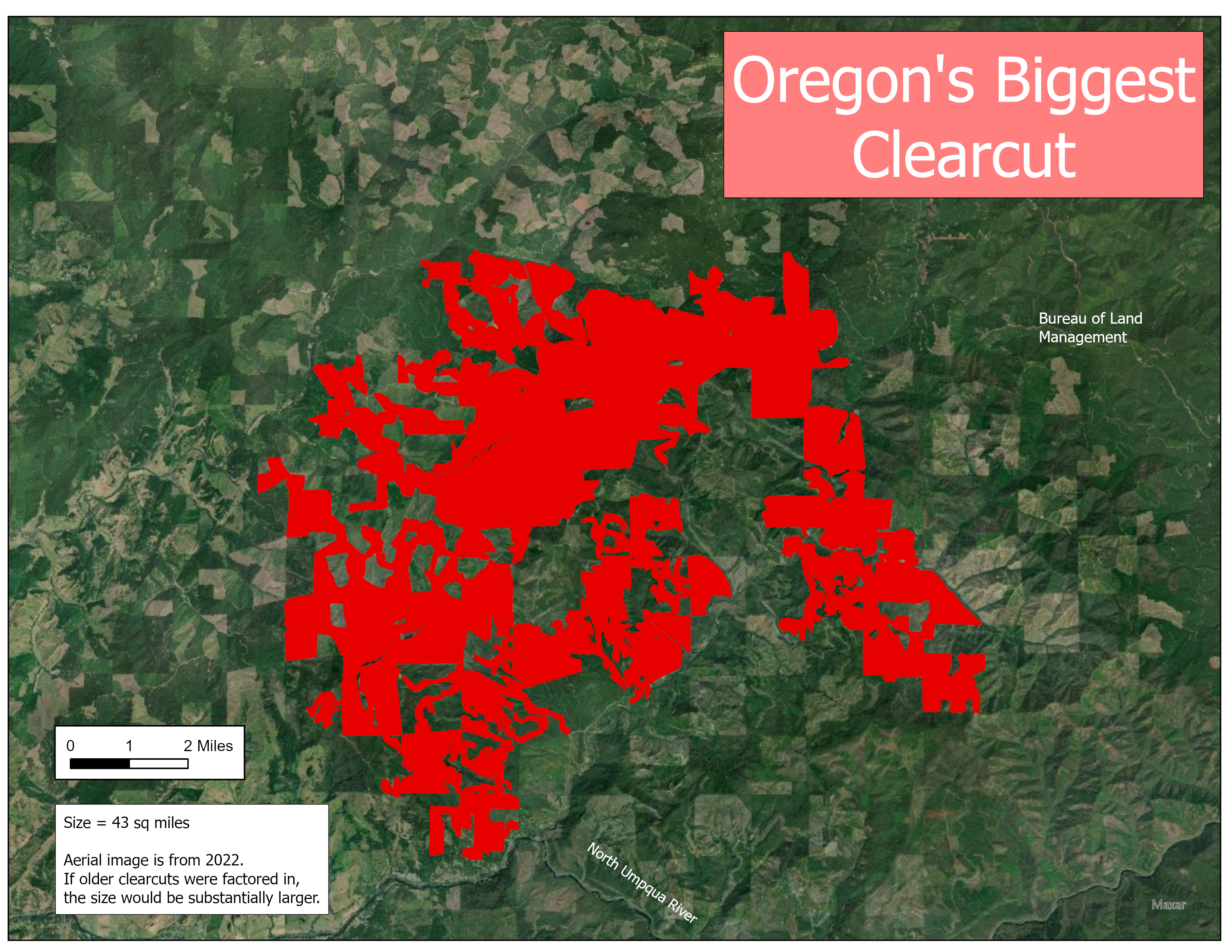
- Biggest clearcut in Oregon Map
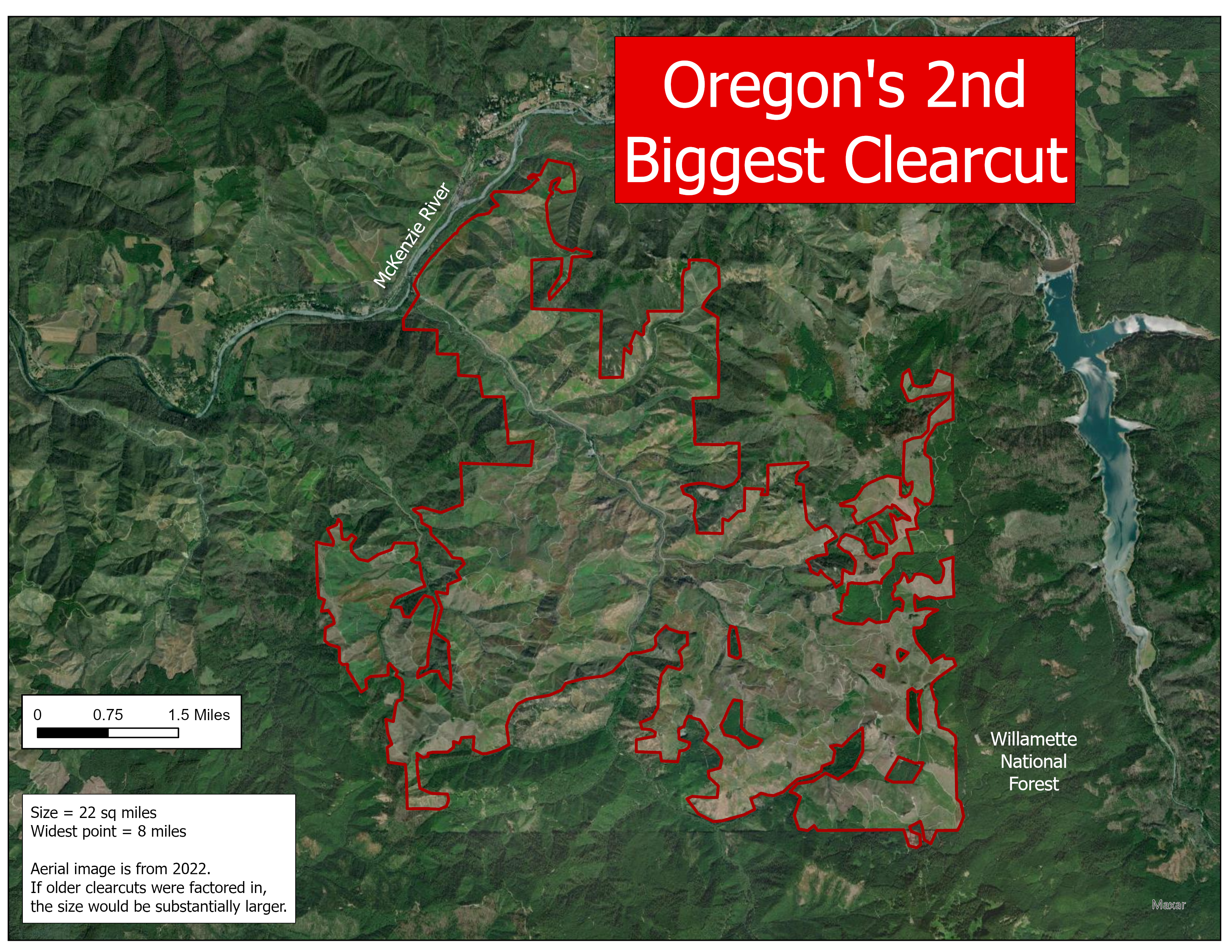
- 2nd biggest clearcut in Oregon map
- NASA report and maps of clearcuts in Oregon drinking watersheds
- Bootleg Fire previously logged/grazed map
- Loafer timber sale map (in relation to proposed Crater Lake Wilderness)
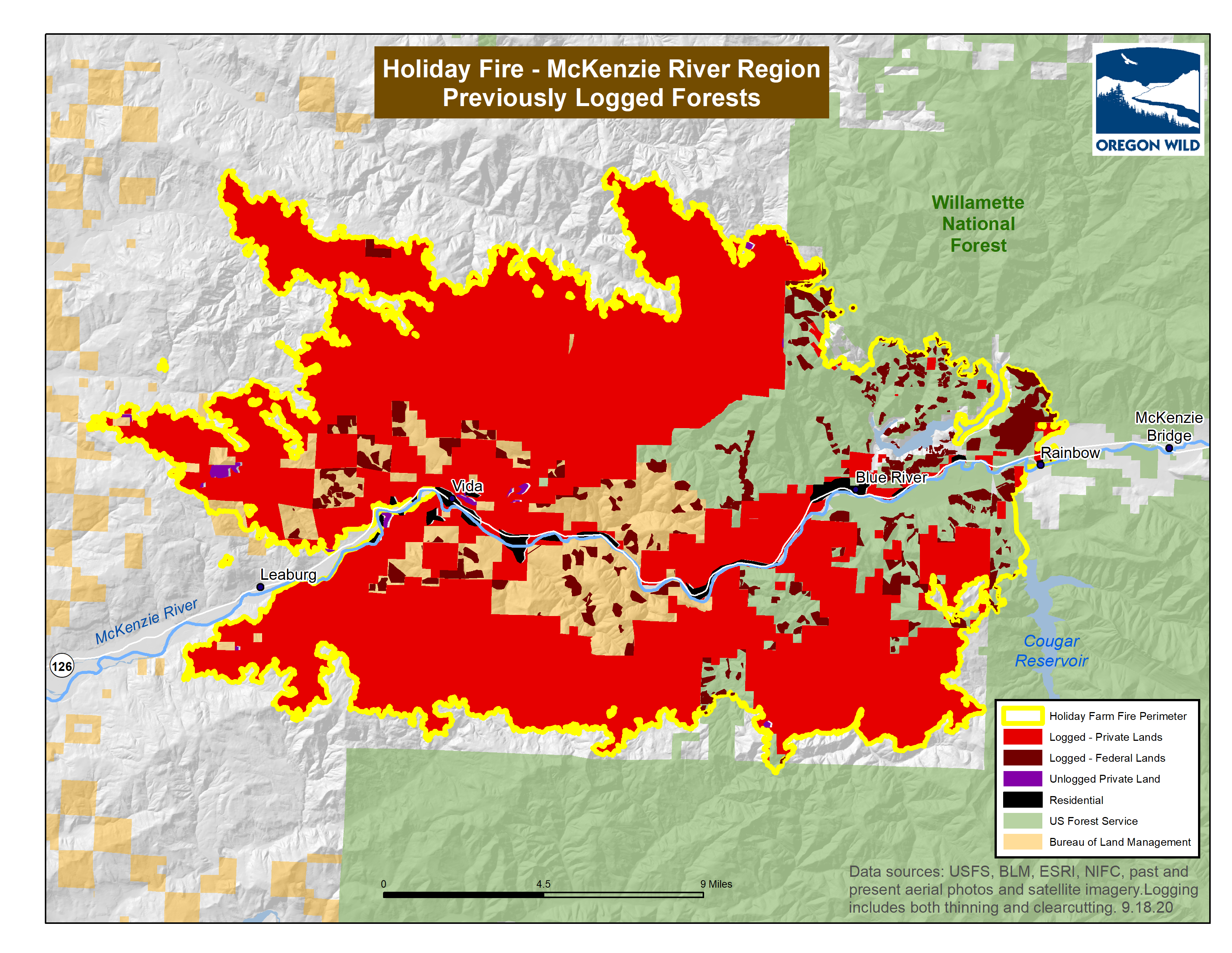
- Holiday Farm 2020 Fire (McKenzie) previously logged forests map
- Current and recent logging projects in Oregon
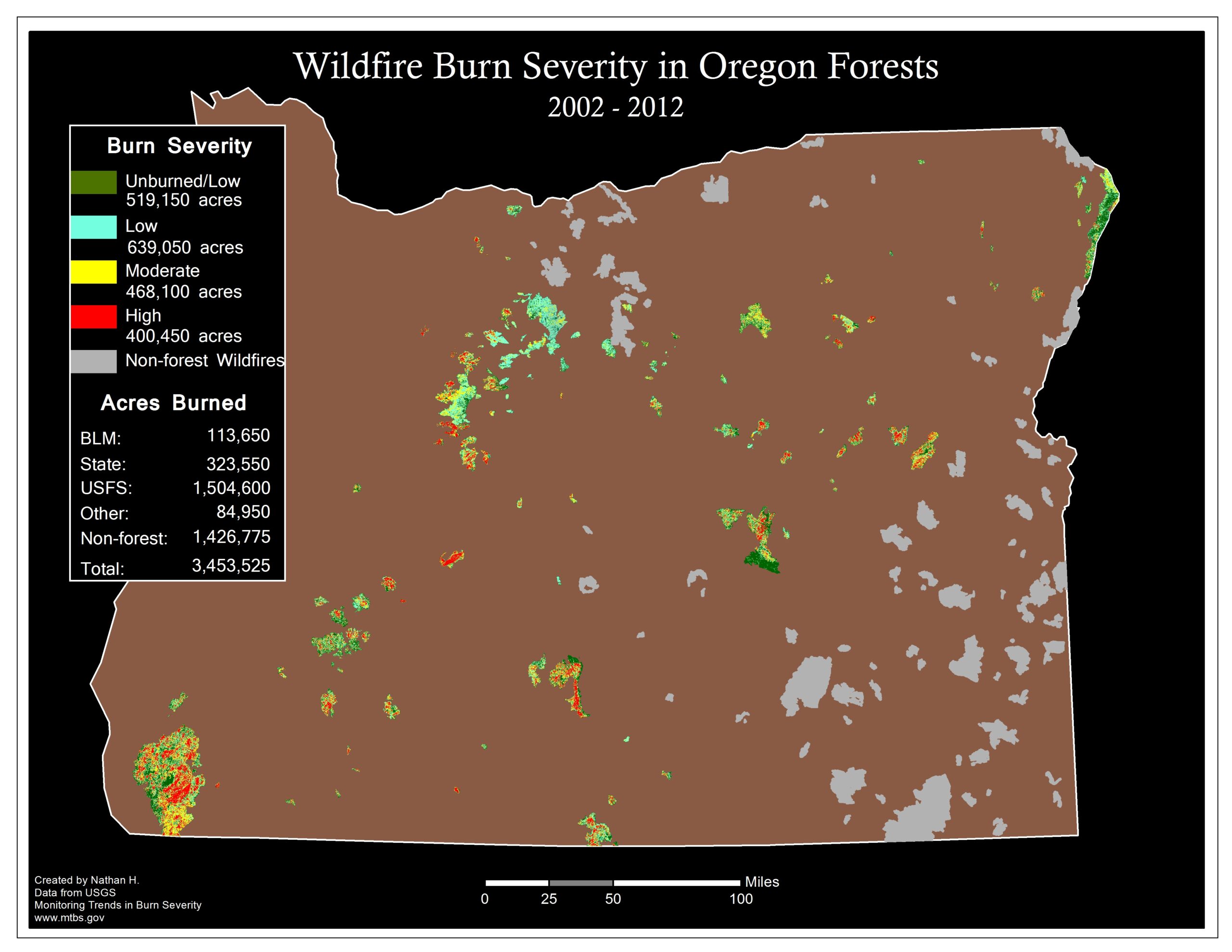
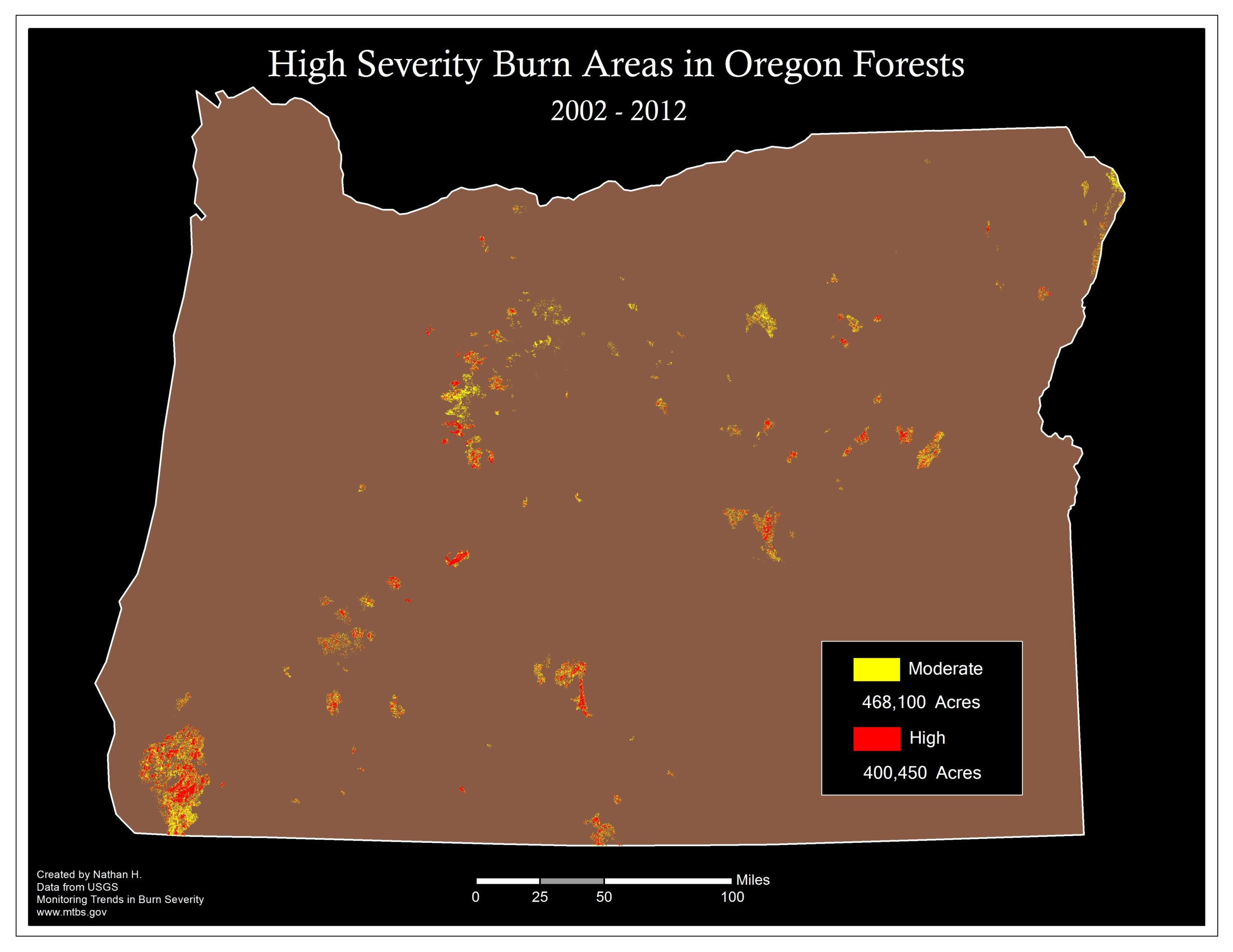
- Map of fire severity from 2002-2012 and high severity only
- Polallie Cooper Logging Map – Tamanawas Falls (some logging since postponed)
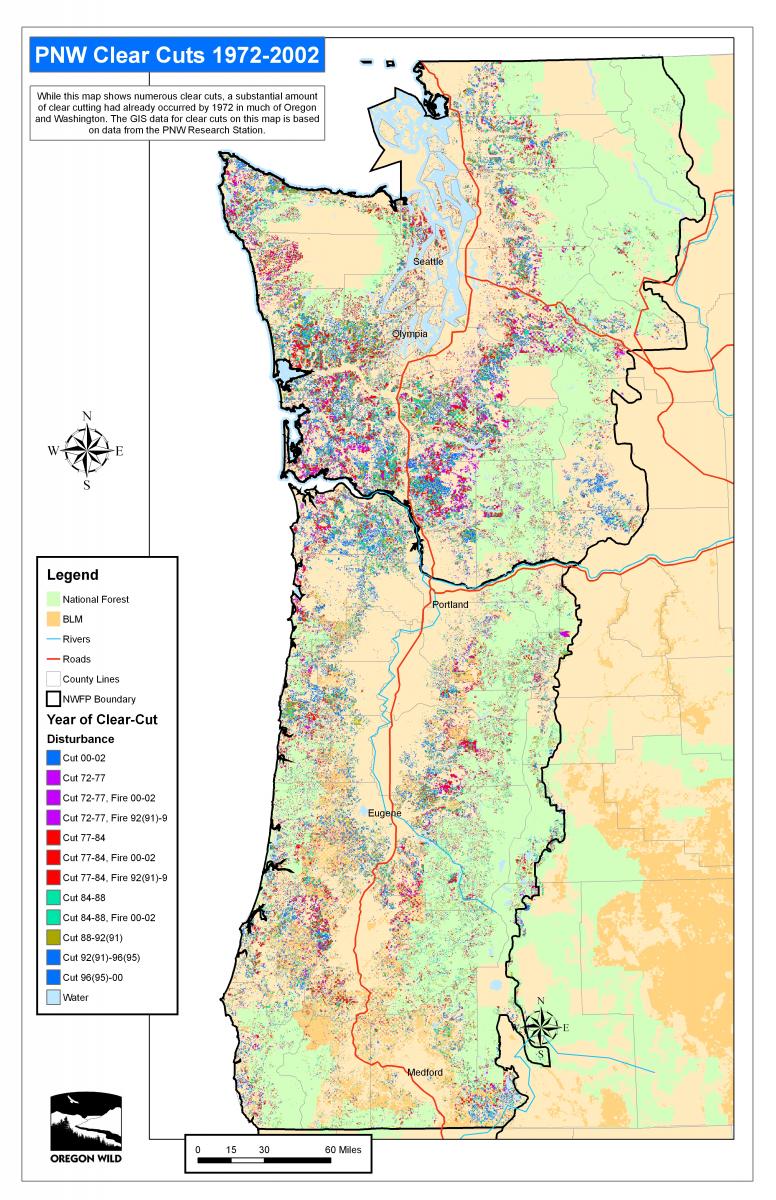
- Northwest Forest Plan area clear-cuts from 1972-2002
Other Oregon Maps
- General map of public lands in Oregon
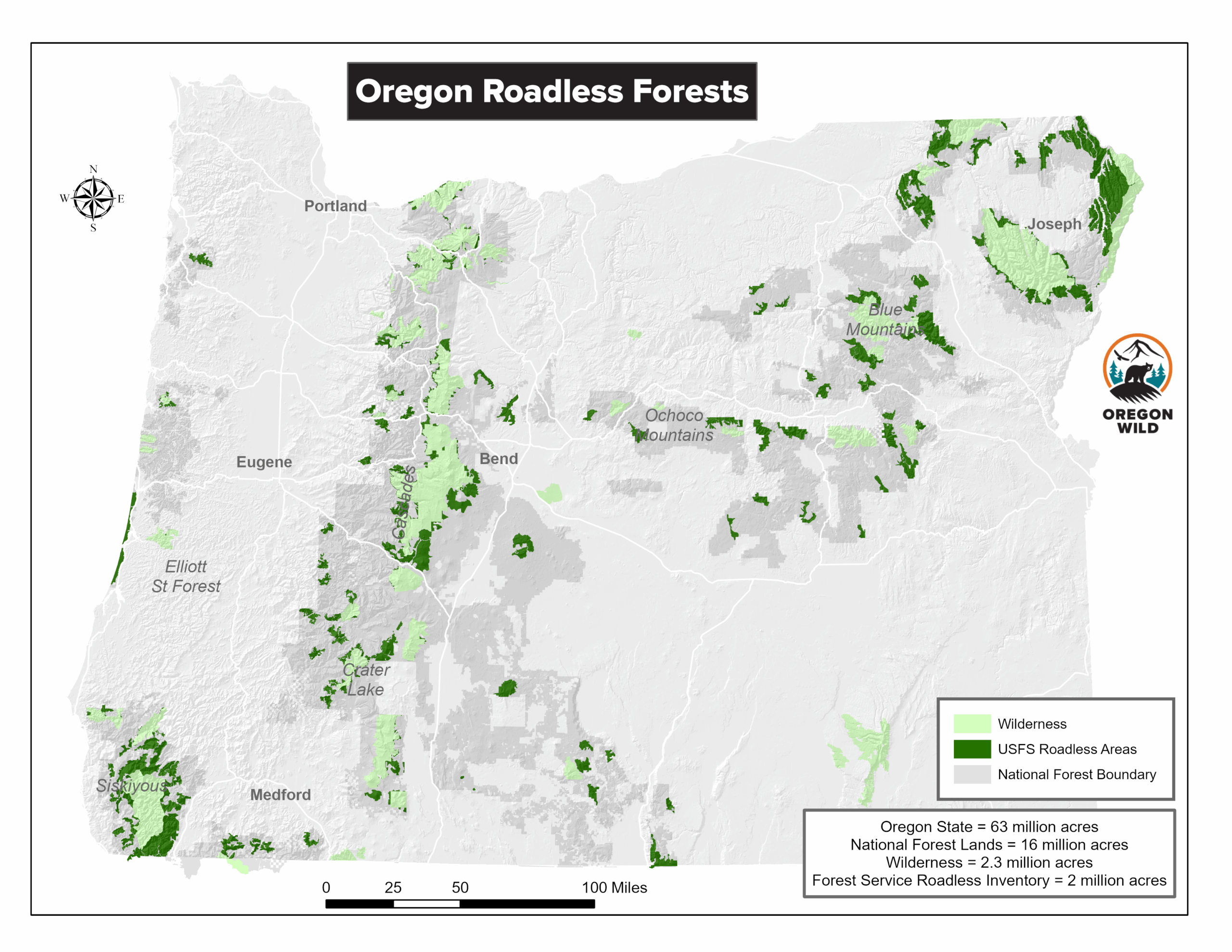
- Oregon Inventoried Roadless Areas, and Interactive version
- Drinking watersheds in Oregon including population, backgrounder blog
- Interactive map of old-growth forests
- Interactive map of the 2024 NW Forest Plan forest stand ages
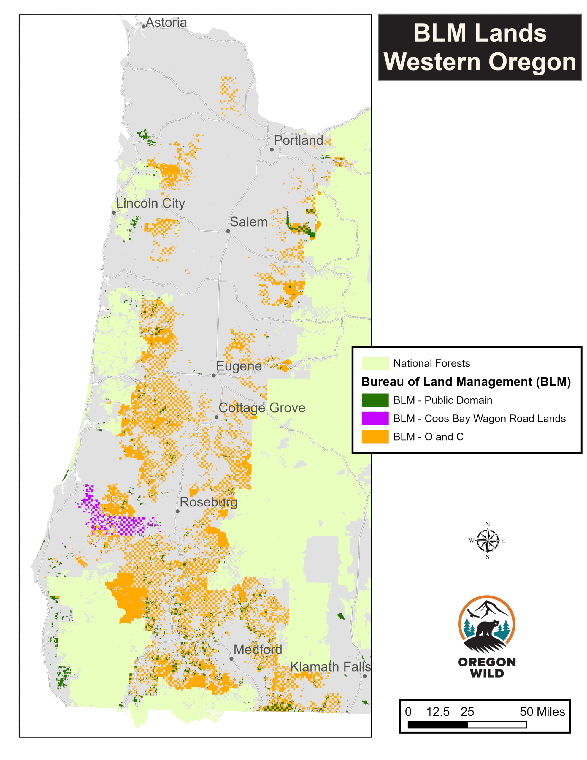
- Interactive map of Oregon’s BLM O&C public lands
- Bureau of Land Management Lands – O&C/Public Domain/Coos Bay Wagon Road Lands
- Interactive map of Oregon’s Wilderness Areas
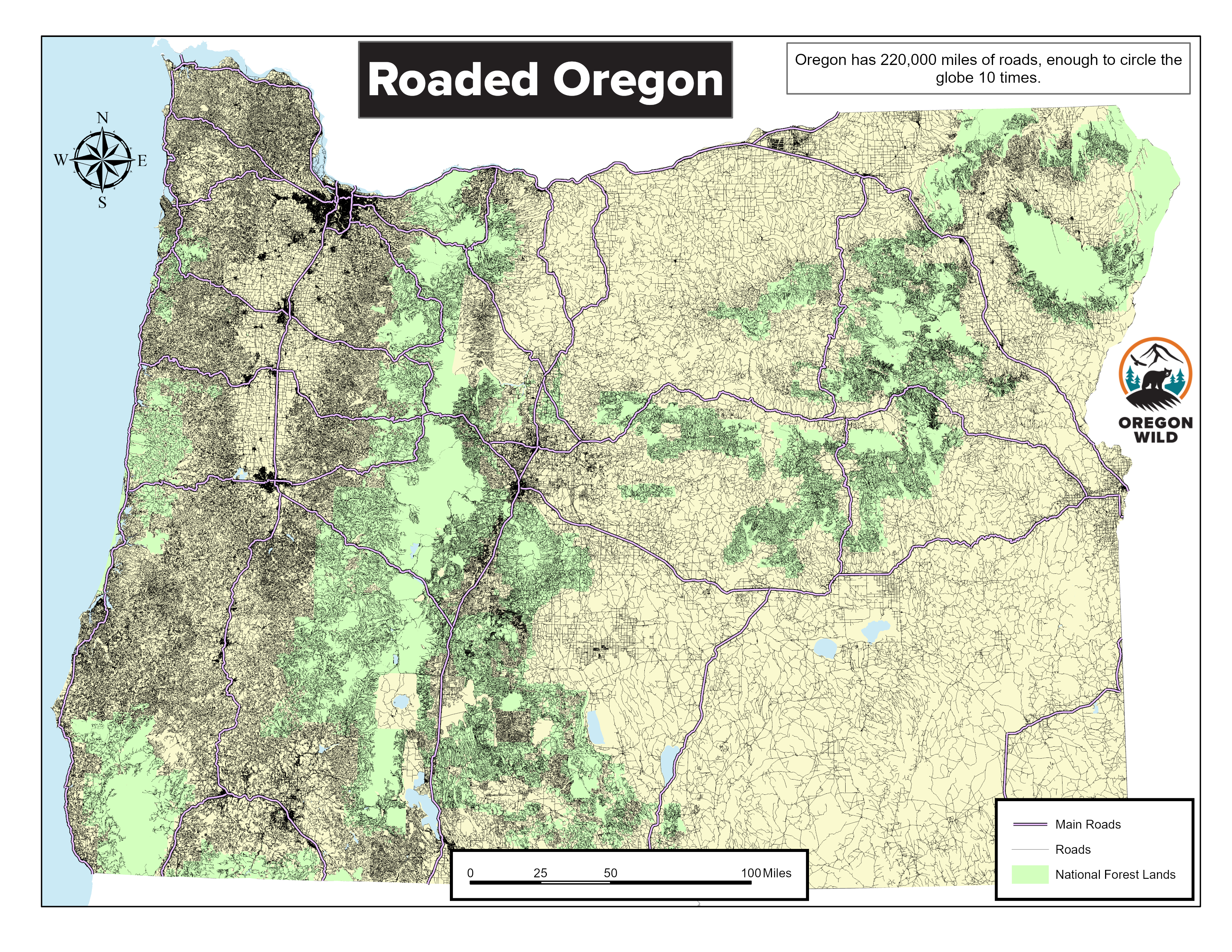
- Roaded Oregon: A map of all roads in Oregon
- Oregon Redwoods Map
- Oregon Carbon Storage Maps Report
- Mining in Oregon
- Swiss Needle Cast Infected Areas
- Oregon Forest Types Map
- Black Butte – Glaze Meadow Restoration area map
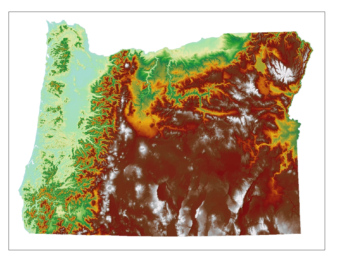
- Oregon Topography Map
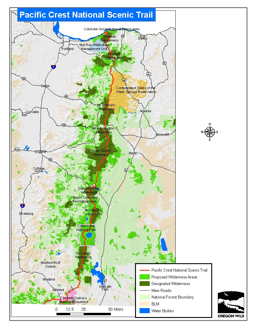
- Oregon Section of the Pacific Crest National Scenic Trail